Mount Ōminakami
大水上山
Mount Ōminakami, a remote peak marking the Tone River source, offers a challenging hike for nature enthusiasts.
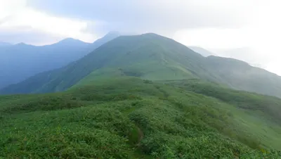
What it is
- A 1,834-meter high mountain in the Mikuni Mountains.
- Marks the northernmost point of Gunma Prefecture.
- The headwater source for the Tone River.
- The central watershed of Japan bends east at this summit.
What to see
- A monument marking the Tone River source stands south of the peak.
- The surrounding area is a designated Nature Conservation Area.
Getting there
- Reaching the peak from Jujikyo takes six to ten hours.
Notes written by Japan Gems from facts in Japanese Wikipedia.
Where it is
Mount Ōminakami Open in Google Maps
この施設の関係者の方へ
このページは公開情報をもとに Japan Gems が作成し、訪日外国人向けに英語で掲載しています。 写真や情報の追加・修正を承っています。お店の写真に差し替えることもできます。
このページの情報を更新する