Iwo Jima
硫黄島
A volcanic island and former battlefield now serving as a Japan Self-Defense Forces air base with restricted civilian access.
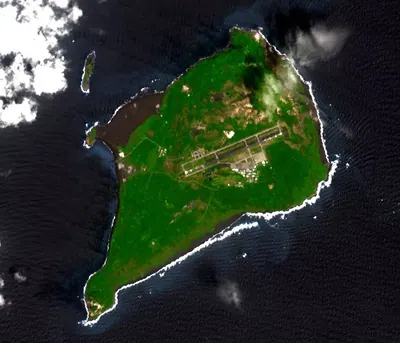
What it is
- A volcanic island in the Ogasawara chain located 1,250 kilometers south of Tokyo.
- An active military site operated as an air base by the Japan Self-Defense Forces.
- A landmass officially renamed to Ioto in 2007 that continues to rise due to crustal movement.
- A former residential area where all civilians were evacuated in 1944.
What to see
- Mount Suribachi which stands as the highest point on the island at 172 meters.
- Expanding coastlines that reached a total area of nearly thirty square kilometers by 2022.
- The active volcanic landscape and military infrastructure of the current air base.
Notes written by Japan Gems from facts in Japanese Wikipedia.
Where it is
Iwo Jima Open in Google Maps
この施設の関係者の方へ
このページは公開情報をもとに Japan Gems が作成し、訪日外国人向けに英語で掲載しています。 写真や情報の追加・修正を承っています。お店の写真に差し替えることもできます。
このページの情報を更新する