

20 Islands in Tokyo worth your time
Japan Gems
62 Islands in Tokyo, with what to see and how to get there.
Tokyo has 62 islands on Japan Gems. Below are the 20 we can tell you the most about — each one written up in English from Japanese sources, with what to see and how to get there. See all islands in Tokyo.
01
Katsushima
TOKYO · PLACE 勝島
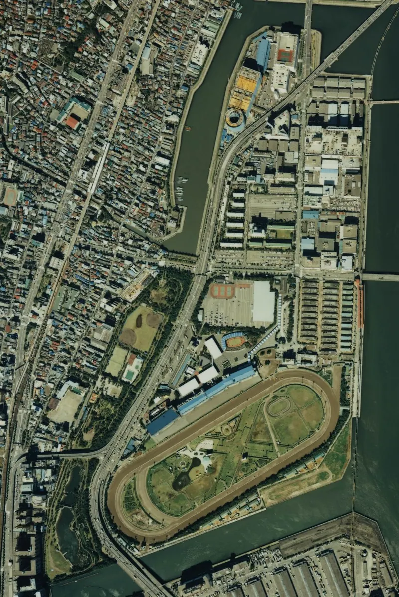
An artificial island in Tokyo featuring a major horse racing track, a public aquarium, and a large waterfront park.
What it is
- An artificial island in Tokyo Shinagawa Ward created through a land reclamation project started in 1939.
- A functional district named by the Ministry of the Navy containing warehouses and corporate distribution centers.
- Home to the Ohi Racecourse which was completed on the island in September 1950.
- Site of the Shinagawa Kumin Park which opened to the public in 1987.
What to see
- The Ohi Racecourse located on the central part of the island.
- Shinagawa Aquarium situated within the grounds of the third district.
- Shinagawa Kumin Park offering green space and recreational facilities.
- The Katsushima Bridge which connects the island to the neighboring Yashio area.
- Metropolitan Expressway Route 1 Haneda Line passing through the district.
Getting there
- Access the area via the Tokyo Monorail at Oi Keibajo-mae Station.
02
Umi no mori
TOKYO · PLACE 海の森
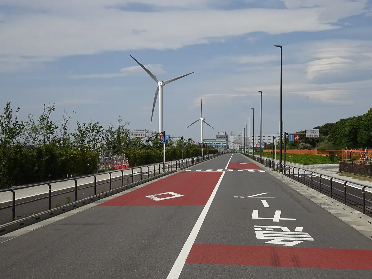
A massive reclaimed island in Tokyo Bay transformed from a former landfill into a sprawling public park and waterway.
What it is
- A district in Koto Ward built entirely on reclaimed land in Tokyo Bay.
- A former waste landfill site that operated between 1973 and 1986.
- A public space officially established as a new district in April 2020.
- A green transformation project featuring the Sea Forest Park and Waterway.
What to see
- The Sea Forest Waterway used for international rowing and canoeing events.
- Sea Forest Park which offers expansive green space on the reclaimed island.
- The Tokyo Gate Bridge which connects the district to the Wakasu area.
- The Daini Koro Tunnel linking the island to the nearby Aomi district.
Getting there
- Toei Bus provides public transportation services directly to the district.
- Access is available via the Tokyo Gate Bridge from the Wakasu side.
- The area is reachable from Aomi through the Daini Koro Tunnel.
03
Hachijō-jima
TOKYO · PLACE 八丈島
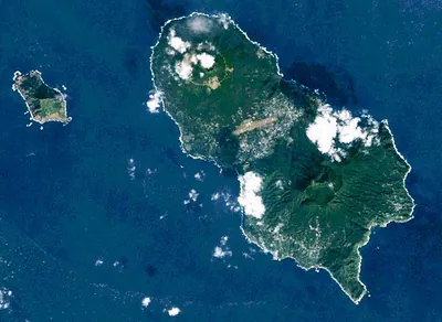
A subtropical volcanic island in the Izu chain offering national park scenery, whale watching, and unique local silk crafts.
What it is
- A volcanic island in the Izu archipelago designated as part of Fuji-Hakone-Izu National Park.
- A former place of exile during the Edo period located 287 kilometers south of Tokyo.
- A land formed by two volcanoes named Higashiyama and Nishiyama.
- A community where residents speak a unique dialect designated as endangered by UNESCO.
What to see
- Green and loggerhead sea turtles that inhabit the local waters.
- Kihachijo silk fabric and other local products like Ashitaba and Kusaya.
- Subtropical landscapes influenced by the warm Kuroshio Current.
- Two distinct volcanic peaks that define the island's geography.
When to go
- November to April to see humpback whales in the surrounding waters.
Getting there
- Three daily flights operated by ANA from Haneda Airport to the island.
04
Jōnanjima
TOKYO · PLACE 城南島
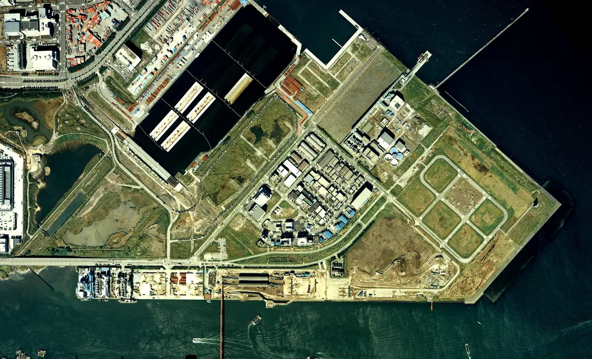
An industrial artificial island in Tokyo Bay featuring a seaside park with views of planes and ships.
What it is
- An artificial island in Tokyo Ota Ward officially named in 1979.
- A district primarily used for industrial purposes, logistics, and cold storage facilities.
- Home to the Tokyo Metropolitan Animal Care and Consultation Center branch.
- The island consists of seven numbered sub-districts connected by bridges and tunnels.
What to see
- Jonanjima Seaside Park located on the eastern side of the island.
- Industrial landscapes featuring concrete plants and large warehouses.
- The Jonan Ohashi Bridge connecting the island to the Tokai district.
- The Rinkai Tunnel which links the area to Reiwajima.
Getting there
- Take a Keikyu bus from Omori Station to reach the island.
- Public transportation is available via Keikyu bus from Heiwajima Station.
- There are no railway stations located directly on the island.
05
Tsukuda Island
TOKYO · PLACE 佃島
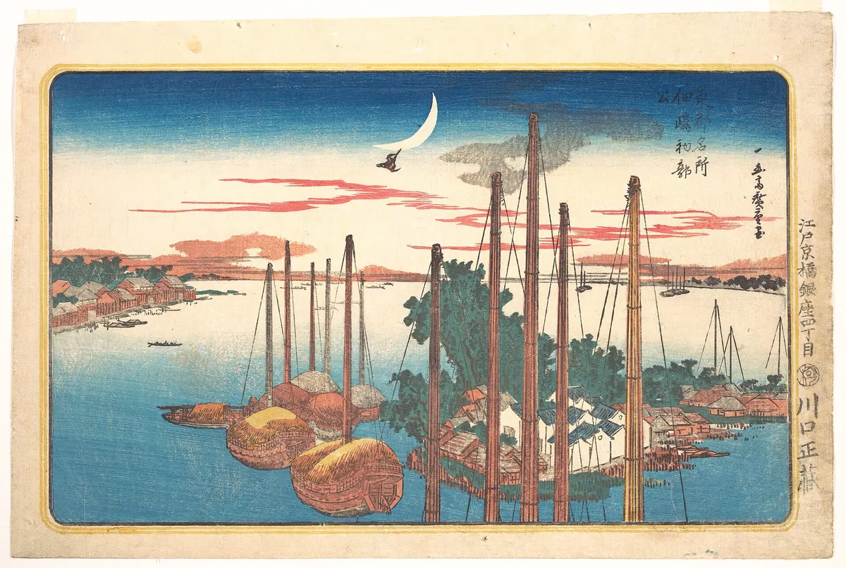
A historic district where Edo-period fishing village charm meets modern high-rise living, famous for its shrine and preserved food heritage.
What it is
- A district in Chuo Ward established by Osaka fishermen in the early Edo period.
- The island was completed in 1644 using stone walls for land reclamation.
- Sumiyoshi Shrine was founded here in 1646 to enshrine four deities and Tokugawa Ieyasu.
- A former industrial site that hosted a major shipyard until 1979.
What to see
- Narrow historic alleys that contrast with the modern Okawabata River City 21 high-rise apartments.
- Sumiyoshi Shrine, a spiritual center for the local community since the seventeenth century.
- Traditional shops selling Tsukudani, a famous local preserved food originating from this area.
When to go
- Visit during the Tsukuda Island Bon Odori, a designated cultural property.
Getting there
- The district is served by Tsukishima Station on two subway lines.
06
Tennōzu Isle
TOKYO · PLACE 天王洲アイル
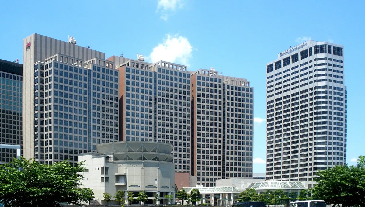
A redeveloped waterfront district in Tokyo featuring art galleries, a theater, and a scenic boardwalk along reclaimed land canals.
What it is
- A redeveloped district in Shinagawa covering twenty-two hectares of reclaimed land.
- Built on the historic site of the Fourth Daiba fortification.
- A designated hub for art galleries, cultural events, and corporate headquarters.
- The district is bordered by the Keihin and Tennōzu canals.
What to see
- An eight-hundred-meter boardwalk running along the waterfront.
- The Tennoz Galaxy Theatre which opened in the district in 1992.
- Numerous art galleries and cultural event spaces throughout the area.
- Views of the surrounding Keihin and Tennōzu canals.
When to go
- The Tennōzu Canal Festival is held four times every year.
Getting there
- Accessible via the Tokyo Monorail at Tennōzu Isle Station.
- The Rinkai Line serves the district at Tennōzu Isle Station.
- Official site
- www.e-tennoz.com
07
Minamijima
TOKYO · PLACE 南島
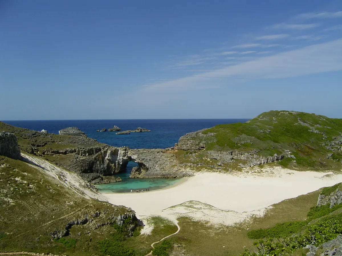
An uninhabited submerged karst island and natural monument offering rare fossils and nesting sites for green sea turtles.
What it is
- An uninhabited submerged karst landform located in the Chichijima island group.
- A nationally designated natural monument protected for its unique ecosystem.
- A strictly regulated site with a daily limit of one hundred visitors.
- A protected area where visitors must be accompanied by a Tokyo Nature Guide.
What to see
- Subfossils of the extinct Mandarina luhuana snail scattered across the landscape.
- Nesting sites used by green sea turtles along the island's shores.
- Unique geological formations characteristic of a submerged karst environment.
- Restored vegetation following the removal of feral goats in the 1970s.
When to go
- Landing is prohibited from November to February to protect local vegetation.
- Visits are restricted to a maximum stay of two hours per person.
08
Keihinjima
TOKYO · PLACE 京浜島
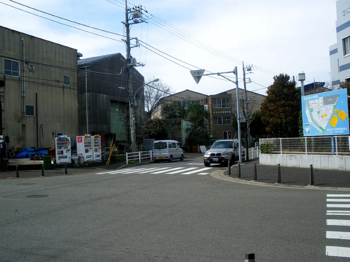
An industrial man-made island in Tokyo Bay offering unique close-up views of airplanes taking off and landing at Haneda Airport.
What it is
- A man-made industrial island in Tokyo Ota Ward created through land reclamation
- The island consists of three districts primarily used for industrial and waste treatment facilities
- Keihinjima Ryokudo Park opened in 1982 as a public green space
- The land area covers over one million square meters of reclaimed territory
What to see
- Views of planes at Haneda Airport from the waterfront at Tsubasa Park
- Industrial landscapes including waste treatment and incineration facilities
- Kyo-wa Bridge which connects the island to neighboring Showajima to the west
- The Wangan Route of the Shuto Expressway passing through the island
Getting there
- Keikyu buses provide public transportation access from Omori Station
- The island has no railway stations located within its borders
09
Hahajima
TOKYO · PLACE 母島
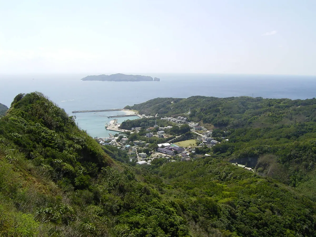
A remote island in the Ogasawara National Park offering unique endemic wildlife, mountain hiking, and local rum production.
What it is
- A remote island covering nearly twenty square kilometers within the Ogasawara National Park.
- The highest peak is Mount Chibusa which reaches four hundred sixty-three meters.
- The only residential settlement on the island is the village of Okimura.
- A former territory governed by the United States Navy between 1945 and 1968.
What to see
- The endemic Hahajima Meguro bird species found only on this island.
- Tokyo Metropolitan Route 241 which serves as the southernmost prefectural road.
- Local agricultural sites producing domestic rum and cacao crops.
- Panoramic views from the summit of Mount Chibusa.
Getting there
- A regular ferry service connects to the island from Chichijima in two hours.
- There are no public buses or taxis available for transport upon arrival.
10
Miyakejima
TOKYO · PLACE 三宅島
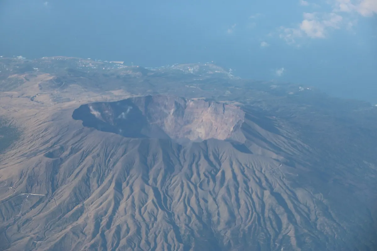
An active volcanic island and national park known for its unique geological sites, endemic birdlife, and diverse marine ecosystems.
What it is
- An inhabited basaltic stratovolcano island located 175 kilometers south of mainland Tokyo.
- A designated part of the Fuji-Hakone-Izu National Park.
- One of the Top 100 Geological Sites in Japan due to its volcanic history.
- A protected habitat for the endemic Akakokko bird and over 600 saltwater fish species.
What to see
- The peak of Mount Oyama and the caldera formed during the 2000 eruption.
- Remnants of Ako village which was largely destroyed by lava in 1983.
- Diverse wildlife including the rare Akakokko bird and abundant marine life in surrounding waters.
When to go
- The annual WERIDE Miyakejima motorcycle event takes place on the island.
Getting there
- A daily passenger ship operated by Tokai Kisen departs from Takeshiba in Tokyo.
- Official site
- www.miyakemura.com
11
Mikura-jima
TOKYO · PLACE 御蔵島
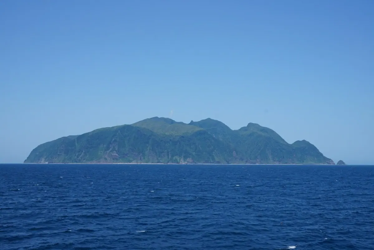
An inhabited volcanic island south of Tokyo famous for wild bottlenose dolphins and protected seabird breeding grounds.
What it is
- An inhabited volcanic island located 190 kilometers south of central Tokyo.
- A designated breeding ground for Streaked Shearwaters and home to wild bottlenose dolphins.
- Part of the Izu Islands chain governed as Mikura-jima Village.
- A protected area where camping, sleeping outdoors, and bicycles are strictly prohibited.
What to see
- Wild Indo-Pacific bottlenose dolphins living in the waters surrounding the island.
- Mount Oyama, an active volcano reaching an elevation of 851 meters.
- Large populations of Streaked Shearwaters nesting across the island landscape.
When to go
- Visitors must book accommodation in advance before arriving on the island.
Getting there
- Tokai Kisen operates daily passenger ships from Tokyo to the island.
12
Harumi
TOKYO · PLACE 晴海
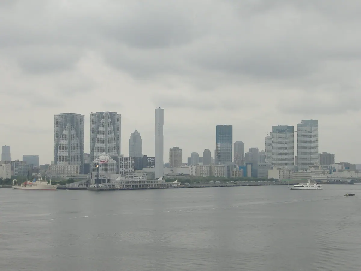
A modern waterfront district in Chuo Ward built on reclaimed land, featuring the former 2020 Olympic Village and commercial complexes.
What it is
- A district in Chuo Ward created from seabed dredging and reclaimed land.
- The former site of the Tokyo International Trade Fair Grounds and 2020 Olympic Village.
- A residential and commercial area now featuring the Harumi Flag development.
- A waterfront zone that originally opened as a foreign trade wharf in 1955.
What to see
- Harumi Island Triton Square, a large commercial and office complex.
- The Harumi Flag residential development on the former athlete village site.
- Harumi Bridge which connects the district to the neighboring Toyosu area.
- The Tokyo BRT terminal which began operations in 2020.
Getting there
- Access the district via the Toei Oedo Line at Kachidoki Station.
- The area is served by the Tokyo BRT terminal located within the district.
13
Bayonnaise Rocks
TOKYO · PLACE ベヨネース列岩
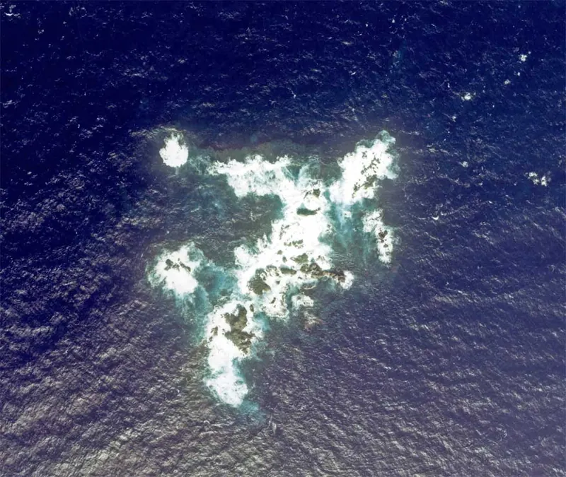
A remote volcanic reef formation south of Tokyo, serving as a resting place for migratory birds and an active volcano site.
What it is
- A group of three large and several small reefs located 408 kilometers south of Tokyo.
- An active volcano registered by the Japan Meteorological Agency on the edge of the Myojinsho Caldera.
- A formation discovered by a French corvette in 1846, also known as Myojin Volcano.
- A resting place for migratory birds with a maximum elevation of 9.9 meters.
What to see
- Exposed volcanic rocks and reefs rising from the Pacific Ocean.
- Discolored water caused by ongoing volcanic activity near the site.
- Migratory birds resting on the rocky outcrops during their journey.
- The surrounding sea area where hydrothermal deposits of gold and silver exist on the seabed.
Getting there
- Access requires a six-hour boat journey from Hachijojima.
14
Aogashima
TOKYO · PLACE 青ヶ島
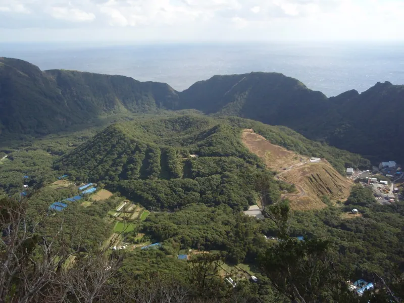
A remote double volcano island south of Tokyo featuring a unique caldera within a caldera and Japan's smallest village population.
What it is
- The southernmost inhabited island of the Izu chain located 360 kilometers south of Tokyo.
- A double volcano featuring a large caldera with a secondary inner cone.
- The least populated municipality in Japan with all residents living on the outer crater rim.
- A Class C active volcano classified by the Japan Meteorological Agency.
What to see
- The inner volcanic cone situated inside the larger caldera floor.
- Otonbu peak which serves as the highest point at 423 meters above sea level.
- Steep coastal cliffs that surround the entire island instead of sandy beaches.
- Local production facilities for Aochu, a specialty sweet potato shochu.
Getting there
- Travel is only possible by taking a boat or helicopter from Hachijojima.
15
Tori-shima
TOKYO · PLACE 鳥島
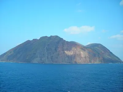
An uninhabited volcanic island and National Natural Monument serving as a critical breeding ground for the rare Short-tailed Albatross.
What it is
- A circular volcanic island located approximately 600 kilometers south of Tokyo.
- A designated National Natural Monument and protected wildlife area for rare birds.
- An uninhabited site since the closure of a weather station in 1965.
- A Rank A active volcano managed by the Tokyo Metropolitan Hachijo Branch Office.
What to see
- The breeding grounds of the rare Short-tailed Albatross species.
- Mount Io, the highest point of the island at 394 meters.
- A landscape composed primarily of basalt, dacite, and andesite volcanic rocks.
- The site of a 1902 eruption that historically impacted the local population.
When to go
- Visitors must obtain landing permission from the Tokyo Metropolitan Government before visiting.
- Official site
- www.data.jma.go.jp
16
Nii-jima
TOKYO · PLACE 新島
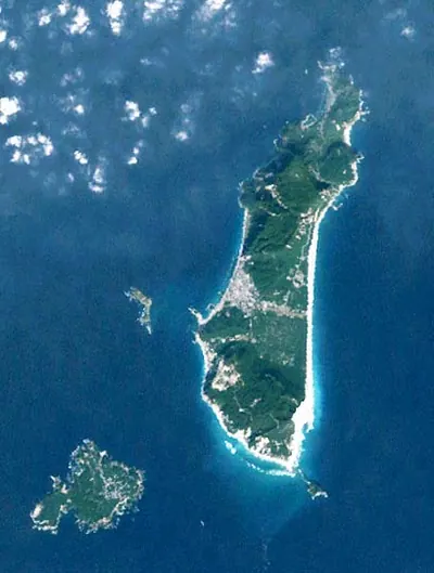
A volcanic island south of Tokyo famous for its white sand beaches, unique stone carvings, and free outdoor hot springs.
What it is
- A volcanic island composed of rhyolite located 160 kilometers south of Tokyo
- A former penal colony dating back to the Edo period
- The primary source of Koga stone used for local construction and art
- A destination known for the local fermented fish specialty called Kusaya
What to see
- Habushiura Coast featuring a seven kilometer stretch of white sand
- Mount Miyatsuka which stands as the highest point at 432 meters
- Free open-air hot springs that remain open to visitors 24 hours a day
- Art and structures made from locally mined Koga stone
Getting there
- Flights from Chofu Airport reach the island in approximately 30 minutes
- Access is available via high-speed jetfoil and large ferries from the mainland
17
Shōwajima
TOKYO · PLACE 昭和島
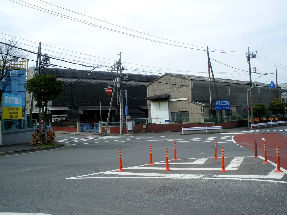
An industrial artificial island in Tokyo Bay featuring public parks, a monorail station, and massive water reclamation infrastructure.
What it is
- An artificial island in Tokyo's Ota Ward completed in 1967.
- A dedicated industrial zone with zero permanent residents.
- Home to the Haneda Ironworks Industrial Estate and a water reclamation center.
- A landmass divided into two districts by the Metropolitan Expressway Route 1.
What to see
- Public green spaces including Shōwajima Nichome Park and Shōwajima Minami Ryokudo Park.
- The Kyowa Bridge which connects the island to neighboring Keihinjima.
- The Shōwajima Junction where the Haneda and Bayshore expressway lines meet.
- Industrial infrastructure across a total area of over 600,000 square meters.
Getting there
- Accessible via Shōwajima Station on the Tokyo Monorail line.
18
Inamba-jima
TOKYO · PLACE 藺灘波島
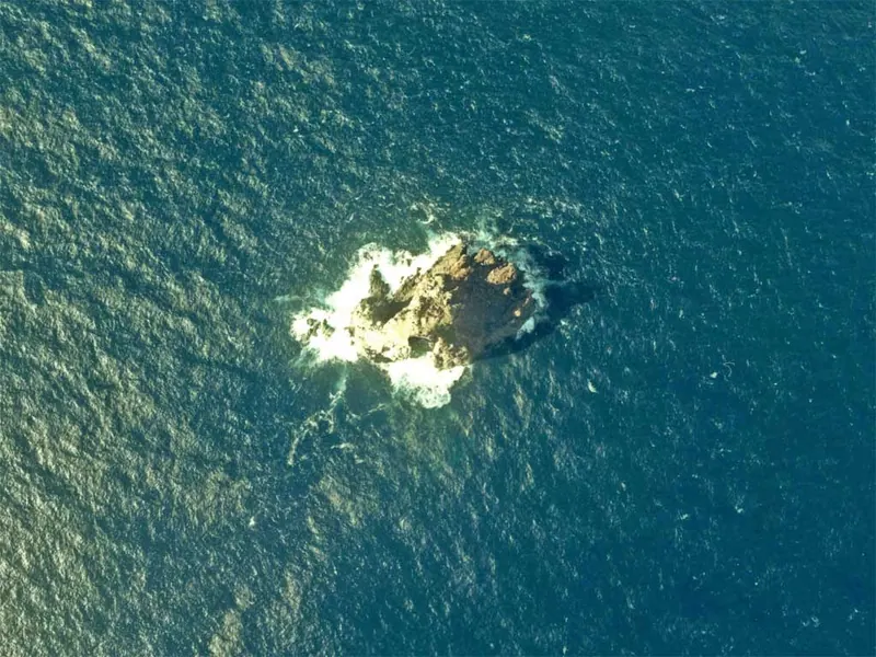
An uninhabited volcanic rock in the Izu Islands known for its steep cliffs and historical Japanese sea lion habitat.
What it is
- An uninhabited rock island located southwest of Mikurajima in the Izu chain
- A small landmass rising from the Mikura Basin within the Kuroshio Current
- A protected area that previously served as a habitat for Japanese sea lions
- Part of Mikurajima Village under the administration of Tokyo
What to see
- Steep rock faces reaching a peak height of seventy-five meters
- A rugged perimeter measuring approximately five hundred and eighty meters
- The southern wall which contains the only possible landing point on the island
Getting there
- No scheduled ferry routes provide transportation to this remote location
- Access requires chartering a private fishing boat to reach the island
19
Nakōdo Island
TOKYO · PLACE 媒島
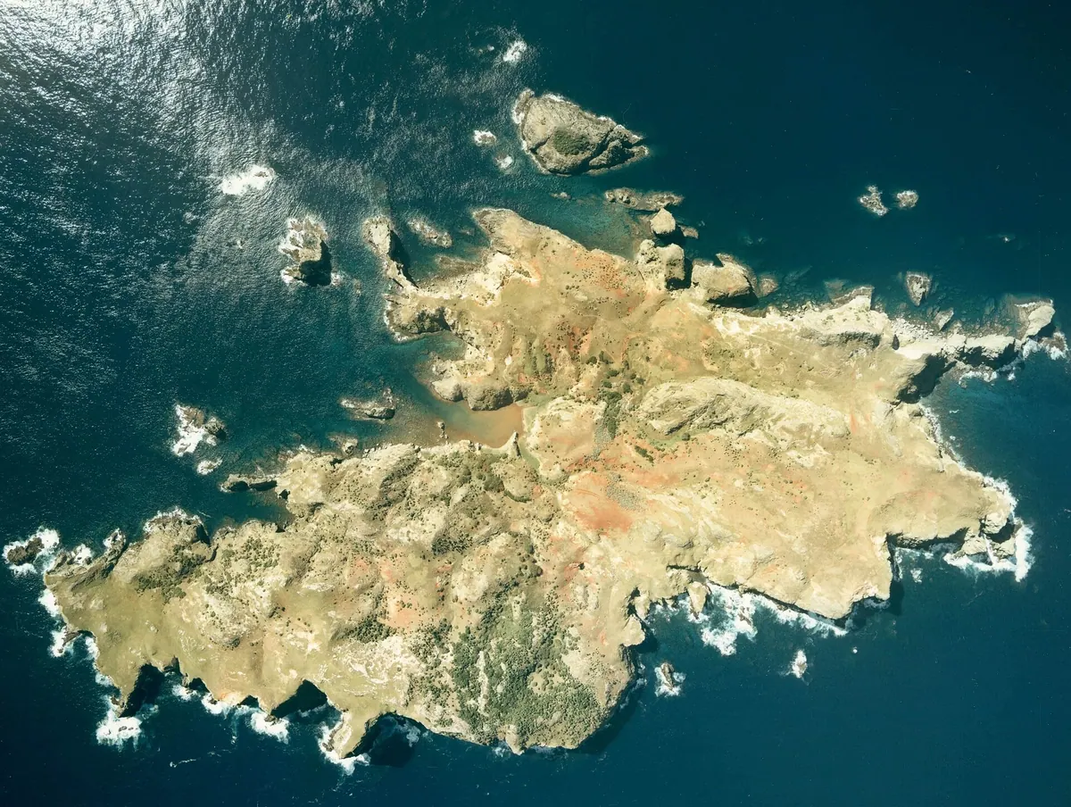
An uninhabited UNESCO World Heritage island in the Ogasawara chain known for rare albatross colonies and unique stag beetles.
What it is
- An uninhabited island located between Muko Island and Yome Island in Ogasawara Village.
- A former settlement where residents raised cattle and sweet potatoes during the Meiji era.
- Part of a UNESCO World Heritage site dedicated to preserving unique island ecosystems.
- A conservation area where feral goats were eradicated to restore the natural vegetation.
What to see
- Nesting sites for the black-footed albatross and the rare short-tailed albatross.
- The Nakodojima stag beetle, a subspecies found only on this island.
- The main peaks of Mount Tsurugi and Mount Byobu rising from the landscape.
Getting there
- Accessible by a two-hour boat ride departing from Chichijima.
20
No.3 Battery
TOKYO · PLACE 第三台場
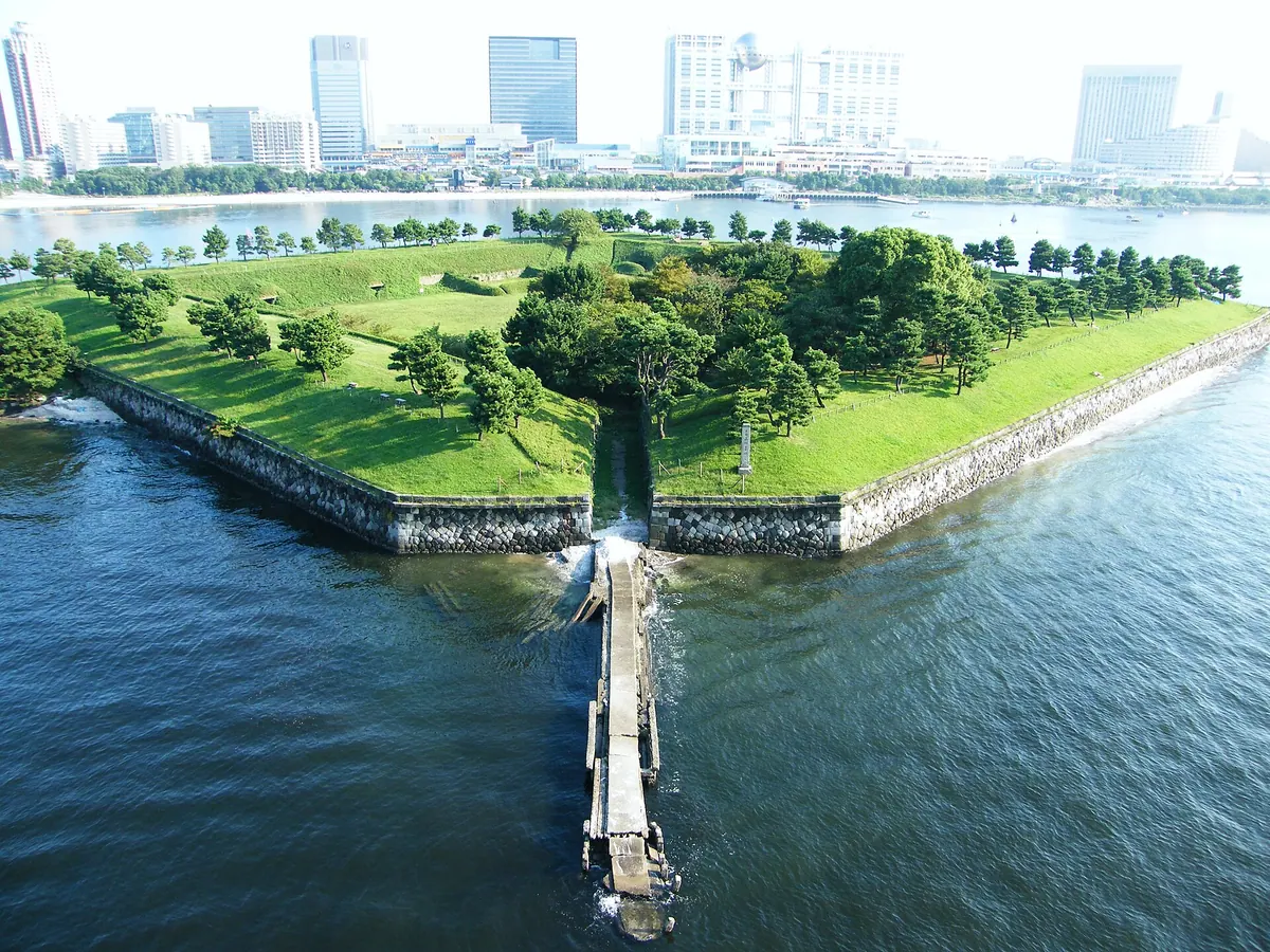
A historic island fortress turned public park offering ruins of 19th-century military defenses and scenic views of Tokyo Bay.
What it is
- A square defensive battery built by the Edo Shogunate after Commodore Perry arrived.
- The site was designated as a national historic site in 1926.
- The public park opened on the former military grounds in 1928.
- A preserved square island measuring 160 meters on each side.
What to see
- Stone walls and embankments that surround the entire perimeter of the park.
- Ruins of a former powder magazine and military barracks.
- A historic stone boat landing located on the north side of the island.
When to go
- The park is open year-round with free admission for all visitors.
Getting there
- The site is a 12-minute walk from Odaiba Kaihinkoen Station.
- Official site
- www.tptc.co.jp