

20 Islands in Okinawa worth your time
Japan Gems
85 Islands in Okinawa, with what to see and how to get there.
Okinawa has 85 islands on Japan Gems. Below are the 20 we can tell you the most about — each one written up in English from Japanese sources, with what to see and how to get there. See all islands in Okinawa.
01
Tarama Island
OKINAWA · PLACE 多良間島

A flat coral island in Okinawa known for its traditional August dance festival and scenic provincial natural park landscapes.
What it is
- A flat island formed from raised coral reefs located between Miyako and Ishigaki.
- A designated provincial natural park with a tropical rainforest climate.
- A rural community centered on sugarcane cultivation and beef cattle raising.
- Home to over one thousand residents within the Okinawa Prefecture.
What to see
- The highest point on the island reaching thirty-four meters above sea level.
- Traditional performances during the Hachigatsu Odori festival.
- Expansive sugarcane fields and cattle grazing across the flat landscape.
When to go
- August for the Hachigatsu Odori, a national important intangible cultural property.
- November to participate in or watch the annual island-wide marathon.
Getting there
- Fly from Miyako Airport directly to the local airport on the island.
- Take a two-hour ferry ride from Miyako Island to Futenma Port.
02
Senaga Island
OKINAWA · PLACE 瀬長島

A small island near Naha Airport featuring a Mediterranean-style shopping resort, hot springs, and prime views of landing aircraft.
What it is
- A small island located 600 meters west of Okinawa Island connected by a causeway.
- The site of the former Senaga Gusuku castle and a former U.S. military base.
- A modern resort destination home to the Umikaji Terrace development and a luxury hotel.
- A recreational hub featuring four municipal baseball fields in the northeast section.
What to see
- Low-flying airplanes taking off and landing at the adjacent Naha Airport.
- White Mediterranean-style buildings and terraces overlooking the ocean at Umikaji Terrace.
- Natural coral reefs and tidal flats surrounding the island's 1.8-kilometer circumference.
- Panoramic views of the sea from the Ryukyu Onsen Senaga Island Hotel.
Getting there
- Buses run directly to the island from Naha Airport and Akamine Station.
- The island is accessible by car via a causeway from the main Okinawa Island.
03
Hateruma Island
OKINAWA · PLACE 波照間島

Japan's southernmost inhabited island offers the Southern Cross constellation, a top-ranked beach, and rare local awamori spirits.
What it is
- The southernmost inhabited island in Japan located in the Yaeyama District of Okinawa.
- A small island covering twelve square kilometers with a population of under five hundred people.
- A primary center for sugarcane cultivation and home to the Shimotabaru Shell Mound.
- One of the few locations in Japan where the Southern Cross constellation is visible.
What to see
- Nishi Beach, which was ranked as the best beach in Japan in 2017.
- The 3,700 year old remains of the Shimotabaru Shell Mound.
- A local distillery that produces the rare and highly sought after Awanami awamori.
- Expansive sugarcane fields that serve as the island's primary agricultural industry.
- A seawater desalination plant that provides the local water supply.
Getting there
- Access the island via high-speed boat or ferry departing from Ishigaki Port.
04
Barasu Island
OKINAWA · PLACE バラス島
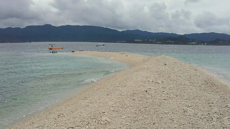
A unique island made entirely of coral fragments, offering exceptional snorkeling within the Iriomote-Ishigaki National Park.
What it is
- An island composed entirely of coral fragments located between Iriomote and Hatoma.
- The name originates from the word ballast and it sits on an isolated reef.
- A protected area that is part of the Iriomote-Ishigaki National Park.
- A shifting landmass that has existed in its current form since at least 1963.
What to see
- White coral fragments that make up the entire surface of the island.
- Branching Acropora corals inhabiting the waters immediately surrounding the reef.
- A popular snorkeling spot located on the southern side of the island.
- Varying island shapes caused by seasonal waves and recent typhoons.
When to go
- Low tide is essential as high tides can cause the island to submerge completely.
Getting there
- Access is provided by tour operators departing from nearby Iriomote Island.
05
Sonaichizaki
OKINAWA · PLACE 祖納地崎

An uninhabited island north of Yonaguni serving as a modern harbor facility connected to the main village by a bridge.
What it is
- An uninhabited island located just north of the Sonai settlement on Yonaguni Island.
- A functional harbor site belonging to Yonaguni Town in Okinawa Prefecture.
- The location of a major two thousand ton class wharf completed in 2005.
- A developed area containing breakwaters and essential harbor facilities for the region.
What to see
- The Nanta Bridge which links the island to the main village of Sonai.
- Modern harbor infrastructure and a large wharf designed for heavy maritime traffic.
- Views of the surrounding ocean from the northernmost point of the harbor development.
- The newer bridge structure that replaced the original 1981 crossing in 2007.
Getting there
- Access the island via Okinawa Prefectural Road 217 from the Sonai settlement.
- Cross the Nanta Bridge to reach the harbor facilities from the main island.
06
Taketomi Island
OKINAWA · PLACE 竹富島
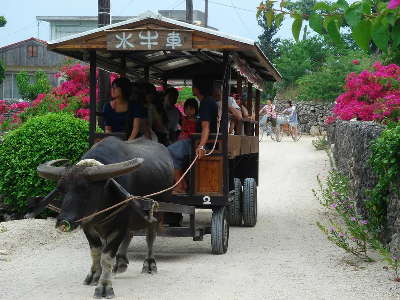
A preserved coral island featuring traditional red-tiled villages and white sand paths within a protected national park.
What it is
- A small island made of raised coral reef and Ryukyu limestone.
- The entire area is part of the Iriomote-Ishigaki National Park.
- The central village is a National Important Preservation District for traditional buildings.
- A destination where visitors are requested to pay a voluntary 300 yen entry fee.
What to see
- Traditional houses featuring red-tiled roofs and streets lined with white sand.
- Kondoi Beach and Kaiji Beach located on the western coast.
- The Nagomi no Tou tower, which is a Registered Tangible Cultural Property.
- Three main villages located in the central and northwestern areas.
When to go
- The Tanadui seed-sowing festival, a National Important Intangible Folk Cultural Property.
Getting there
- High-speed boats connect Ishigaki Port to the island in 10 minutes.
07
Kuroshima
OKINAWA · PLACE 黒島
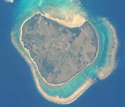
A heart-shaped coral island in the Yaeyama chain known for its vast cattle pastures and sea turtle research institute.
What it is
- A flat island made of raised coral reef located south-southwest of Ishigaki Island.
- Nicknamed Heart Island because of its physical shape when viewed from above.
- A rural community where beef cattle farming is the primary industry for residents.
- A small island with a circumference of twelve kilometers and a population of about two hundred.
What to see
- The Kuroshima Research Institute which focuses on studying sea turtles and local coral.
- Iko Pier which is officially designated as a Registered Tangible Cultural Property.
- Extensive pastures filled with grazing beef cattle across the flat landscape.
When to go
- The Kuroshima Cow Festival takes place on the last Sunday of February.
Getting there
- High-speed boats run from Ishigaki Port to Kuroshima Port in thirty minutes.
08
Hanarijima
OKINAWA · PLACE 離島
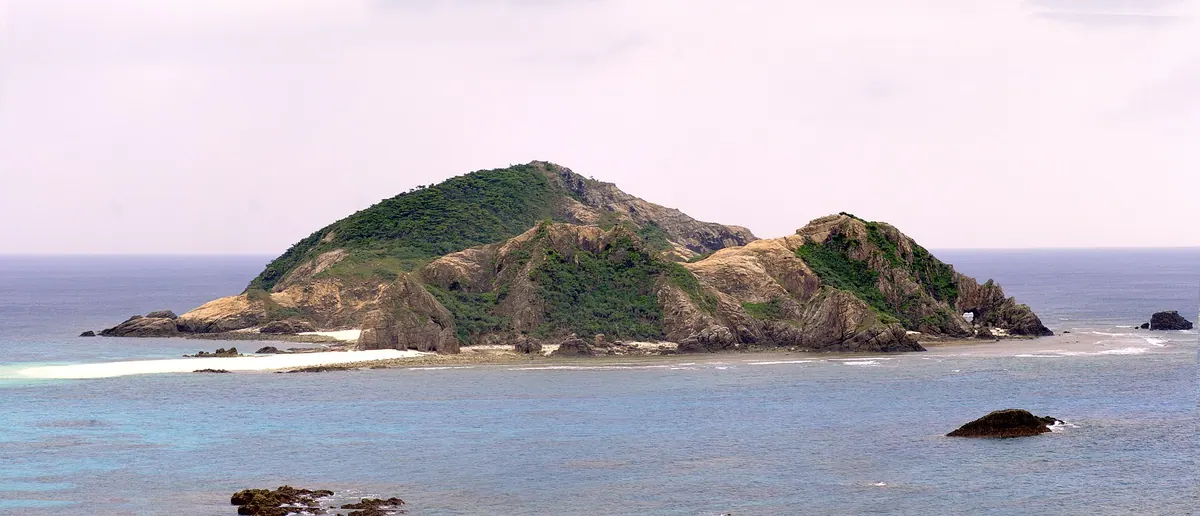
An uninhabited island in the Kerama Islands featuring unique rock formations and a statue of a famous Japanese idol group.
What it is
- An uninhabited island covering 0.1 square kilometers within Okinawa Kaigan Quasi-National Park.
- A landmass consisting of two hills connected by a natural sandbar called a tombolo.
- Part of Tokashiki Village located 800 meters southwest of Aharen Beach.
- A site composed of ancient Paleogene and Cretaceous sandstone reaching 59.4 meters high.
What to see
- A commemorative statue of the Japanese idol group Shibugakitai.
- A natural cave formation known locally as Chinbe-yaya.
- Two distinct hills joined by a narrow strip of land.
- Scenic views of the surrounding Kerama Islands and clear Okinawan waters.
When to go
- The third lunar month to observe residents performing the traditional Hamauri ritual.
Getting there
- Take a ten-minute ferry ride departing from Aharen Beach.
09
Kohama Island
OKINAWA · PLACE 小浜島

A peaceful Yaeyama island known as a TV drama setting, featuring resort facilities, cattle farms, and panoramic hilltop views.
What it is
- A small inhabited island located in the Yaeyama chain of Okinawa Prefecture.
- The primary filming location for the popular NHK television drama Churasan.
- A rural landscape where livestock farming and beef cattle raising are common.
- An island where resort facilities occupy approximately one-fifth of the total land area.
What to see
- Mount Ufudaki provides a viewpoint from the highest point of ninety-nine meters.
- The Omore House is a preserved building registered as a tangible cultural property.
- A natural mangrove community located at Ishinagata Beach.
- Views across the water to the nearby Iriomote Island only two kilometers away.
Getting there
- Regular high-speed boats connect Ishigaki Island directly to Kohama Port.
- Access is limited to sea travel as there is no airport on the island.
10
Ikema Island
OKINAWA · PLACE 池間島
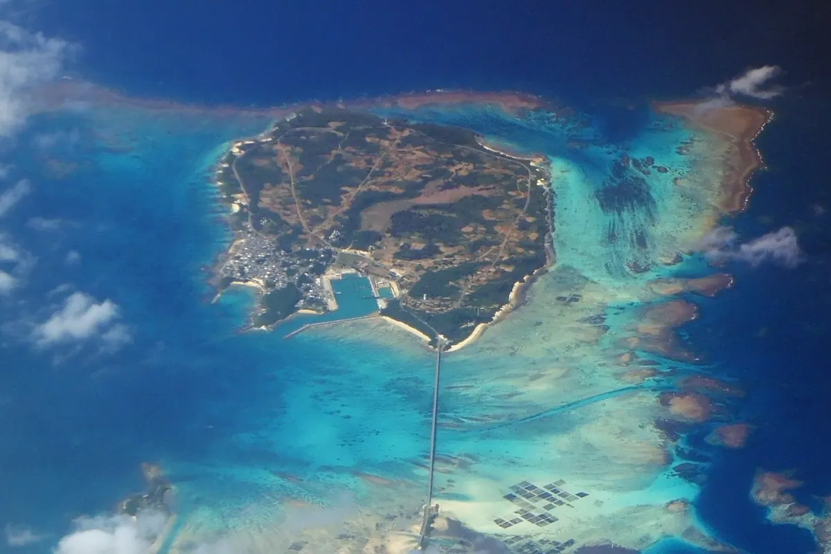
A small island connected to Miyako by bridge, offering a national wildlife protection area and traditional fishing culture.
What it is
- A 2.83 square kilometer island located 1.5 kilometers northwest of Miyako Island.
- A designated national wildlife protection area providing habitat for the Kishinoue's giant skink.
- A fishing community known for its local production of bonito flakes.
- A single landmass originally formed by two separate areas joined by sand.
What to see
- The Ikema Bridge connecting the island to the Miyako mainland.
- A lighthouse on the north coast that has operated since 1940.
- The Ikema Wetland which serves as a protected habitat for local wildlife.
- The Yabiji coral reef group located just north of the island.
When to go
- The Myakuzutsu festival is held annually during the ninth lunar month.
Getting there
- A public bus provides a direct connection from central Miyako Island.
11
Ōgami Island
OKINAWA · PLACE 大神島

A small, sacred island near Miyako featuring unique rock formations and restricted ritual sites accessible only by ferry.
What it is
- A small island covering 0.24 square kilometers north of Miyako Island.
- A sacred location where most areas outside the village are restricted to visitors.
- A community known for the secret Uyagan festival and local dried octopus.
- An island with an unfinished perimeter road and no bridge connections.
What to see
- Eroded rock formations called notches lining the coastal areas.
- A nationally designated historic site used as an observation point.
- The local village and the buildings of the closed schools.
When to go
- During the secret Uyagan festival held on the island.
- Times coordinated with the four daily ferry departures.
Getting there
- Take a ferry from Shimajiri Fishing Port on Miyako Island.
- The ferry service runs four times daily to reach the island.
- Official site
- o-gamijima.com
12
Pinishi Island
OKINAWA · PLACE 平西島
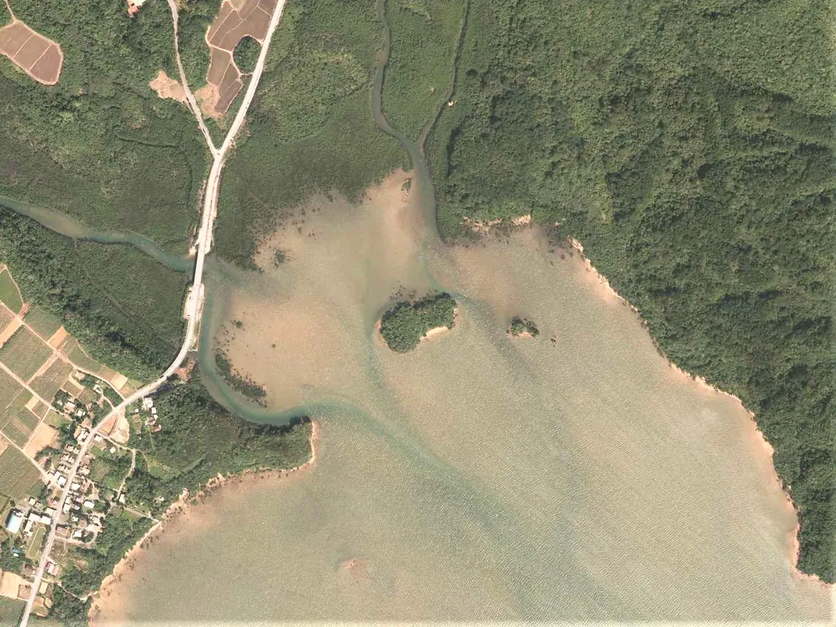
An uninhabited island and sacred site near Iriomote featuring a prehistoric shell mound and protected subtropical marine park waters.
What it is
- An uninhabited island located east of Iriomote Island in Okinawa Prefecture.
- A designated religious site known as an Utaki within a national park.
- A historic site containing a shell mound with prehistoric and medieval artifacts.
- A protected area covered in subtropical evergreen broadleaf forest.
What to see
- The Pinishi Shell Mound featuring ancient earthenware and Chinese ceramics.
- Subtropical evergreen broadleaf forest covering the island landscape.
- Surrounding waters designated as a marine park district.
- Historical site where artifacts from the twelfth to fifteenth centuries were found.
When to go
- Visit during low tide to walk across to the island from the main shore.
Getting there
- Walk four hundred meters east from Komi village during low tide.
13
Minna Island
OKINAWA · PLACE 水納島
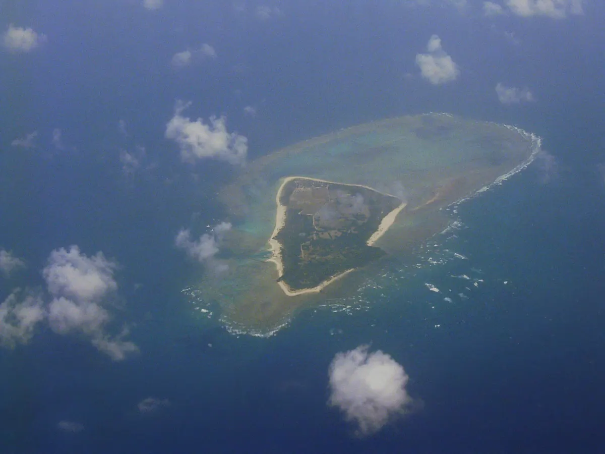
A flat coral reef island and natural park featuring a historic lighthouse and national beacon ruins accessible by charter boat.
What it is
- A flat island formed from raised coral reef within Tarama Prefectural Natural Park.
- Part of the Miyako Islands located eight kilometers north of Tarama Island.
- A small land area of 2.15 square kilometers powered by undersea cables.
- A designated national historic site known for the Sakishima Beacons.
What to see
- The Miyako Minna Island Lighthouse standing in the southeastern part of the island.
- The Sakishima Beacons which are recognized as a national historic site.
- An emergency heliport located in the vicinity of the lighthouse.
- Natural landscapes protected as part of the Tarama Prefectural Natural Park.
Getting there
- Charter boats connect the island to Tarama Island in approximately 20 minutes.
- There are no scheduled ferry services currently available to the island.
14
Ou Island
OKINAWA · PLACE 奥武島

A small inhabited island connected by bridge, famous for its local tempura shops, diving spots, and traditional dragon boat races.
What it is
- A small island in southern Nanjo City connected to the main island by a bridge.
- A fishing community with approximately nine hundred residents and a road circling the entire perimeter.
- A destination known for its local seafood restaurants and specialty tempura shops.
- A hub for scuba diving located primarily on the western side of the island.
What to see
- The Kannon-do temple which houses a statue gifted by Chinese sailors.
- A distinctive dragon god rock located along the coastal road.
- Traditional Haari boat races held on the water during the festival season.
When to go
- The Haari boat race takes place on the fourth day of the fifth lunar month.
Getting there
- The island is approximately forty minutes from Naha by car via the connecting bridge.
15
Geruma Island
OKINAWA · PLACE 慶留間島
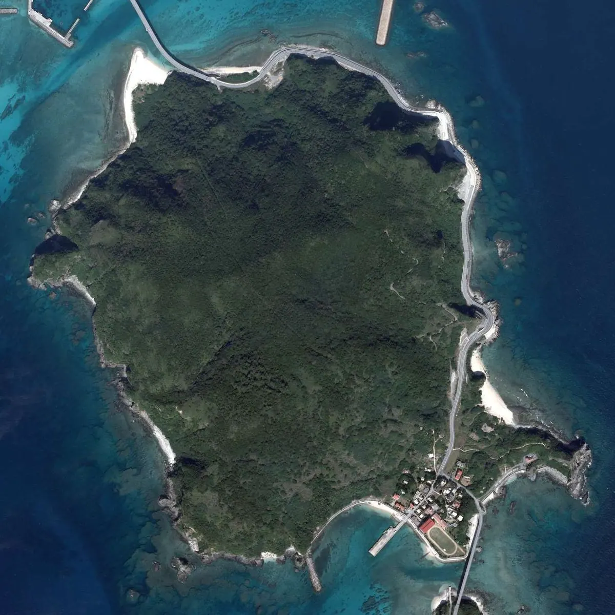
The smallest inhabited island in Zamami, offering traditional Okinawan architecture and sightings of wild Kerama deer in a quiet setting.
What it is
- A small inhabited island within the Kerama Islands of Okinawa Prefecture.
- The smallest populated island in Zamami Village with only sixty-two residents.
- A quiet rural destination measuring just over one square kilometer in total area.
What to see
- The Takara House, which is designated as a National Important Cultural Property.
- Wild Kerama deer that live across the island's natural landscape.
- Local papaya crops which are grown as a specialty product of the island.
- Aka Bridge and Geruma Bridge which connect to neighboring islands.
Getting there
- High speed boats from Naha reach nearby Aka Port in fifty minutes.
- The island is accessible by car from the Kerama Airport on Fukaji Island.
- Road bridges allow travelers to cross over from Aka Island and Fukaji Island.
16
Miyagi Island
OKINAWA · PLACE 宮城島
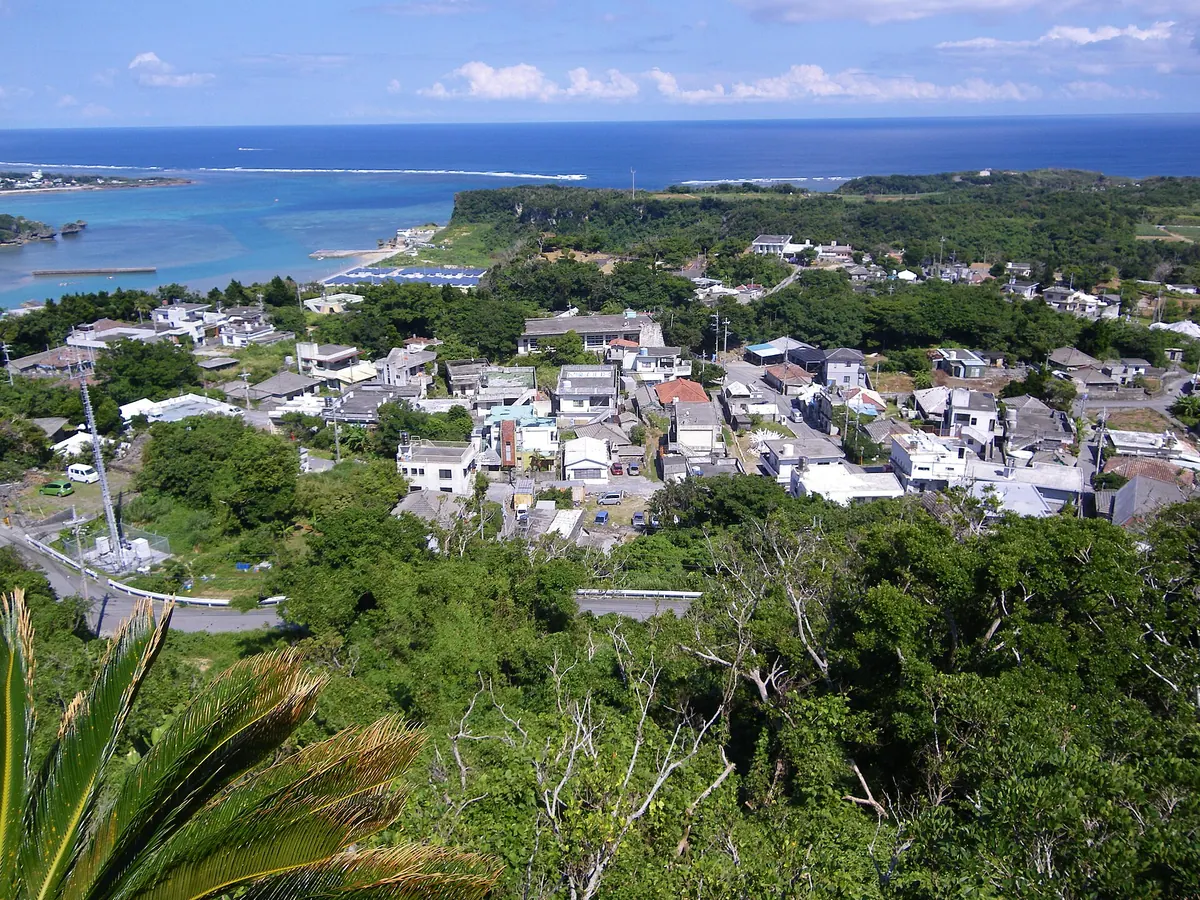
A peaceful Okinawan island featuring ancient archaeological sites, historic castle ruins, and traditional sugarcane fields connected by scenic bridges.
What it is
- A 5.54 square kilometer island located between Henza Island and Ikei Island in Okinawa.
- A historic location once used as a place of exile for the Ryukyu Kingdom.
- An agricultural community primarily focused on the production of sugarcane.
- A site of human habitation dating back approximately 3,000 years at Shinugudo.
What to see
- The Hitaki peak which serves as the highest point at 121.4 meters.
- Stone walls from the Gusuku period located at the Tomari Gusuku site.
- The Tobaru Bridge connecting the island to neighboring Henza Island.
- The Ikei Ohashi Bridge providing a path to Ikei Island.
- Traditional landscapes across the four districts of Ikemi, Uehara, Miyagi, and Tobaru.
Getting there
- Access is available via a community bus service operated by Uruma City.
17
Kurima Island
OKINAWA · PLACE 来間島
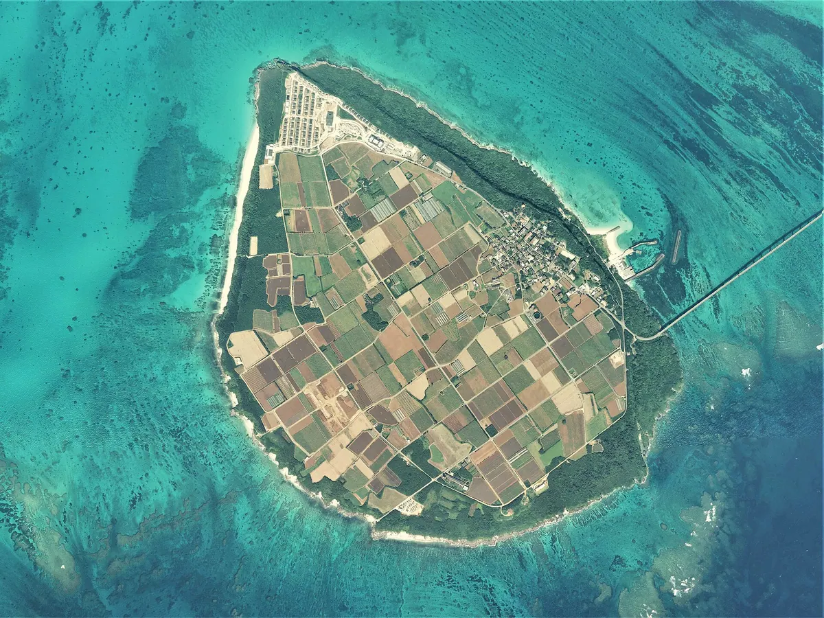
A small agricultural island connected by bridge to Miyako, offering panoramic ocean views and quiet white sand beaches.
What it is
- A small island in Okinawa Prefecture covering less than three square kilometers
- An agricultural community primarily focused on growing sugarcane and leaf tobacco
- A residential area with a population of approximately one hundred and fifty people
- A destination connected to Miyako Island by a bridge opened in 1995
What to see
- The three-story Ryugujo Observatory designed in the shape of a palace
- Nagama Beach featuring one kilometer of sand on the western coast
- The Kurima Tomi national historic site constructed from piled Ryukyu limestone
- The 1,690 meter long bridge spanning the water to Miyako Island
Getting there
- The Miyako Kyoei Bus provides public transportation from central Miyako
- Visitors can drive across the bridge connecting the island to Miyako
18
Kudaka Island
OKINAWA · PLACE 久高島
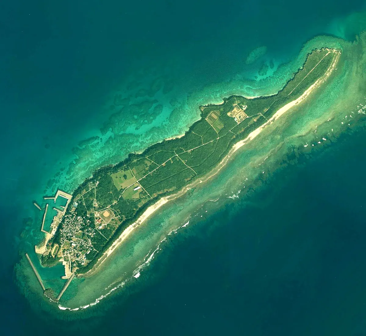
A sacred Ryukyuan island near Okinawa known for its deep spiritual traditions, communal land ownership, and unique sea snake soup.
What it is
- A sacred site in Ryukyuan mythology located east of Cape Chinen.
- A small island with a circumference of eight kilometers and low elevation.
- A community where land is collectively owned by the local association.
- A traditional agricultural center producing noni tea and smoked sea snake.
What to see
- Kubo Utaki, a sacred site where men are strictly prohibited from entering.
- Tokujin Port, the primary maritime gateway connecting to the main island.
- Coastal views from the highest point seventeen meters above sea level.
When to go
- The Izaiho ritual is held once every twelve years.
Getting there
- Take a ferry from Azama Port on Okinawa Island to Tokujin Port.
- Expect no public transportation system once you arrive on the island.
- Official site
- kudaka-island.com
19
Henza Island
OKINAWA · PLACE 平安座島
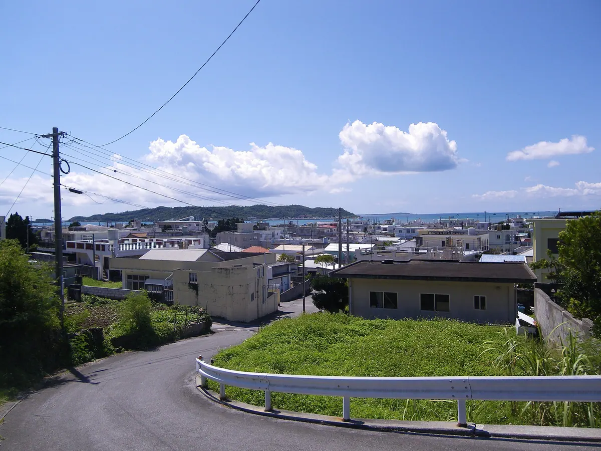
An Okinawan island featuring massive oil storage terminals and a scenic sea road connecting it to the main island.
What it is
- A 5.44 square kilometer island in Uruma City composed of Ryukyu limestone.
- A designated quasi-national park since 1965 featuring large oil storage terminals.
- Home to the Agari-hantabaru shell mound discovered by archaeologists.
- A populated island connected to the mainland by a 4.75 kilometer sea road.
What to see
- Extensive oil storage facilities built on reclaimed land.
- The Hamahiga Bridge which connects the island to neighboring Hamahiga Island.
- The highest point of the island reaching 115.6 meters above sea level.
- The 4.75 kilometer sea road offering views of the surrounding water.
Getting there
- Uruma City operates a bus service connecting the island to Yakena.
- Accessible from the Okinawa mainland via a 4.75 kilometer sea road.
- Official site
- www.henza.jp
20
Tokashiki Island
OKINAWA · PLACE 渡嘉敷島

The largest Kerama island offering white sand beaches, humpback whale watching, and a history spanning from prehistory to World War II.
What it is
- The largest island in the Kerama Islands chain west of Naha.
- A primary tourism destination within the Kerama Shotoku National Park.
- A former Japanese Imperial Army base with a tragic World War II history.
- Site of the prehistoric Hinakushi Shell Mound and a Ryukyu Kingdom signal platform.
What to see
- Aharen Beach featuring eight hundred meters of white sand.
- Humpback whales migrating through the surrounding waters.
- The National Okinawa Youth Friendship Center facilities.
- Historical sites including the ancient shell mound and signal fire platform.
When to go
- Winter months to observe migrating humpback whales in the area.
Getting there
- High-speed boat from Naha reaches the island in thirty-five minutes.