

20 Islands in Kagoshima worth your time
Japan Gems
42 Islands in Kagoshima, with what to see and how to get there.
Kagoshima has 42 islands on Japan Gems. Below are the 20 we can tell you the most about — each one written up in English from Japanese sources, with what to see and how to get there. See all islands in Kagoshima.
01
Akusekijima
KAGOSHIMA · PLACE 悪石島
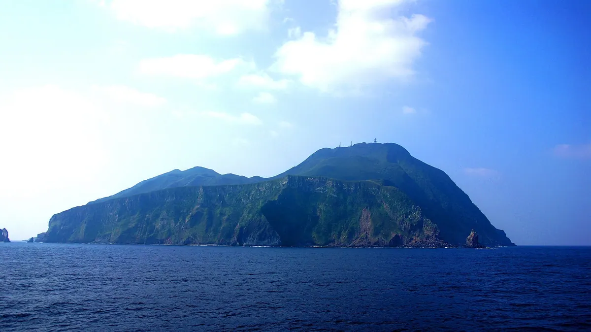
A remote volcanic island home to unique masked god rituals, natural hot springs, and lush subtropical plant life.
What it is
- A volcanic island in the Tokara chain formed during the late Pleistocene period.
- A small community with a population of eighty-nine people.
- The southern geographic limit for several northern animal species.
- A land of subtropical flora including banyan trees and Chinese fan palms.
What to see
- Mount Mitake which serves as the highest point at five hundred eighty-four meters.
- Masked gods known as Boze that appear during the Obon festival.
- A memorial dedicated to the sunken cargo ship Tsushima Maru.
- Natural sand baths and hot springs located on the island.
When to go
- During the Obon festival to witness the appearance of the Boze masked gods.
Getting there
- Take a ferry from Kagoshima Port which takes eleven hours to arrive.
- Plan carefully as the ferry service operates only twice a week.
02
Takeshima
KAGOSHIMA · PLACE 竹島
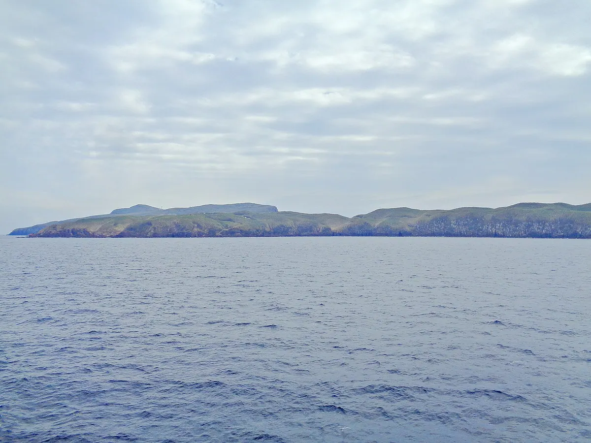
A remote volcanic island in Kagoshima covered in Ryukyu bamboo, offering a quiet look at rural island life and nature.
What it is
- A small inhabited island located in the northern Satsunan Islands of Kagoshima Prefecture.
- Part of Mishima Village situated on the northern edge of the Kikai Caldera.
- Home to a small community of fifty-eight people and grazing black cattle.
- A land area of four square kilometers dominated by dense Ryukyu bamboo.
What to see
- Mount Magome reaches two hundred and twenty meters as the island's highest point.
- The endemic Takeshima Gastrodia orchid grows within the island's unique ecosystem.
- Expansive pastures where local black cattle graze across the landscape.
- Dense forests of Ryukyu bamboo that cover the majority of the island surface.
Getting there
- The village-run Ferry Mishima departs from Kagoshima Port four times per week.
- The ferry journey from the mainland takes approximately three hours to arrive.
03
Kakeromajima
KAGOSHIMA · PLACE 加計呂麻島
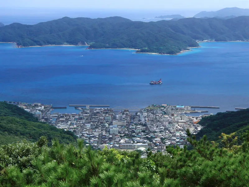
A quiet island south of Amami Oshima featuring traditional settlements, historical shrines, and a former World War II military port.
What it is
- A seventy-seven square kilometer island located south of Amami Oshima across the Oshima Strait.
- A rural community with approximately thirty small settlements and a population of about twelve hundred people.
- An island with industries focused on sugarcane cultivation, fishing, and local tourism.
- A former military port during World War II and a filming location for the Tora-san movie.
What to see
- Ochon Shrine which enshrines the historical figure Taira no Sukemori.
- A long coastline measuring over one hundred and forty-seven kilometers.
- Traditional island settlements connected by several local bus routes.
When to go
- Visit during the Shodon Shibaya festival hosted at the Ochon Shrine.
Getting there
- Take a regular ferry from Koniya Port on Amami Oshima to reach the island.
04
Amami Ōshima
KAGOSHIMA · PLACE 奄美大島
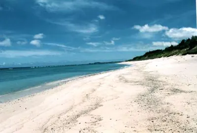
A UNESCO World Natural Heritage island featuring Japan's second largest mangrove forest and unique wildlife like the endangered Amami rabbit.
What it is
- The fifth largest island in Japan, located between Kagoshima City and Okinawa Island.
- A UNESCO World Natural Heritage site registered in 2021 for its unique biodiversity.
- Part of the Amami Gunto National Park featuring diverse subtropical ecosystems.
- The production center for Amami Oshima Tsumugi, a famous traditional silk textile.
What to see
- The second largest mangrove forest in Japan located along the coastline.
- Mount Yuwan, the highest peak on the island at 694.4 meters.
- The endangered Amami rabbit, which is native to this specific island habitat.
- Setouchi Town, known as the top producer of farmed bluefin tuna in Japan.
Getting there
- Amami Airport provides flight connections via JAL, Skymark, and Peach airlines.
- Ferries connect Naze Port to both Kagoshima and Okinawa for sea travelers.
05
Kuroshima
KAGOSHIMA · PLACE 黒島
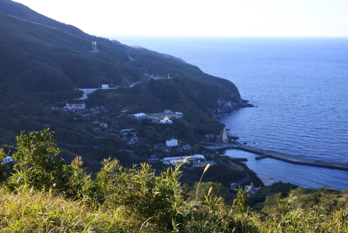
A remote volcanic island in Kagoshima offering national natural monuments, peace memorials, and a unique geopark landscape.
What it is
- An inhabited island in the northern Satsunan Islands part of Mishima Village.
- A designated Mishima Village-Kikai Caldera Geopark with two main settlements.
- A national natural monument recognized for its unique forest plant community.
- The setting for the novel I Will Not Forget by Sawako Ariyoshi.
What to see
- Peace memorials located in the southern part of the island honoring war victims.
- Extensive forest plant communities protected as a national natural monument.
- Local livestock farms and agricultural fields producing sweet potatoes for shochu.
- Geological formations within the Mishima Village-Kikai Caldera Geopark.
Getting there
- Mishima village-run ferries operate three times a week from Kagoshima Port.
- There is no airport or public transportation available once on the island.
06
Shoura Island
KAGOSHIMA · PLACE 諸浦島
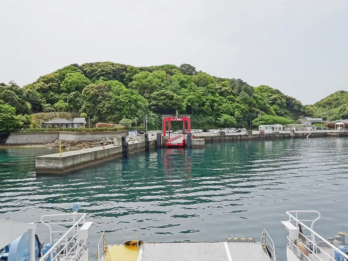
A populated island in Unzen-Amakusa National Park connected by bridge, offering scenic coastal views and ferry access to nearby ports.
What it is
- A residential island in the Nagashima Archipelago with approximately five hundred inhabitants.
- Most of the island territory is designated as part of Unzen-Amakusa National Park.
- The island is divided into three distinct districts named Shirase, Motoura, and Kuzuwa.
- It is also known by the alternative name Motoura Island.
What to see
- The Chichinoseto Bridge which connects the island to the Nagashima Main Island.
- Shoura Port where local ferry services operate daily.
- Kagoshima Prefectural Road Forty-Seven which serves as the main route through the island.
- The local Motoura Elementary School located within the island community.
Getting there
- Cross the Chichinoseto Bridge from Nagashima Main Island by vehicle.
- Take the Tencho Ferry from Shoura Port to Katasoba or Nakada Ports.
07
Okinoerabujima
KAGOSHIMA · PLACE 沖永良部島
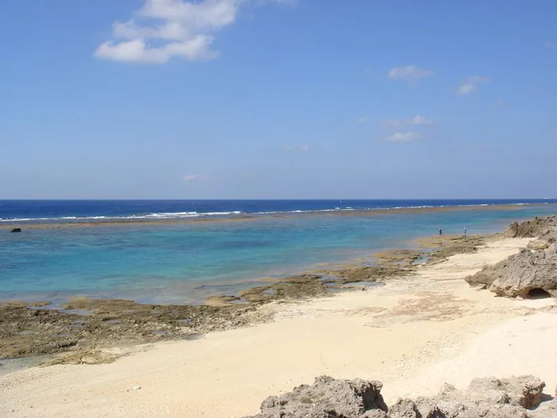
A subtropical coral reef island in the Amami chain famous for its extensive limestone cave systems and lily fields.
What it is
- A raised coral reef island located in the southwestern Amami Islands of Kagoshima Prefecture.
- A subtropical destination consisting of two municipalities named Wadomari and China.
- A unique landscape of limestone terrain that is notably free of venomous habu snakes.
- An island formerly under United States military rule until its return to Japan in 1953.
What to see
- Numerous limestone caves including Shoryudo and the 240-meter high Mount Oyama.
- Oyama Mizukagami Cave, which is the second longest cave system in Japan.
- Agricultural fields dedicated to the production of potatoes, sugarcane, and lilies.
- Coastal views across the island's unique raised coral reef formations.
Getting there
- Okinoerabu Airport provides flight connections from Kagoshima, Amami, Tokunoshima, and Okinawa.
08
Kodakara Island
KAGOSHIMA · PLACE 小宝島
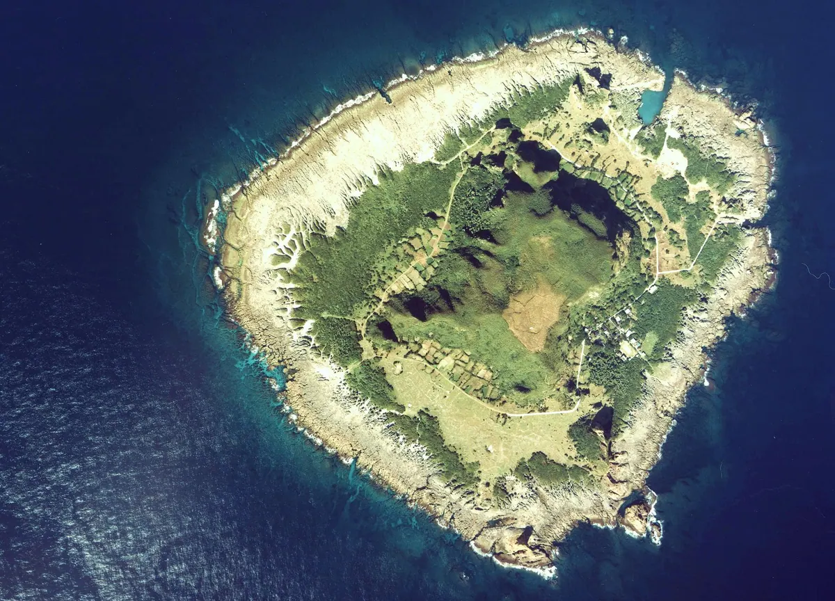
A tiny subtropical island in the Tokara chain featuring unique coral formations and a high-temperature natural hot spring.
What it is
- A small inhabited island spanning one square kilometer within the Tokara Islands chain.
- Part of Toshima Village in Kagoshima Prefecture with a population of approximately fifty-three people.
- A landmass formed from coral reef deposits and volcanic rock surrounded by active submarine volcanoes.
- The northernmost natural habitat for the Tokara habu snake species.
What to see
- Yudomari Hot Spring which features a water source temperature exceeding ninety degrees Celsius.
- The local school facility known as the Kodakara Island Academy.
- A small community post office serving the island residents.
- Natural landscapes across a coastline with a total circumference of 4.74 kilometers.
When to go
- Be aware that the subtropical climate brings heavy rainfall starting in May.
09
Yoroshima
KAGOSHIMA · PLACE 与路島
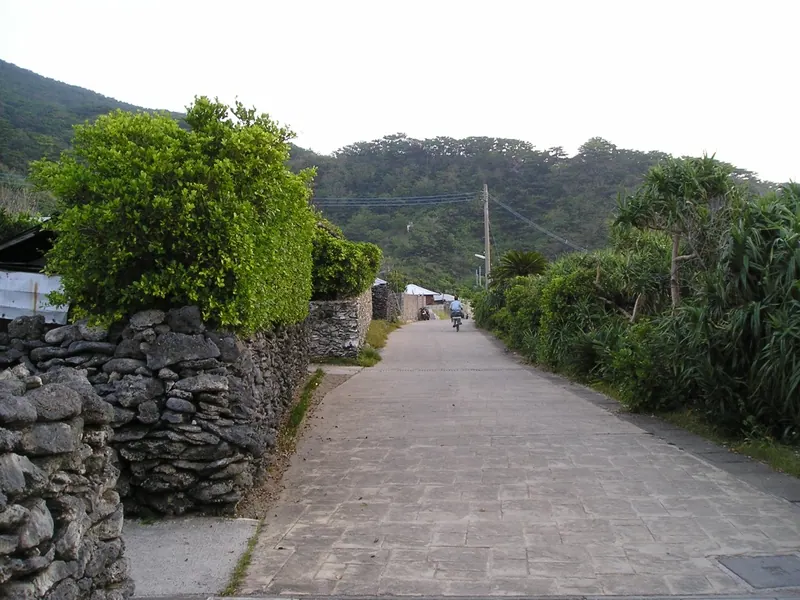
A quiet Amami island famous for traditional coral stone walls and rare nocturnal flowers blooming in the summer months.
What it is
- A small island in the Amami archipelago covering nine square kilometers.
- A rural community with a population of approximately forty-one people.
- An award-winning destination recognized for its traditional landscape and culture.
- A center for local fishing, cattle farming, and poultry industries.
What to see
- Hand-stacked coral stone walls surrounding seventy percent of the local houses.
- Sagaribana flowers that bloom across the island during the summer.
- Local wildlife including Ryukyu wild boars and native Habu snakes.
- A cosmetics research facility that processes seawater near the coast.
When to go
- July to August to see the Sagaribana flowers in bloom.
Getting there
- Take the municipal ferry from Koniya Port to reach Yoro Port.
- Official site
- yorojima.jp
10
Kuchinoerabu Island
KAGOSHIMA · PLACE 口永良部島
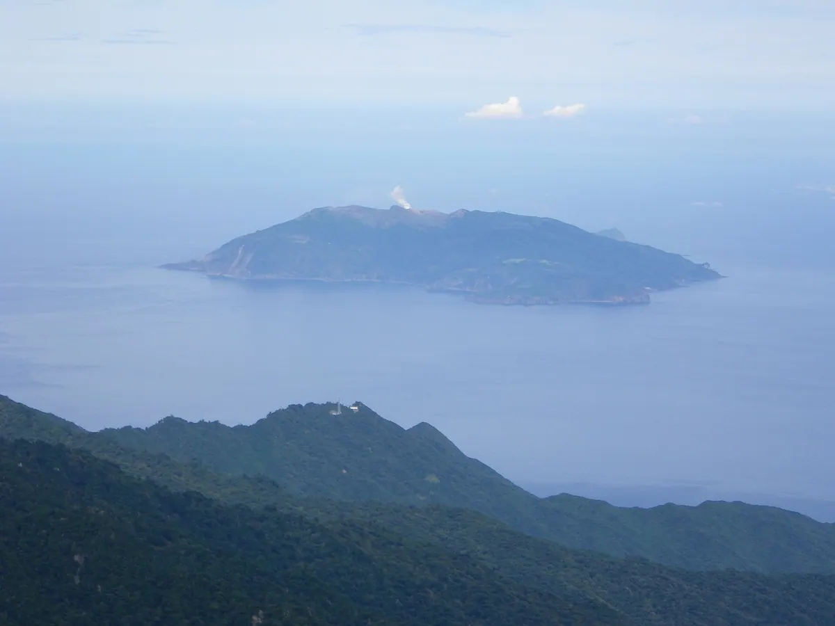
A volcanic island and UNESCO Eco Park near Yakushima featuring active craters, rare flying foxes, and natural hot springs.
What it is
- A volcanic island located twelve kilometers west of Yakushima within a national park.
- A UNESCO Eco Park home to a small community of approximately one hundred thirty-seven residents.
- An active volcanic site monitored by the Japan Meteorological Agency for seismic activity.
- The natural habitat of the rare Erabu flying fox species.
What to see
- The Shindake crater which experienced explosive eruptions in 2014 and 2015.
- Mount Furudake reaching a peak elevation of six hundred fifty-seven meters.
- Natural hot springs including the Motomura and Yumugi baths.
- Diverse wildlife and volcanic landscapes across thirty-eight square kilometers of protected land.
Getting there
- A municipal ferry provides transportation from Yakushima and Tanegashima islands.
- Official site
- kuchinoerabujima.com
11
Iōjima
KAGOSHIMA · PLACE 硫黄島
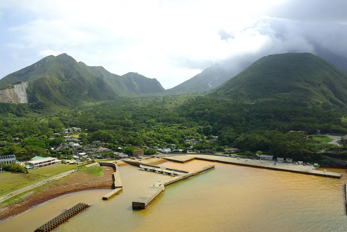
A remote volcanic island in Kagoshima featuring reddish-brown harbor waters and a UNESCO-recognized ritual mask festival.
What it is
- A volcanic island on the Kikai Caldera rim within the Satsunan Islands chain.
- An active Class A volcano with a main peak reaching 703.7 meters high.
- A small community of 125 people known for producing black-haired Wagyu beef.
- A historic site where sulfur mining has taken place since the 11th century.
What to see
- The harbor waters which appear reddish-brown due to high iron content.
- Mount Io, the island's prominent volcanic peak rising from the sea.
- Showa Iojima, a landmass formed by a submarine eruption in 1934.
- The Mendon ritual masks associated with UNESCO Intangible Cultural Heritage.
Getting there
- Take the Ferry Mishima from Kagoshima Port for the journey to the island.
- The ferry service operates only once every two to three days.
12
Nakanoshima
KAGOSHIMA · PLACE 中之島
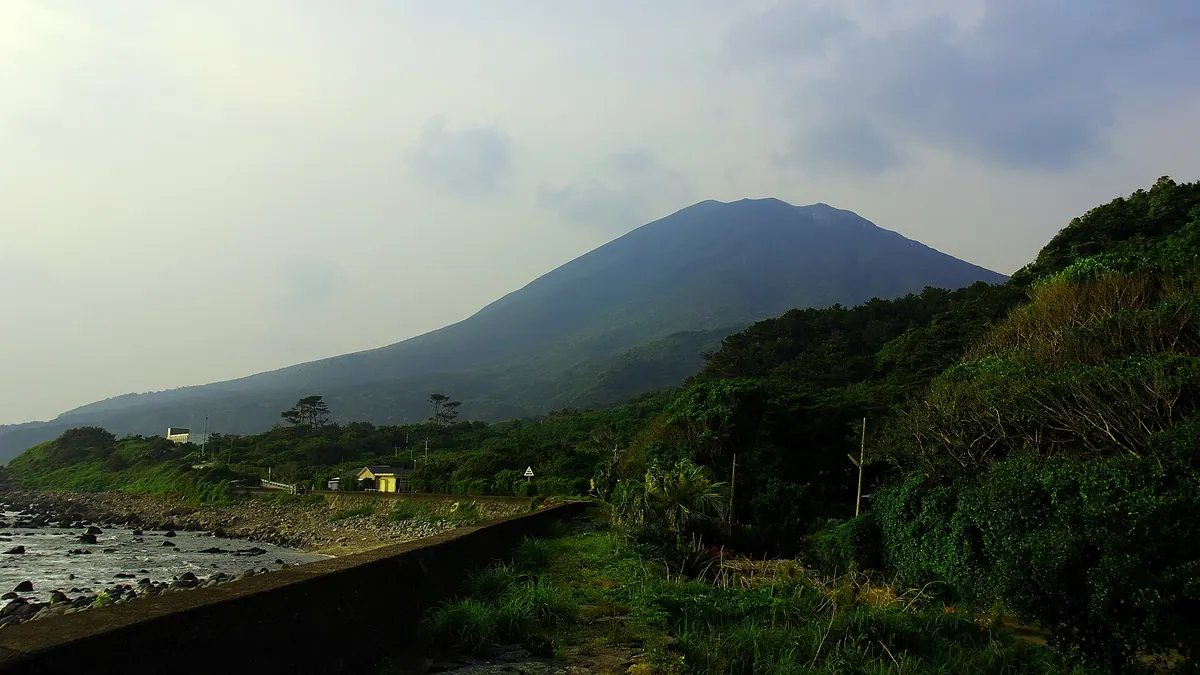
A volcanic island in the Tokara archipelago featuring an active stratovolcano, ancient Jomon ruins, and unique native horses.
What it is
- An island in the Tokara archipelago covering over thirty-four square kilometers.
- Part of Toshima Village and served as the village administrative center until 1956.
- Home to the native Tokara horse breed.
- Site of the Tachibana ruins containing remains from a Late Jomon settlement.
What to see
- Mount Otake, an active andesite stratovolcano rising 979 meters above sea level.
- Multiple public hot spring baths located across the island.
- The Nakanoshima Observatory which houses a 60cm Cassegrain reflecting telescope.
- Archaeological remains of an ancient settlement at the Tachibana ruins.
Getting there
- A ferry from Kagoshima Port reaches the island in approximately seven hours.
- No buses or taxis are available for transport once on the island.
13
Nakakoshiki Island
KAGOSHIMA · PLACE 中甑島
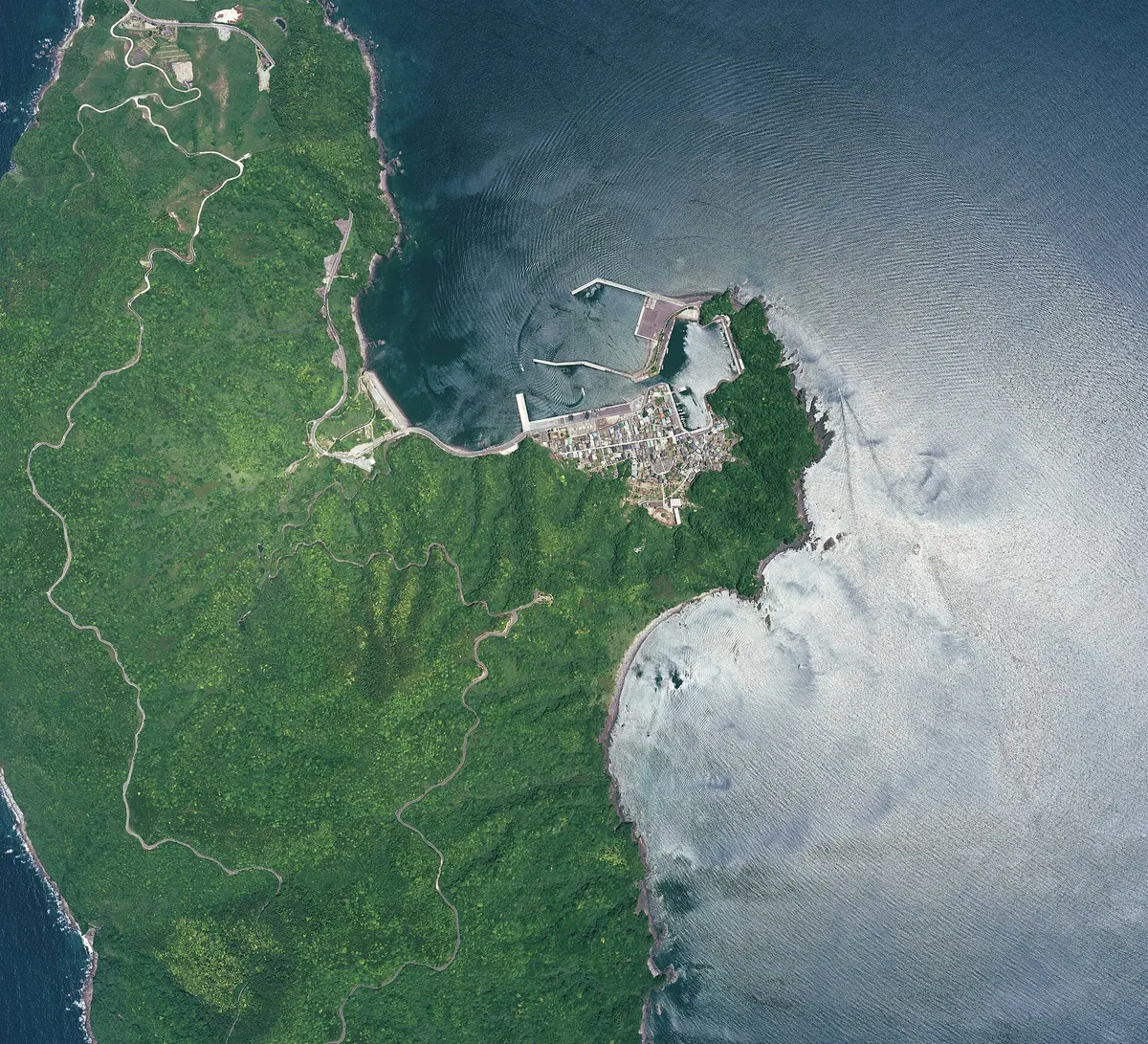
A quiet island in Kagoshima offering dramatic geological faults, rare botanical life, and traditional dances within a quasi-national park.
What it is
- A small island covering seven square kilometers within the Koshiki Island Quasi-National Park.
- A fishing community that was home to fewer than two hundred residents in 2020.
- The northernmost natural habitat for the Cyathea lepifera fern species.
- A mountainous landscape reaching its highest point at the summit of Mount Kinokuchi.
What to see
- The Koshiki Bridge which provides a road connection to neighboring Shimokoshiki Island.
- The Kanoko Fault which serves as a major visible geological feature on the island.
- Wild Lilium speciosum flowers growing in their natural island habitat.
- Traditional Naishimai dances performed by local middle school girls.
When to go
- Visit in November to witness the traditional Naishimai dance performances.
14
Yokoate-jima
KAGOSHIMA · PLACE 横当島
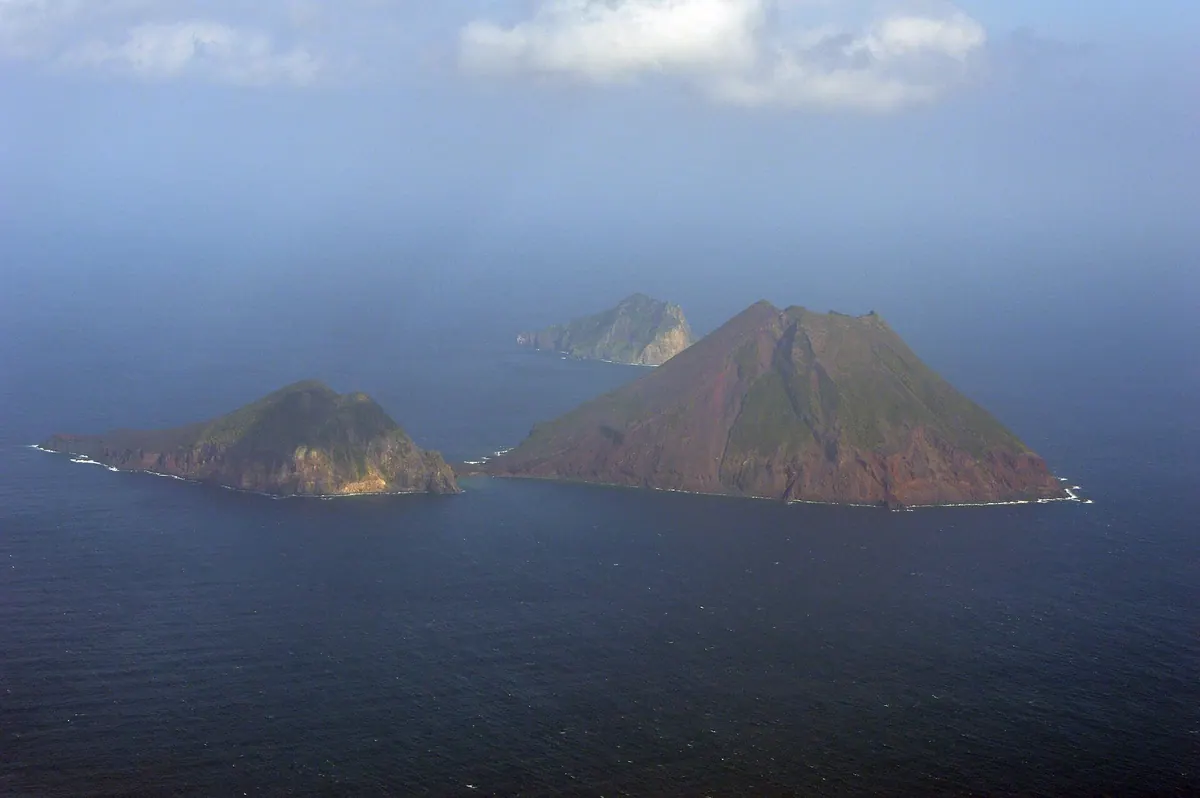
An uninhabited volcanic island in the Tokara chain featuring two peaks, feral goats, and remnants of past palm harvesting operations.
What it is
- The southernmost uninhabited island in the Tokara chain of Kagoshima Prefecture.
- A landmass formed by two stratovolcanoes connected by a natural sandbar.
- A location with no historical record of permanent human habitation.
- Part of Toshima Village situated forty-two kilometers south-southwest of Takarajima.
What to see
- A volcanic crater measuring approximately three hundred and fifty meters wide.
- The highest peak reaching an elevation of nearly four hundred and ninety-five meters.
- Feral goats that live across the island and nearby Kannonijima.
- Remains of old huts and steel towers from former palm harvesting activities.
- Andesite rock formations that compose the majority of the island terrain.
- Views of Kannonijima located about two kilometers to the north.
15
Shimokoshikijima
KAGOSHIMA · PLACE 下甑島
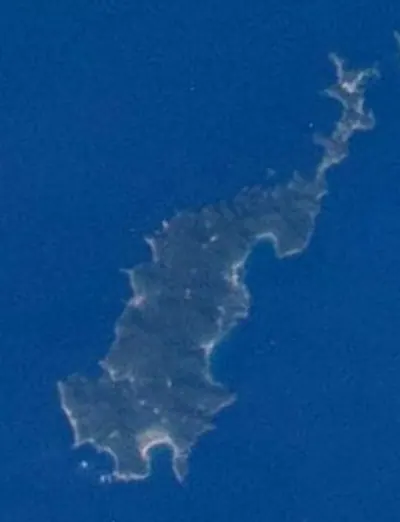
A scenic island in Kagoshima known for dinosaur fossils, unique flora, and the UNESCO-recognized Toshidon folk tradition.
What it is
- A 65.56 square kilometer island located in the southern Koshikijima chain.
- The northernmost natural habitat for the tree fern species.
- The real-world setting that served as the model for the Dr. Koto Shinryojo manga.
- A site where Ceratopsian dinosaur fossils were discovered in 2013.
What to see
- Mount Odake which reaches a height of 604 meters.
- The Koshiki Bridge connecting the island to Nakakoshikijima.
- Natural habitats of the Lilium speciosum lily.
- Deep seawater collection facilities operating at a depth of 375 meters.
When to go
- The Toshidon folk event which is a UNESCO Intangible Cultural Heritage tradition.
Getting there
- High-speed boats and ferries provide transportation from the mainland.
16
Takarajima
KAGOSHIMA · PLACE 宝島
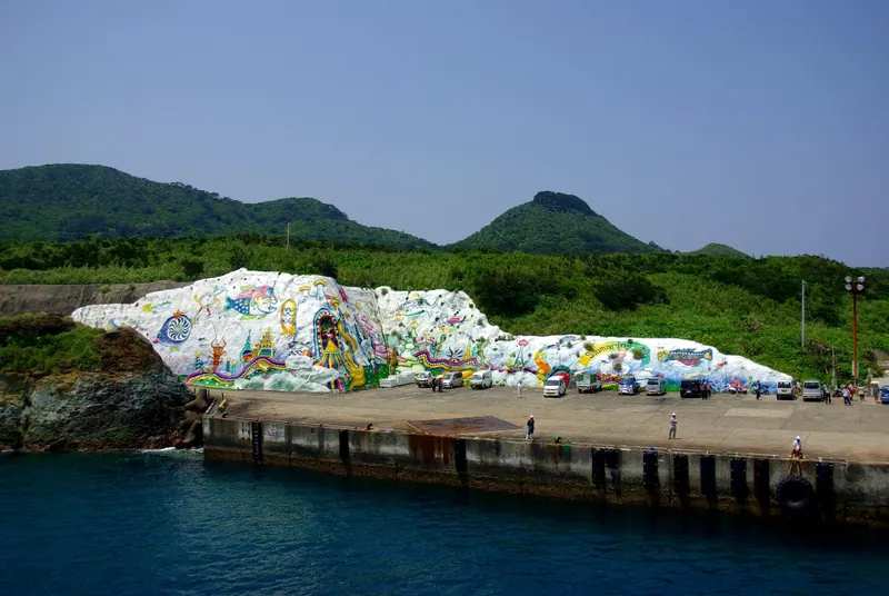
A remote subtropical island in the Tokara chain known for coral reefs and legends of Captain Kidd's buried treasure.
What it is
- The southernmost inhabited island in the Tokara archipelago with a population of 131 people.
- A small landmass of seven square kilometers surrounded by coral reefs.
- Site of an 1824 raid by British sailors that triggered a national isolationist edict.
- A location where ancient Jomon and Yayoi period pottery has been excavated.
What to see
- Extensive coral reefs surrounding the entire island coastline.
- A public school and a post office serving the local community.
- Subtropical landscapes that reportedly inspired legends of hidden pirate treasure.
When to go
- Avoid the heavy rain common during the subtropical summer months.
Getting there
- Take a ferry from Kagoshima Port for a thirteen hour journey.
17
Kuchinoshima
KAGOSHIMA · PLACE 口之島
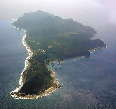
The northernmost inhabited Tokara island featuring wild cattle, volcanic peaks, and a hot spring on the southwest coast.
What it is
- A volcanic island covering thirteen square kilometers in the Tokara chain.
- The northernmost inhabited island in the archipelago with about one hundred residents.
- A former territory under United States administration from 1946 to 1952.
- The location where the 30th parallel north passes through the northern end.
What to see
- Wild Kuchinoshima cattle living in the southern evergreen forests.
- Mount Maedake, the highest volcanic peak reaching 628 meters.
- Seramma Onsen, a hot spring located on the southwest coast.
- The Tamoto lily, a plant species endemic to this specific island.
Getting there
- Access is available via the village-run ferry from Kagoshima.
- The island can also be reached by ferry from Amami Oshima.
18
Tokunoshima
KAGOSHIMA · PLACE 徳之島
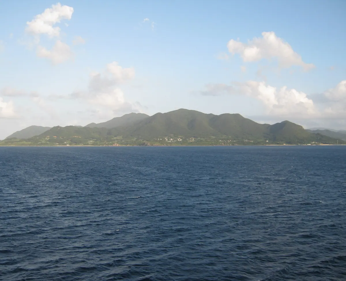
A UNESCO World Natural Heritage island featuring rare wildlife, unique limestone landscapes, and a 400-year-old bullfighting tradition.
What it is
- A World Natural Heritage island located in the center of the Amami archipelago.
- A rural landscape dominated by sugarcane, potato, and ginger farming industries.
- An area famous for its high birth rate and the longevity of its residents.
- A 247 square kilometer island consisting of Tokunoshima, Isen, and Amagi towns.
What to see
- Rare local wildlife including the endangered Amami rabbit.
- Distinctive limestone karst topography and natural sea caves along the coast.
- Mount Inokawa, the highest peak on the island at 645 meters.
- Traditional bullfighting events, a local custom practiced for over 400 years.
Getting there
- JAL operates direct flights to the island from Kagoshima and Amami airports.
19
Tanegashima
KAGOSHIMA · PLACE 種子島
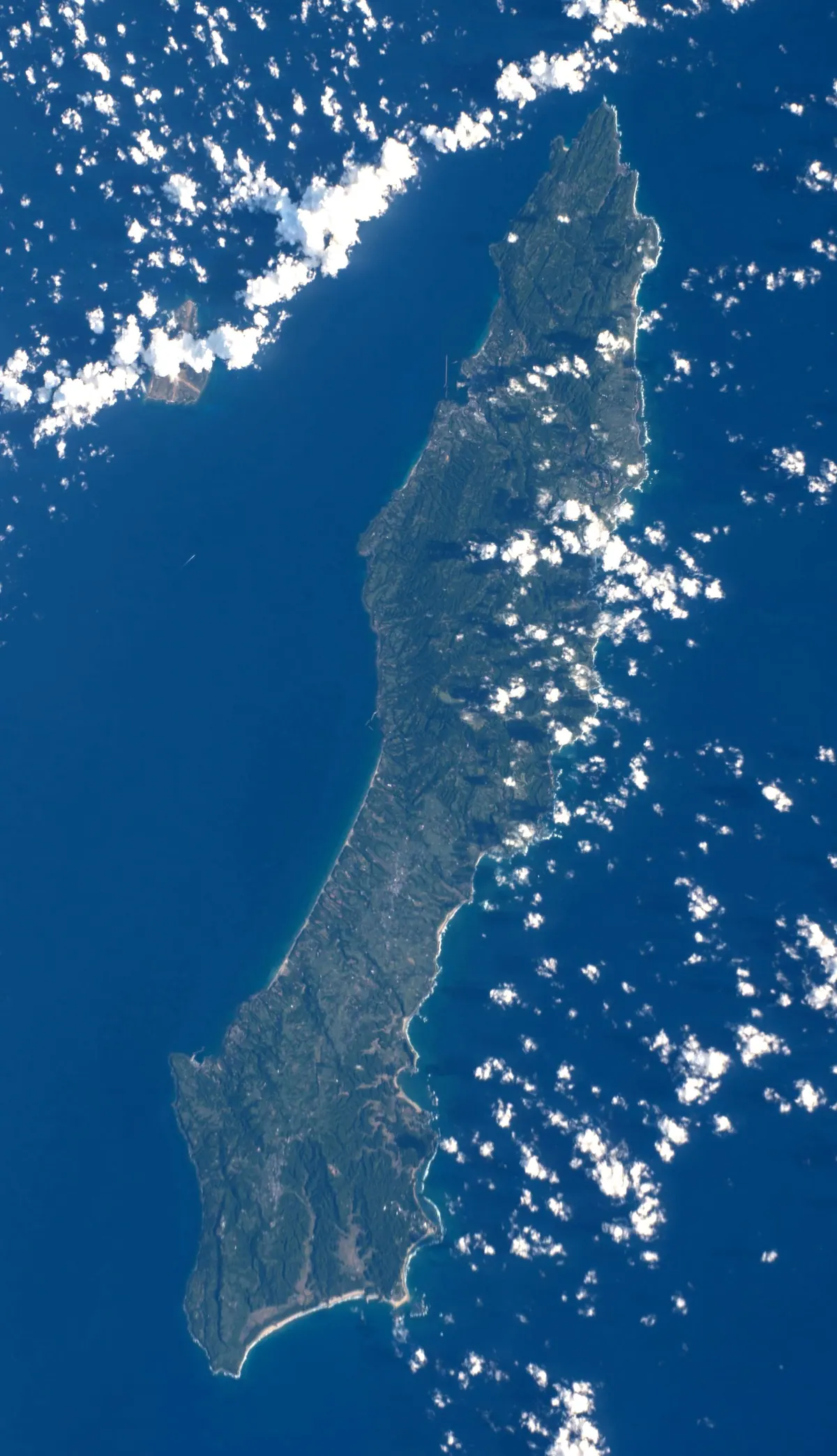
A historic island in Kagoshima known for the introduction of firearms, modern space exploration, and ancient archaeological ruins.
What it is
- An island in the Osumi chain covering 444 square kilometers in Kagoshima Prefecture.
- The site where Portuguese travelers introduced firearms to Japan in 1543.
- A major hub for satellite launches at the Tanegashima Space Center.
- A destination for surfing and various marine sports across three local municipalities.
What to see
- The Hirota ruins which are a designated National Historic Site.
- The Tanegashima Space Center facilities used for modern rocket launches.
- Mawarinomine which is the highest point on the island at 282.4 meters.
- The central city area of Nishinoomote and the surrounding coastal landscapes.
When to go
- August for the annual Tanegashima Gun Festival held on the island.
20
Kamikoshikijima
KAGOSHIMA · PLACE 上甑島
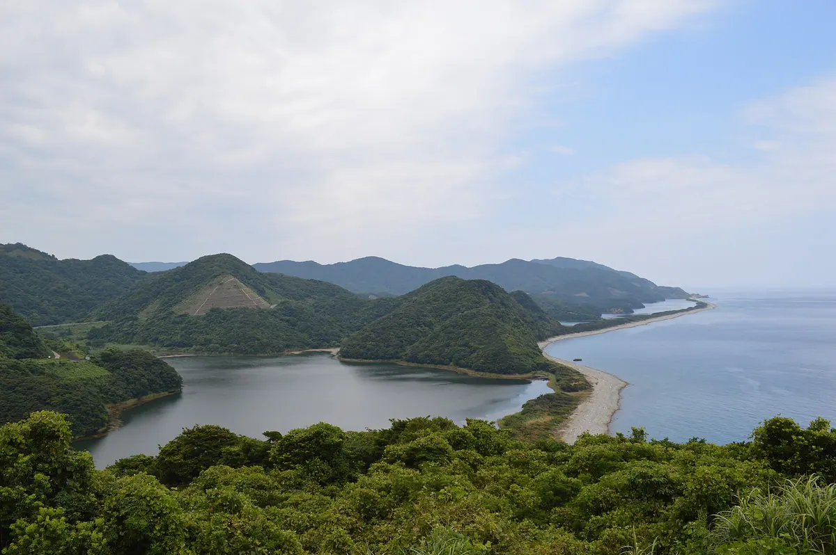
An island in the Koshikijima Archipelago known for unique sandbar ponds, scenic bridges, and rare wild lilies.
What it is
- An island covering forty-four square kilometers in the northern Koshikijima Archipelago.
- Part of the Koshikijima Quasi-National Park designated in 2015.
- A natural habitat for the Lilium speciosum flower.
- Home to the Koshikijima Wind Power Plant which began operations in 1990.
What to see
- Nagame-no-hama features three ponds separated from the sea by long sandbars.
- Mount Tomeki offers views from the island's highest peak at 423 meters.
- Koshiki Bridge and Kanoko Bridge connect the island to neighboring Nakakoshikijima.
- Traditional Naishimai folk dances performed at the local Hachiman Shrine.
Getting there
- High-speed boats travel from Sendai Port to Sato Port in 50 minutes.