

20 Islands in Hokkaidō worth your time
Japan Gems
27 Islands in Hokkaidō, with what to see and how to get there.
Hokkaidō has 27 islands on Japan Gems. Below are the 20 we can tell you the most about — each one written up in English from Japanese sources, with what to see and how to get there. See all islands in Hokkaidō.
01
Rishiri Island
HOKKAIDō · PLACE 利尻島
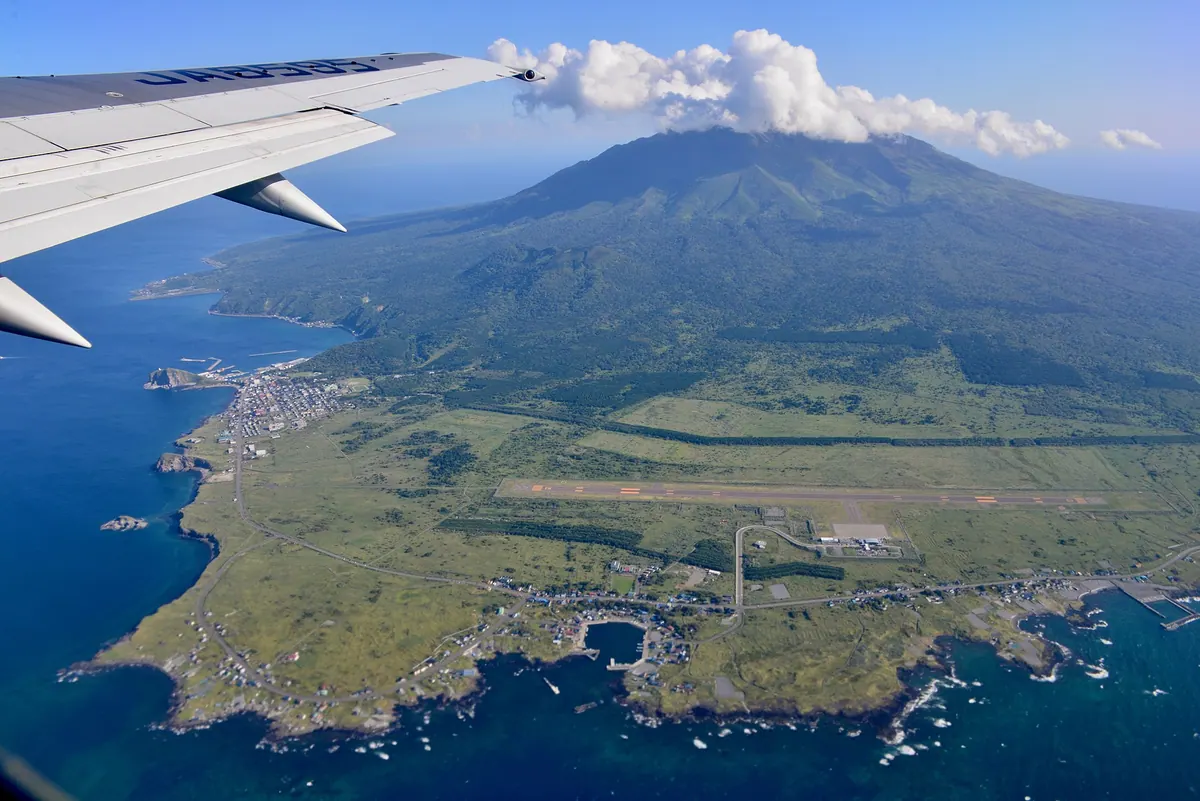
A volcanic island in Hokkaido featuring a 1,721-meter peak, unique alpine flora, and famous local seafood within a national park.
What it is
- A volcanic island located 52 kilometers west of Wakkanai in northern Hokkaido.
- Part of the Rishiri-Rebun-Sarobetsu National Park featuring Mount Rishiri.
- A designated heavy snowfall zone consisting of two separate towns.
- The landing site of Ranald MacDonald who arrived on July 1, 1848.
What to see
- Mount Rishiri, a volcanic mountain standing 1,721 meters high.
- Endemic plant species including the Rishiri poppy and Botankinbai.
- Active fishery operations harvesting local sea urchins and kelp.
When to go
- Summer months for seasonal flights from New Chitose Airport.
Getting there
- Ferries connect the island to Wakkanai and nearby Rebun Island.
- Flights operate directly to Rishiri Airport from New Chitose Airport.
- Rishiri Airport serves as the primary air gateway to the island.
- Official site
- www.rishiri-plus.jp
02
Rebun Island
HOKKAIDō · PLACE 礼文島
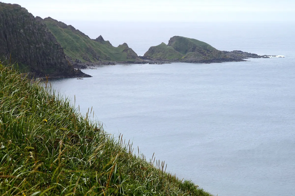
Japan's northernmost inhabited island offers rare alpine flowers at sea level and dramatic volcanic rock formations within a national park.
What it is
- The northernmost inhabited island in Japan, located 60 kilometers west of Wakkanai.
- Part of the Rishiri-Rebun-Sarobetsu National Park featuring a humid continental climate.
- An island named after the Ainu word for offshore island with no bears or foxes.
- A landscape defined by Mount Rebun and the northernmost freshwater lake in Japan.
What to see
- Over 200 species of alpine plants that uniquely grow near sea level.
- Momoiwa Rock, a massive magma formation created 1.3 million years ago.
- Mount Rebun, the highest point on the island reaching 490 meters.
- Lake Kushu, the northernmost freshwater lake in the country.
Getting there
- Heartland Ferry connects Kafuka Port to Wakkanai and Rishiri Island.
- Rebun Airport operations are currently suspended until March 2026.
- Official site
- www.rebun-island.jp
03
Kojima
HOKKAIDō · PLACE 渡島小島
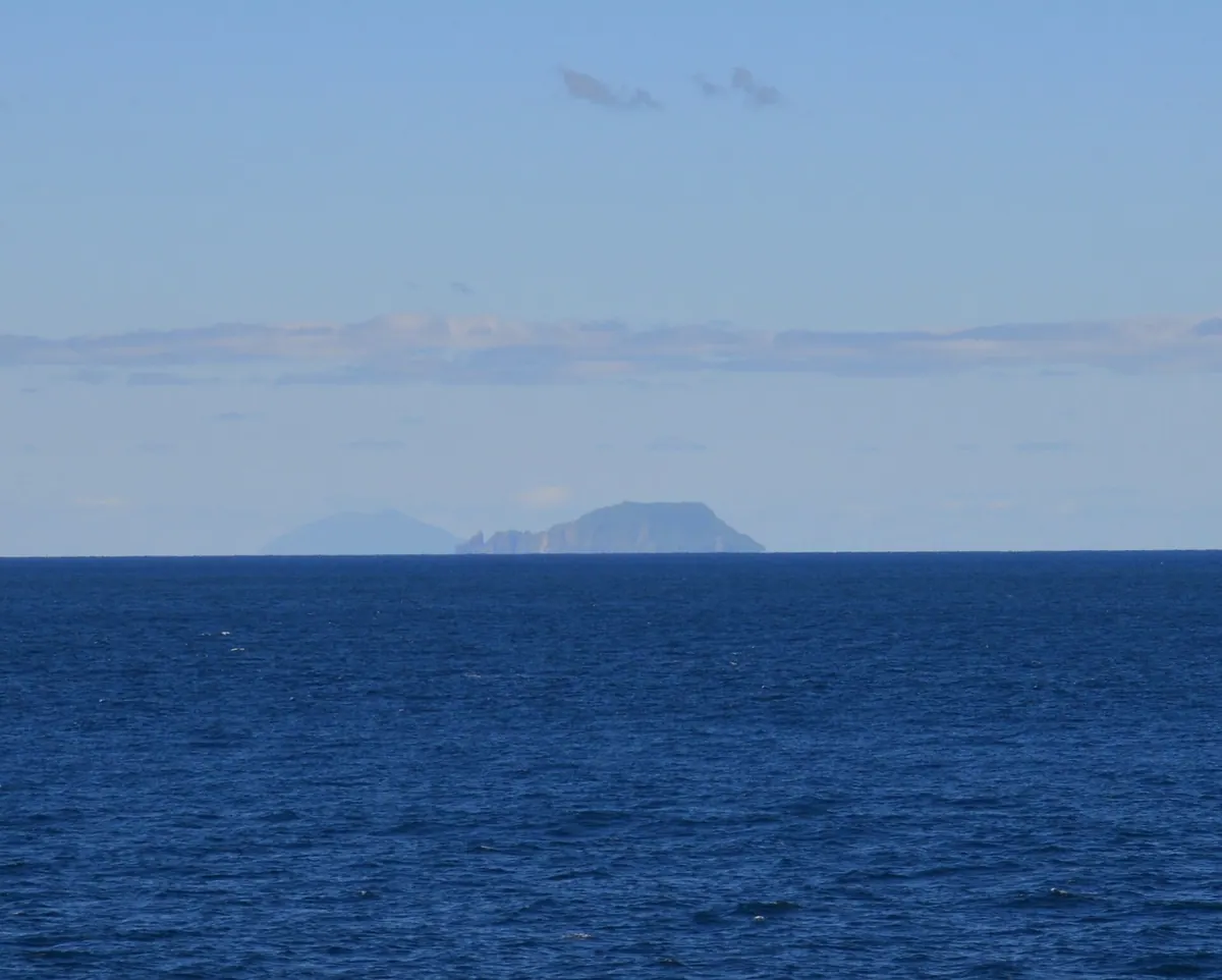
An uninhabited volcanic island and national natural monument off Hokkaido's coast, serving as a protected bird sanctuary and fishing shelter.
What it is
- An uninhabited island located twenty-four kilometers off the coast of Matsumae in Hokkaido.
- A designated national natural monument that serves as a protected bird breeding ground.
- The southern tip of the island marks the southernmost point of Hokkaido.
- The land consists mostly of andesite rock with a peak reaching two hundred eighty-two meters.
What to see
- The unmanned Matsumae Kojima Lighthouse operated by the Japan Coast Guard.
- Itsukushima Shrine which remains on the island for local religious ceremonies.
- A fishing port that provides shelter for vessels in the surrounding waters.
- Diverse bird populations nesting across the one point five four square kilometer area.
When to go
- July 20th for the annual opening ceremony held at Itsukushima Shrine.
04
Etomo Peninsula
HOKKAIDō · PLACE 絵鞆半島
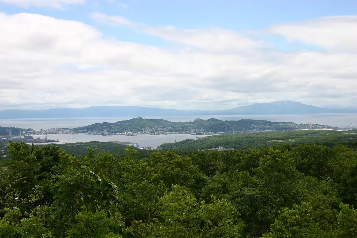
A scenic Hokkaido peninsula featuring dramatic coastal cliffs, mountain hiking trails, and views of the Pacific Ocean and Hakucho Bridge.
What it is
- A peninsula in southern Muroran City facing the Pacific Ocean and Uchiura Bay.
- The name originates from the Ainu word Enrum, which means cape.
- The eastern and southern coasts are designated national scenic spots.
- The area is part of the Muroran Eight Views and contains thirteen mountains.
What to see
- Cape Chikyu marks the southern end of the peninsula.
- Mount Sokuryo stands as the highest point at 199.3 meters.
- The Hakucho Bridge connects the peninsula tip to the opposite shore.
- Thirteen mountains with established hiking trails for outdoor exploration.
- The Muroran Aquarium located near Cape Etomo.
- Nippon Steel Muroran Works situated on reclaimed land along the bay.
Getting there
- The Muroran Main Line branch runs to Muroran Station.
05
Midorinoshima
HOKKAIDō · PLACE 緑の島
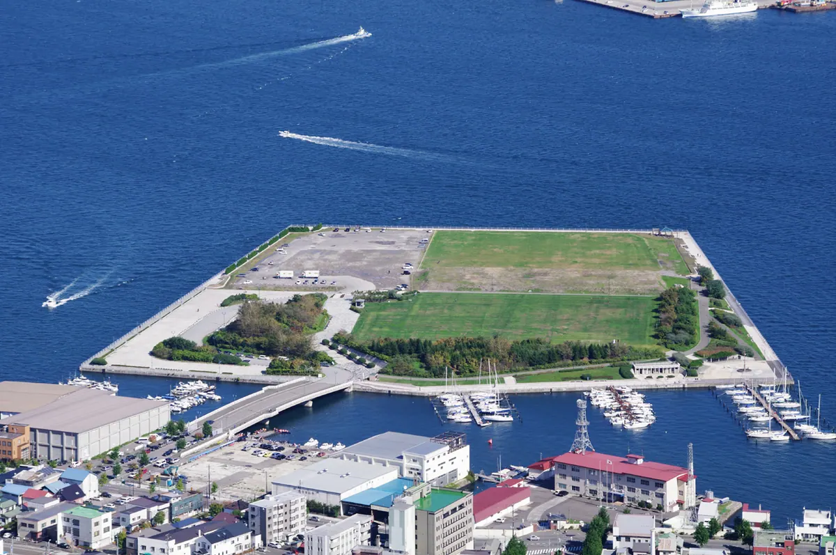
An artificial island park in Hakodate port offering walking paths, event spaces, and scenic views of the harbor.
What it is
- An artificial island in Hakodate constructed from 700,000 cubic meters of dredged soil.
- A public port park managed by the city that opened to visitors in 1996.
- A registered part of the Minato Oasis Hakodate area connected by Niijima Bridge.
What to see
- A 1,100-meter walking path circling the perimeter of the island.
- An event square that hosts large-scale outdoor concerts and festivals.
- A designated skateboard area scheduled to open in May 2025.
- A large parking lot with space for approximately 230 vehicles.
When to go
- During the Hakodate Port Fireworks Display when the island serves as a venue.
Getting there
- A three-minute walk from the Omachi tram station across the Niijima Bridge.
06
Yagishiri Island
HOKKAIDō · PLACE 焼尻島
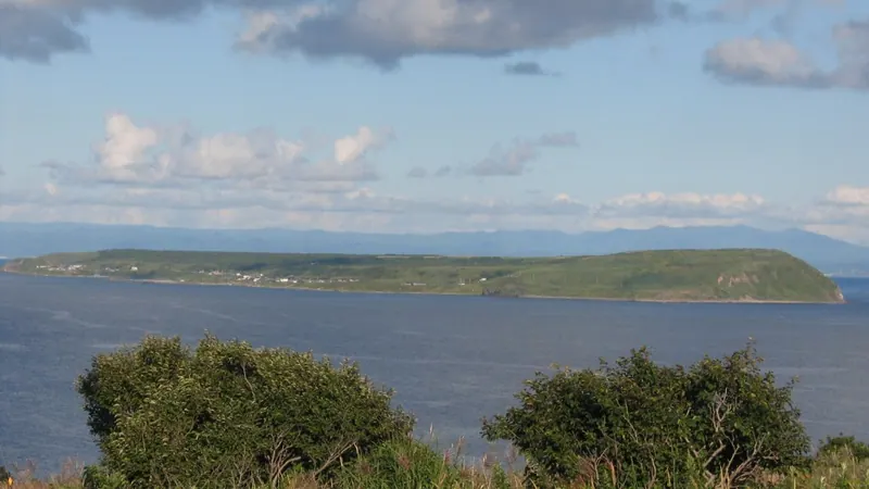
A remote island in a quasi-national park featuring a protected yew forest, a historic sheep ranch, and cultural heritage sites.
What it is
- A small island measuring five square kilometers within Shokanbetsu-Teuri-Yagishiri Quasi-National Park.
- A historic landing site for American Ranald MacDonald who arrived in 1848.
- A rural community with a population of 171 people as of the 2020 census.
- A filming location used for the movie The Yellow Handkerchief of Happiness.
What to see
- A national natural monument consisting of a native Japanese yew forest.
- The Yagishiri Kyodokan which is a designated Tangible Cultural Property of Hokkaido.
- A local ranch that breeds Suffolk sheep on the island.
- Itsukushima Shrine which was relocated to its current site in 1922.
Getting there
- A ferry connects Haboro Port to Yagishiri Port in approximately one hour.
07
Nakajima
HOKKAIDō · PLACE 中島

Four volcanic islands in Lake Toya featuring a forest museum, sika deer, and hiking trails accessible by sightseeing boat.
What it is
- A cluster of four islands located within the waters of Lake Toya.
- Formed from volcanic eruptions that occurred approximately 50,000 years ago.
- The islands are part of the towns of Sobetsu and Toyako.
- Oshima is the largest island with a circumference of 9.6 kilometers.
What to see
- The Toyako Forest Museum located on the island interior.
- A population of sika deer descended from three individuals introduced in the 1950s.
- Tonoshikenupuri peak which rises 455 meters above sea level.
- The remains of a 350 year old spruce tree that fell during a 2004 typhoon.
Getting there
- Sightseeing boats depart from Toyako Onsen for the islands.
- The boat journey across the lake takes approximately 30 minutes.
08
Kenbokki Island
HOKKAIDō · PLACE 嶮暮帰島
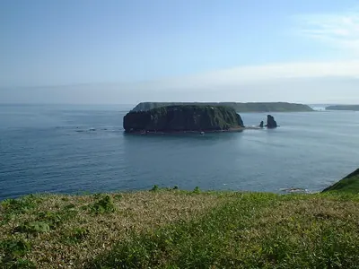
An uninhabited marine plateau in Hokkaido offering rare birdwatching and wild landscapes accessible only with a designated local guide.
What it is
- Uninhabited island and raised marine erosion plateau owned by Hamanaka Town
- Part of the Akkeshi Prefectural Natural Park in Hokkaido
- Name originates from the Ainu word meaning under the alder
- Former residence of author Masanori Hata who lived here for one year
What to see
- Breeding grounds for Leach's storm petrels across the island
- Occasional sightings of the endangered tufted puffin
- Coastal plateau landscape reaching a maximum height of 59 meters
- Views of the surrounding Akkeshi Prefectural Natural Park
When to go
- Visitors must be accompanied by a designated guide to enter the island
Getting there
- Located 600 meters offshore from the Biwase Fishing Port
09
Oshima Ōshima
HOKKAIDō · PLACE 渡島大島
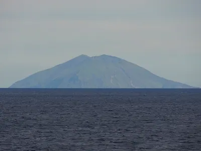
Japan's largest uninhabited volcanic island is a national natural monument known for its caldera and significant 1741 tsunami history.
What it is
- An uninhabited volcanic island located in Matsumae Town, Hokkaido.
- The largest uninhabited island currently under Japanese administration.
- A designated national natural monument protecting streaked shearwaters.
- Part of the Matsumae-Yagoshi Prefectural Natural Park.
What to see
- A volcano featuring a distinct horseshoe-shaped caldera.
- Era-dake, the highest peak rising 737 meters above sea level.
- The westernmost point of Hokkaido at the island's western tip.
- A lighthouse and heliport located on the southern part of the island.
- A fishing port completed on the eastern shore in 2022.
When to go
- Landing requires advance permission from the Agency for Cultural Affairs.
10
Kamome Island
HOKKAIDō · PLACE 鴎島

A coastal island in Hokkaido featuring a historic shrine, lighthouse, and ruins connected to the mainland by a sandbar.
What it is
- A small island rising twenty meters above sea level connected to the mainland by a sandbar.
- Itsukushima Shrine was established here in 1615 to protect the local area.
- Part of a Hokkaido Prefectural Natural Park with a free campsite in the northern section.
- A historic site featuring ruins of two coastal artillery batteries built in 1852.
What to see
- Heishi Rock stands ten meters tall near the entrance to the island.
- The Kamome Island Lighthouse which has been in operation since 1889.
- Senjojiki is a flat wave-eroded area located behind the island.
- Murakami Well once provided drinking water for Kitamaebune trading ships.
- Ruins of nineteenth-century artillery batteries used for coastal defense.
11
Ebisu Island
HOKKAIDō · PLACE 恵比須島

A scenic coastal rock formation in Otaru known for its green pigeon habitat and proximity to Japan's oldest railway tunnel.
What it is
- A scenic coastal spot in the Hariusu district of Otaru also known as Ebisu Rock.
- Designated as one of the Otaru Hakku Hakkei scenic spots for its natural beauty.
- Known as Waushiri in the Ainu language and formerly home to a shrine dedicated to Benten.
- Named after the operator of the Ebisuyu trading post.
What to see
- A natural habitat for Japanese green pigeons frequently seen around the rock.
- Concrete revetments that now connect the island to the mainland shore.
- The Yoshitsune Tunnel located on the opposite shore, the oldest railway tunnel in Japan.
- The nearby Hariusu River Bridge pier, which is the oldest bridge pier in Hokkaido.
12
Gome Island
HOKKAIDō · PLACE ゴメ島
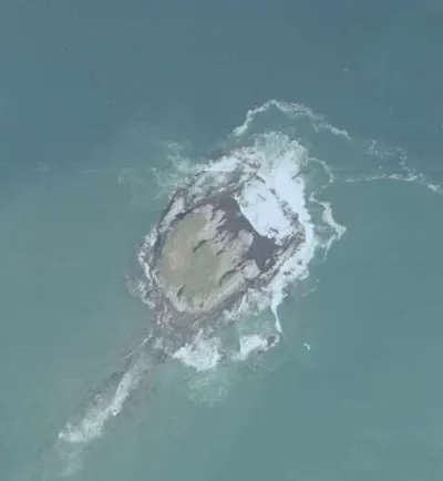
An uninhabited andesite island off Hokkaido serving as a protected gull breeding ground and site of ancient Okhotsk culture ruins.
What it is
- Uninhabited island in Esashi Town designated as a local natural monument.
- Important breeding ground for black-tailed gulls located 500 meters offshore.
- Archaeological site containing pottery from the Epi-Jomon and Okhotsk periods.
- Strategic location defining the outer edge of Japan's exclusive economic zone.
What to see
- Flat terrain composed entirely of andesite rock reaching eight meters high.
- Visible columnar joints along the northeastern coastline of the island.
- Large-scale bird manure deposits formerly collected for use as fertilizer.
- Natural landscape spanning a circumference of approximately one kilometer.
13
Tanfiliev Island
HOKKAIDō · PLACE 水晶島
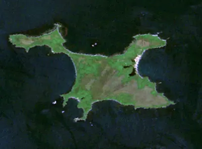
A disputed island near Hokkaido featuring Russian border facilities and modern Orthodox landmarks, currently under Russian Federation control.
What it is
- A twenty-one square kilometer island within the Habomai Islands group.
- A territory claimed by Japan as part of Hokkaido but controlled by Russia.
- A former kelp fishing hub that once housed seven hundred residents before 1945.
- A restricted area currently used for Russian border guard facilities and radar stations.
What to see
- Russian Orthodox churches constructed on the island after the year 2000.
- Religious statues installed during the recent period of Russian administration.
- Active military radar stations and border guard infrastructure.
- Views of the coastline located seven kilometers away from Cape Nosappu.
14
Kunashir Island
HOKKAIDō · PLACE 国後島
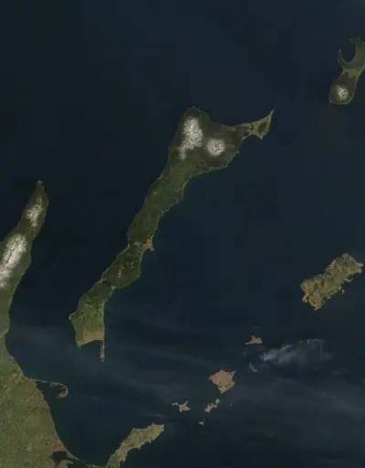
A large volcanic island in the Northern Territories currently under Russian control, featuring active volcanoes and a vast nature reserve.
What it is
- The second largest island in the Northern Territories, covering 1489 square kilometers.
- A territory claimed by Japan but under effective control by Russia since 1945.
- An area where sixty percent of the land is designated as a Russian nature reserve.
- A region historically named by the Ainu as either black island or grass island.
What to see
- Mount Chacha, the highest peak on the island reaching 1822 meters.
- Multiple active volcanoes and natural hot springs located across the landscape.
- The main administrative center and settlement of Yuzhno-Kurilsk.
- Views across the Nemuro Strait toward the coast of Hokkaido.
15
Nabetsuru Iwa Rock
HOKKAIDō · PLACE 鍋釣岩

A unique 19.5-meter natural rock arch shaped like a pot handle, restored after a major earthquake in 1993.
What it is
- A natural andesite formation designated as a municipal scenic spot in 1999.
- The name derives from its distinct resemblance to a traditional pot handle.
- Erosion of surrounding sandstone created its unique donut shape over time.
- Restoration work costing 110 million yen repaired damage from a 1993 earthquake.
What to see
- A rock arch standing approximately 19.5 meters high in Okushiri Town.
- Deciduous shrubs growing naturally on the very top of the formation.
- A structure with a total circumference of about 101 meters.
- The seaward peak which was reconstructed following a collapse during an earthquake.
16
Hokkaidō
HOKKAIDō · PLACE 北海道

Japan's second largest island offers vast subarctic landscapes, indigenous Ainu heritage, and dramatic mountain peaks across its northern territory.
What it is
- The only administrative district in Japan designated as a Do.
- Renamed from Ezochi in 1869 following a proposal by Matsuura Takeshiro.
- The indigenous Ainu people traditionally call this land Ainu Mosir.
- A major biological boundary known as the Blakiston Line sits at the Tsugaru Strait.
What to see
- Mount Asahi stands as the highest peak at an elevation of 2,291 meters.
- The prefectural capital city of Sapporo serves as the central hub.
- Coastlines bordering the Pacific Ocean, the Sea of Japan, and the Okhotsk Sea.
- The Seikan Tunnel which provides a rail connection to Aomori Prefecture.
- Official site
- www.pref.hokkaido.lg.jp
17
Todojima
HOKKAIDō · PLACE 海驢島

An uninhabited island in Hokkaido featuring a lighthouse, shrine, and diverse wildlife including spotted seals and rhinoceros auklets.
What it is
- An uninhabited island in Rebun Town within Rishiri-Rebun-Sarobetsu National Park.
- Known by the Ainu name Ponmosir and located north of Sukoton Cape.
- A former seasonal residence for fishermen until the 1980s.
- Home to a shrine dedicated to the deity Ichikishimahime.
What to see
- Basalt columnar joints and steep sea cliffs along the coastline.
- A steel pier measuring 20 meters on the southern side.
- The Todojima Lighthouse established on high ground in 1959.
- Spotted seals which can be observed around the island all year.
- Major breeding grounds for the rhinoceros auklet bird species.
18
Rōsoku Rock
HOKKAIDō · PLACE ローソク岩
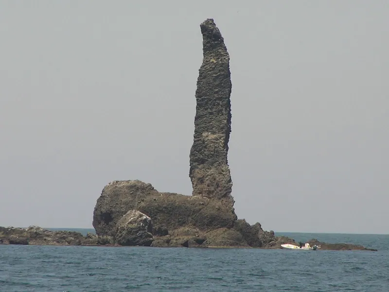
A 45-meter-high rock formation and symbol of Yoichi Town featuring a shrine perched atop its narrow peak.
What it is
- An uninhabited island located 550 meters off the coast of Toyohama Town.
- A symbol of Yoichi Town standing over 45 meters above sea level.
- Part of the protected Niseko-Shakotan-Otaru Kaigan Quasi-National Park.
- A rock formation composed of hyaloclastite that was split by a 1940 tsunami.
What to see
- A small shrine located on the very top of the rock formation.
- The narrow tip of the rock where a portion broke off in 2016.
- Views of the island from a dedicated parking area near the New Wakkake Tunnel.
- The surrounding waters which served as a major historical herring fishing ground.
19
Daikokujima
HOKKAIDō · PLACE 大黒島
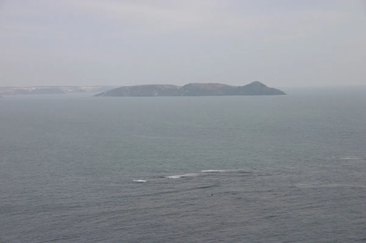
An uninhabited plateau island in Akkeshi Bay known for its high cliffs, historical lighthouse, and massive seabird breeding colonies.
What it is
- An uninhabited plateau island located at the entrance of Akkeshi Bay in Hokkaido.
- A designated natural monument and Special Wildlife Protection Area for Leach's storm petrels.
- Site of a former settlement destroyed by a mudslide in 1945.
- A former World War II fortification used by the Japanese Navy.
What to see
- Steep cliffs surrounding the island reaching heights of up to 80 meters.
- The Akkeshi Lighthouse which was originally established in 1890.
- Historical remains of a Chashi fortification and Kiko Shrine.
- Major breeding grounds for large populations of Leach's storm petrels.
20
Signalny
HOKKAIDō · PLACE 貝殻島
A disputed low-tide elevation featuring a leaning 1937 lighthouse visible from the easternmost point of Hokkaido.
What it is
- A low-tide elevation in the Habomai Islands covering approximately ten square meters.
- Site of the Kaigarajima Lighthouse originally built by Japan in 1937.
- Territory currently under Russian control but claimed by Japan.
- A landmark situated in waters known for productive kelp harvesting.
What to see
- The deteriorating lighthouse structure which is currently leaning to one side.
- A Russian flag placed atop the lighthouse tower in 2023.
- A Russian Orthodox cross installed on the structure during recent years.
- Views of the island across the water from Cape Nosappu via telescope.