Mount Mikuni
三国山
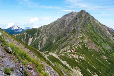
A 1,343-meter peak on a three-prefecture border offering forested hiking trails and seasonal wildflowers near Lake Yamanaka.

What it is
- A mountain peak standing 1,343 meters high in the western Tanzawa Mountains.
- The meeting point of Kanagawa, Yamanashi, and Shizuoka prefectures.
- A destination for hikers located near the shores of Lake Yamanaka.
- The summit area features dense forests of beech and Mongolian oak trees.
What to see
- The three-prefecture border point located 500 meters east of the summit.
- The Mikuni Sanryo ridge extending along the western side of the mountain.
- Autumn wildflowers including Scabiosa and Cirsium purpuratum in the Azami-daira area.
- Views along the ridges connecting to Teppogi-no-atama and Takasasu Mountain.
When to go
- Autumn is the best time to see blooming flowers in the Azami-daira area.
Notes written by Japan Gems from facts in Japanese Wikipedia.
Where it is
Mount Mikuni Open in Google Maps
この施設の関係者の方へ
このページは公開情報をもとに Japan Gems が作成し、訪日外国人向けに英語で掲載しています。 写真や情報の追加・修正を承っています。お店の写真に差し替えることもできます。
このページの情報を更新する