Okirihata Pond
English 繁體中文
大切畑ため池
A historic agricultural reservoir in Kumamoto recognized as a top national site, currently undergoing relocation due to earthquake fault lines.
What it is
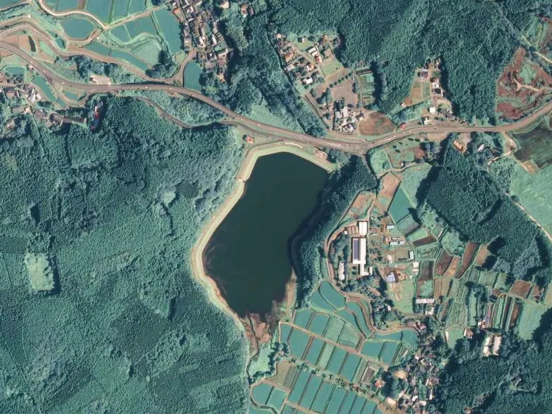
- An agricultural reservoir formed by an earth dam in Nishihara Village.
- Originally constructed by Yano Jinbei between 1855 and 1859.
- Selected by the Ministry of Agriculture as one of the Top 100 Reservoirs.
- Supplies essential irrigation water to approximately 200 hectares of local farmland.
What to see
- A reservoir fed by the primary water source of the Toriko River.
- A walking trail and park area surrounding the water for visitors.
- The site of the Futagawa fault line running east to west nearby.
- Ongoing construction to relocate the dam 270 meters south of the original site.
Getting there
- Public transport access via the Moe-no-sato Tawarayama Tozanguchi bus stop.
Notes written by Japan Gems from facts in Japanese Wikipedia.
Where it is
Okirihata Pond Open in Google Maps
この施設の関係者の方へ
このページは公開情報をもとに Japan Gems が作成し、訪日外国人向けに英語で掲載しています。 写真や情報の追加・修正を承っています。お店の写真に差し替えることもできます。
このページの情報を更新する