North Iwo Jima
北硫黄島
An uninhabited volcanic island in the Ogasawara chain featuring a high peak, ancient archaeological sites, and a wildlife protection area.
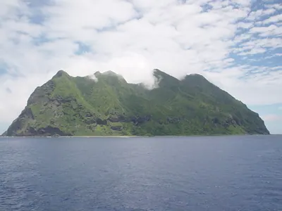
What it is
- A volcanic island in the Ogasawara chain located 1,170 kilometers south of Tokyo
- An uninhabited territory designated as a protected Wildlife Protection Area
- A former settlement site established by residents from Haha-jima during the Meiji period
- An island officially renamed to Kitaiouto in 2007, also known as San Alessandro Island
What to see
- The highest peak of Sakakigamine reaching an elevation of 792 meters
- The Ishino site containing ancient artifacts dating back approximately 2,000 years
- The surrounding submarine volcano known as Funka-asane
- Rugged terrain measuring approximately 2.1 kilometers from east to west
Notes written by Japan Gems from facts in Japanese Wikipedia.
Where it is
North Iwo Jima Open in Google Maps
この施設の関係者の方へ
このページは公開情報をもとに Japan Gems が作成し、訪日外国人向けに英語で掲載しています。 写真や情報の追加・修正を承っています。お店の写真に差し替えることもできます。
このページの情報を更新する