

8 Lakes in Fukushima worth your time
Japan Gems
8 Lakes in Fukushima, with what to see and how to get there.
Fukushima has 8 lakes on Japan Gems. Below are the 8 we can tell you the most about — each one written up in English from Japanese sources, with what to see and how to get there. See all lakes in Fukushima.
01
Oguni-numa Pond
FUKUSHIMA · PLACE 雄国沼
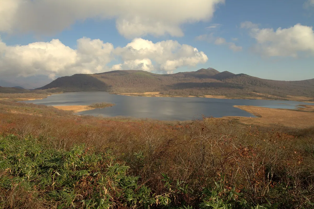
A high-altitude caldera pond in Bandai-Asahi National Park famous for its protected marshland plants and seasonal lily blooms.
What it is
- A high-altitude pond situated in the caldera of Mount Nekoma at 1,090 meters.
- Part of the Bandai-Asahi National Park in Fukushima Prefecture.
- A designated national natural monument protected for its unique plant community.
- An expanded water area resulting from irrigation work during the Edo period.
What to see
- Masses of Nikko-kisuge lilies blooming across the marshland.
- An unmanned mountain hut known as the Oguni-numa Rest House.
- Hiking trails connecting the water to Urabandai and Mount Nekoma.
- Winter landscapes suitable for mountain skiing and snowshoeing.
When to go
- Late June to early July to see the Nikko-kisuge lilies in bloom.
- Winter months for visitors interested in snowshoeing and mountain skiing.
Getting there
- Shuttle buses operate to the site during the peak lily blooming period.
- Access via hiking trails from the Urabandai area or Mount Nekoma.
- Private vehicle access is restricted on the Kanazawa Pass during the busy summer season.
02
Matsukawa Lagoon
FUKUSHIMA · PLACE 松川浦
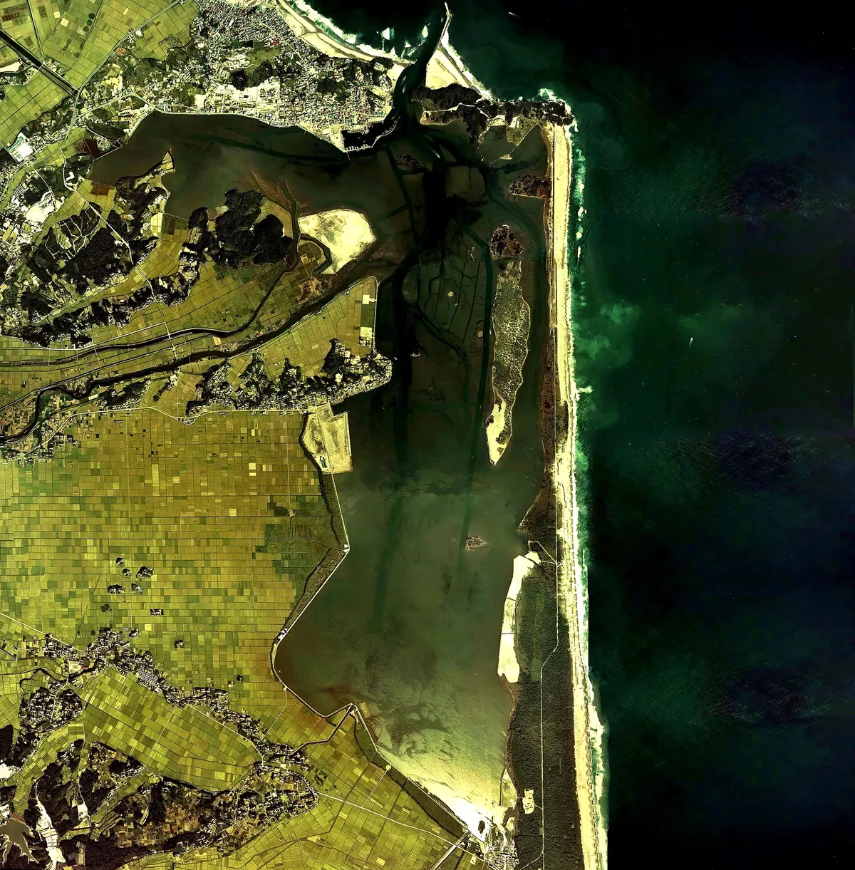
A scenic seven-kilometer lagoon and prefectural natural park separated from the Pacific Ocean by a large sandbar.
What it is
- A natural park designated as one of the 100 Landscapes of Japan.
- A large body of water measuring seven kilometers long and 1.5 kilometers wide.
- One of Japan's 500 Important Wetlands used for cultivating sea lettuce and oysters.
- A protected area separated from the Pacific Ocean by a natural sandbar.
What to see
- The Matsukawaura Ohashi bridge which opened to the public in 1995.
- Expansive views of the lagoon reaching a maximum depth of 5.5 meters.
- Active cultivation areas for local oysters and sea lettuce.
- The coastal scenery of the Matsukawaura Prefectural Natural Park.
When to go
- Visit from spring through summer to participate in local clam digging.
Getting there
- Take a bus or a taxi directly from Soma Station.
- Drive approximately 20 minutes from the Soma Interchange.
03
Lake Inawashiro
FUKUSHIMA · PLACE 猪苗代湖
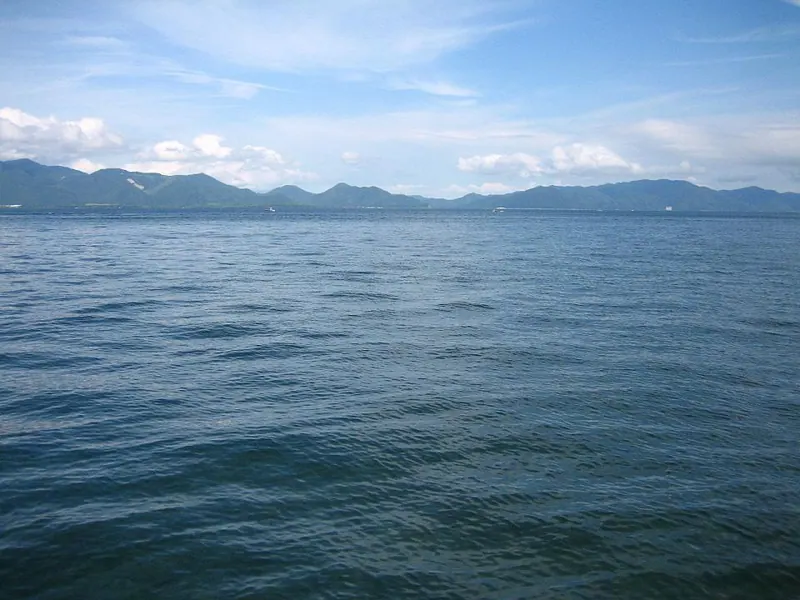
Japan's fourth largest lake is a scenic national park site known for its migratory birds and historic water management systems.
What it is
- The fourth largest lake in Japan, located in central Fukushima Prefecture.
- A designated Ramsar site and part of the Bandai-Asahi National Park.
- A high-elevation lake sitting at 514 meters above sea level.
- Also known as Tenkyoko, with water flowing to both the Sea of Japan and the Pacific.
What to see
- Wintering grounds for large populations of migratory swans and ducks.
- The Inawashiro Daiichi Power Plant, designated as a Japan Heritage site.
- The Sixteen Bridges Sluice Gate which regulates the lake's water levels.
- Scenic views recognized as one of the 100 Landscapes of Japan.
When to go
- Winter months to observe the migratory swans and ducks.
Getting there
- Access the area via the JR Banetsu West Line at Inawashiro Station.
04
Akimoto Lake
FUKUSHIMA · PLACE 秋元湖
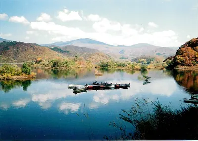
A deep volcanic lake in Bandai-Asahi National Park offering sunrise views, camping, and seasonal outdoor activities.
What it is
- A dammed lake formed by the 1888 eruption of Mount Bandai.
- The deepest of the three major lakes in the Urabandai region.
- Part of the protected Bandai-Asahi National Park area.
- A site used for hydroelectric power generation and flood control.
What to see
- A concrete gravity dam completed in 1999.
- Scenic views of the surrounding mountains and autumn foliage.
- A dedicated cycling road and various camping facilities.
- Rental boats available for exploring the water and bass fishing.
When to go
- Early morning to capture the lake's famous sunrise photography.
- Autumn months for the colorful changing leaves around the shore.
Getting there
- Accessible by bus from Inawashiro Station or Kitakata Station.
05
Lake Hibara
FUKUSHIMA · PLACE 桧原湖
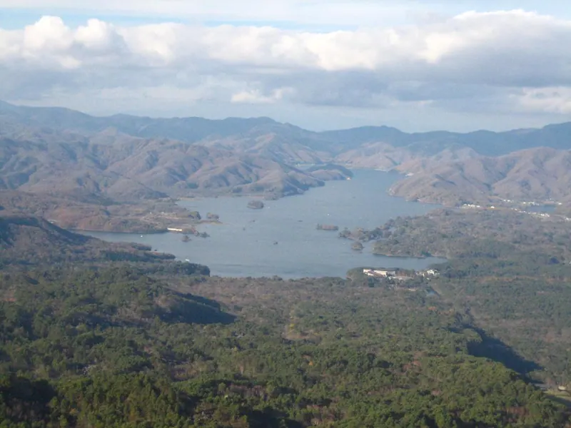
The largest lake in Urabandai, formed by a volcanic eruption, offering unique views of a submerged village and seasonal outdoor activities.
What it is
- A dammed lake in Bandai-Asahi National Park formed by the 1888 eruption of Mount Bandai.
- The largest lake in the Urabandai region measuring eighteen kilometers from north to south.
- A body of water created by a mountain collapse that submerged the former Hibara post town.
- The source of the Nagase River which flows directly into Lake Inawashiro.
What to see
- Sunken shrine gates and gravestones that become visible when the water levels drop.
- A massive lake reaching a maximum depth of thirty-one meters surrounded by national park scenery.
When to go
- Visit in May to see or participate in the annual family cycling event around the lake.
- The winter season offers opportunities for ice fishing for smelt on the frozen surface.
06
Goshiki-numa
FUKUSHIMA · PLACE 五色沼
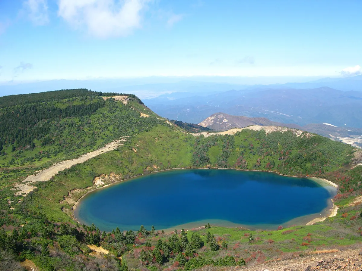
A vibrant crater lake known as the Witch's Eye, offering shifting water colors viewed from the summit of Mount Issaikyo.
What it is
- A crater lake approximately 300 meters in diameter located on Mount Issaikyo.
- Commonly referred to by the nickname the Witch's Eye.
- A natural feature within the Azuma mountain range of Fukushima Prefecture.
- Distinct from the similarly named Goshiki-numa lakes in the Bandai Highlands.
What to see
- Water that changes color depending on the angle and intensity of the sunlight.
- Panoramic views of the lake from the summit of Mount Issaikyo.
- A memorial monument located on the western shore of the water.
- The surrounding volcanic landscape of the Mount Issaikyo crater.
Getting there
- Access the area via the Bandai-Azuma Skyline mountain road.
- Hike for approximately two and a half hours from the Fudozawa trailhead.
07
Lake Onogawa
FUKUSHIMA · PLACE 小野川湖
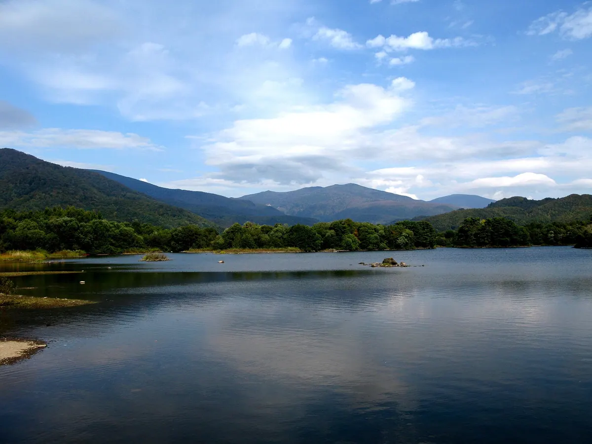
A scenic lake in Bandai-Asahi National Park formed by a volcanic eruption, offering seasonal fishing and clear spring-fed waters.
What it is
- One of the Urabandai Three Lakes located within Bandai-Asahi National Park.
- Formed in 1888 following the eruption of Mount Bandai.
- Fed by the Hyakkan-shimizu spring and the highly rated Onogawa Spring.
- A natural body of water spanning three point five kilometers from east to west.
What to see
- Several uninhabited islands scattered across the lake surface.
- Clear waters designated as some of the top quality springs in Japan.
- Views of the surrounding national park landscape and volcanic terrain.
When to go
- Summer months for outdoor activities like canoeing and fishing.
- Winter season for ice fishing targeting pond smelt.
08
Lake Sohara
FUKUSHIMA · PLACE 曽原湖
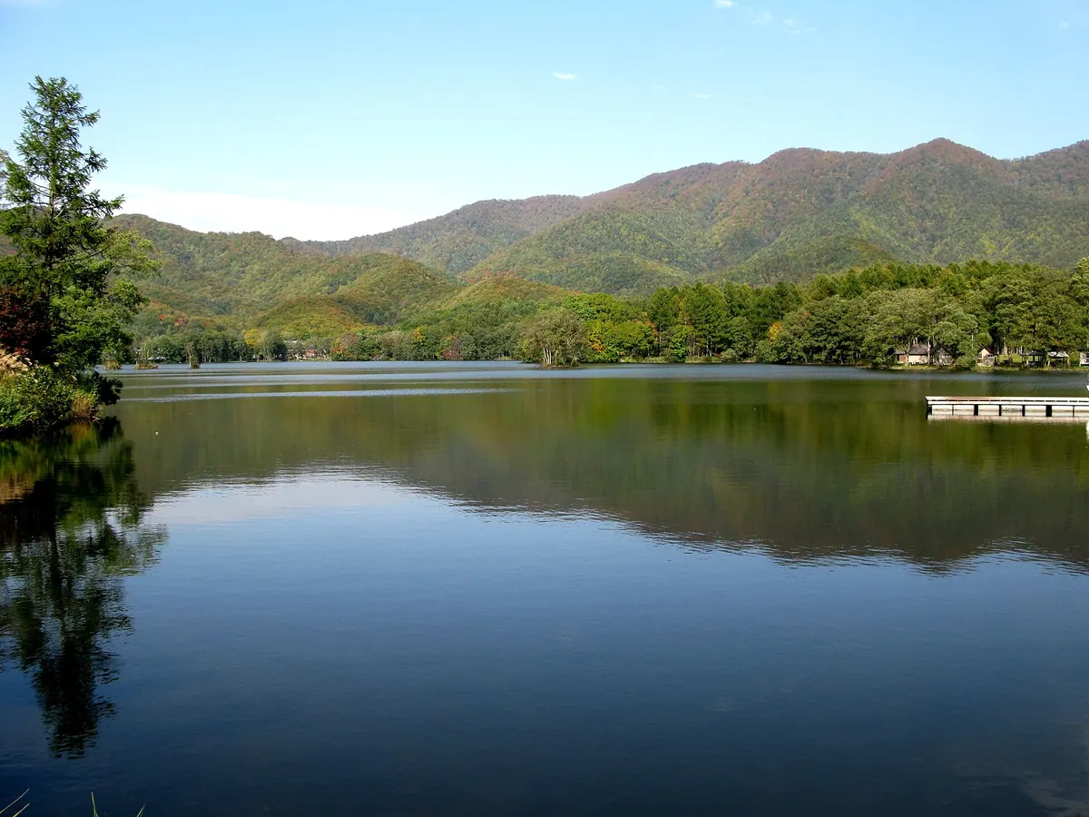
A small, serene lake in Bandai-Asahi National Park formed by the 1888 eruption of Mount Bandai.
What it is
- The smallest lake in the Urabandai area of Fukushima Prefecture.
- Part of the Bandai-Asahi National Park landscape.
- Formed during the eruption of Mount Bandai in 1888.
- A body of water measuring 1.5 kilometers long and 0.4 kilometers wide.
What to see
- Several small islands covered with trees scattered across the water.
- Water shields growing naturally within the lake environment.
- Views of the surrounding campgrounds and pensions along the lakeshore.
- The nearby Kyukamura Urabandai resort facility.