

20 Mountains in Gifu worth your time
Japan Gems
63 Mountains in Gifu, with what to see and how to get there.
Gifu has 63 mountains on Japan Gems. Below are the 20 we can tell you the most about — each one written up in English from Japanese sources, with what to see and how to get there. See all mountains in Gifu.
01
Mount Fujimi
GIFU · PLACE 富士見岳
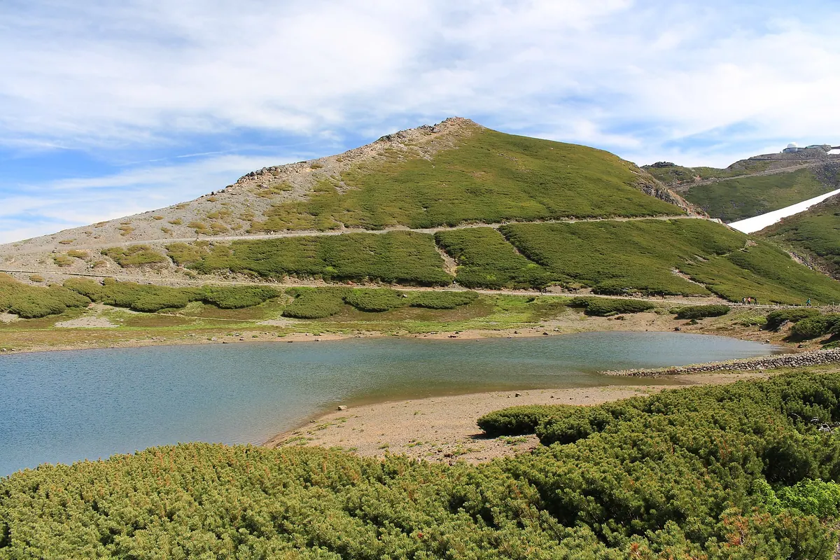
A 2,817-meter peak in the Norikura range offering panoramic views of Mount Fuji and rare alpine flora along accessible hiking trails.
What it is
- A 2,817-meter high peak located within the Norikura mountain range.
- A scenic destination known for views of Mount Fuji on clear days.
- A protected natural area where private cars are prohibited year-round.
- A hiking spot featuring two distinct routes leading to the summit.
What to see
- Panoramic views of Mount Yarigatake and the Hotaka Peaks to the north.
- Rare Komakusa and other native alpine plants growing along the trails.
- The distant peak of Mount Fuji visible from the mountain summit.
- High-altitude landscapes accessible via a forty-minute walk from the bus terminal.
When to go
- Visit between May 15th and October 31st before the winter closure begins.
- Take the shuttle bus during operating hours from 3:30 AM to 5:00 PM.
- Avoid planning trips between November 1st and May 14th due to road closures.
Getting there
- Take a shuttle bus from Honoki-daira to reach the mountain area.
- Walk forty minutes to the summit starting from the Tatamidaira Bus Terminal.
02
Mount Sanshu
GIFU · PLACE 三周ヶ岳
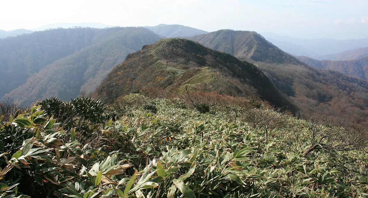
A 1,292-meter peak in Gifu featuring a scenic pond, dramatic rock walls, and vibrant autumn colors for seasonal hikers.
What it is
- A 1,292-meter mountain in Ibigawa selected as one of the 100 Mountains of Gifu.
- The natural source of the Nishitani River featuring a first-class triangulation point at the summit.
- A hiking destination known for the Yashagaike Pond located on its southwest ridge.
What to see
- Yashagaike Pond situated along the southwest ridge of the mountain.
- The Yashakabe sedimentary rock wall located on the south face.
- Panoramic views from the summit's first-class triangulation point.
When to go
- The primary climbing season runs from June through November.
- Peak autumn colors are visible from late October to early November.
- Avoid winter as access roads close during periods of heavy snow.
Getting there
- A trailhead with parking is located at the end of Ikenomata Forest Road.
- The mountain is situated 13.5 kilometers southeast of Imajo Station.
03
Mount Yumiori
GIFU · PLACE 弓折岳
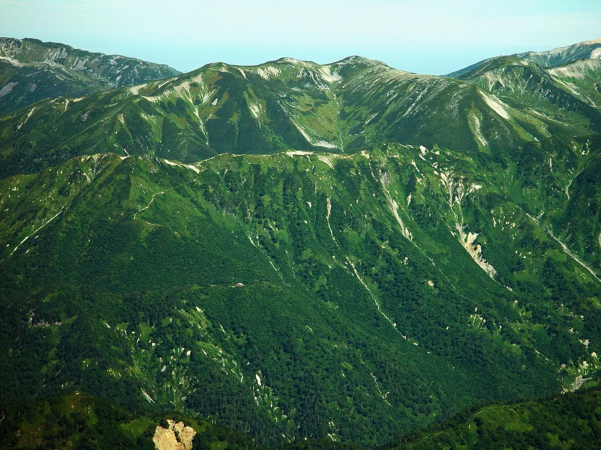
A 2,592-meter peak in Chubu Sangaku National Park famous for its diverse alpine flora and scenic mountain hut.
What it is
- A 2,592-meter mountain located within the Chubu Sangaku National Park in Gifu Prefecture.
- One of Japan's 100 Famous Flower Mountains known for its rare alpine plant species.
- A peak situated on a ridge between Momisawa and Onoma with rivers flowing to the Sea of Japan.
- The site where Prince Chichibu completed a climb in August 1928.
What to see
- The Kagamidaira area located on the eastern slope of the mountain.
- The Kagamidaira Sanso mountain hut which has been operating since 1965.
- The Pinguicula macroceras flower which serves as the representative flora of the area.
- Rare alpine moths including the Alps Kuroyotou species in their natural habitat.
When to go
- August is the historical month when Prince Chichibu visited the summit.
Getting there
- Access the mountain via the Koike-shindo trail starting from Shinhotaka Onsen.
04
Mount Ikeda
GIFU · PLACE 池田山
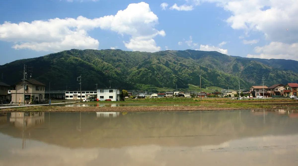
A 923-meter peak in Gifu offering paragliding sites, hot springs at the base, and scenic views from the summit road.
What it is
- A 923.9-meter mountain located within the Ibi-Sekigahara-Yoro Quasi-National Park.
- Part of the Ibuki Mountain range featuring two shrines named Yakiishi and Akiba.
- A recreation area known for sodium bicarbonate hot spring sources at its base.
- The eastern foothills serve as a path for the Tokai Nature Trail.
What to see
- Hang gliding and paragliding launch sites situated near the eighth station.
- A second-class triangulation point marking the highest point of the summit.
- The Kasumaga-ke valley at the foot of the mountain.
- A summit road connecting the local hot springs to the peak area.
When to go
- Visit during cherry blossom season to see the blooms at Kasumaga-ke valley.
- Avoid mid-December to late March when the summit road is closed.
Getting there
- The nearest railway access is via Ikeno and Kita-Ikeno stations.
05
Mount Okumaru
GIFU · PLACE 奥丸山
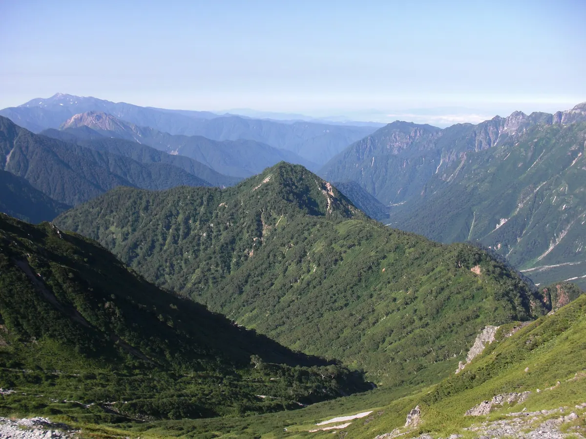
A 2,439-meter peak in the Northern Alps offering panoramic views of Mount Yari and the surrounding Hida Mountains.
What it is
- A mountain peak standing at 2,439 meters in the Chubu Sangaku National Park.
- Part of the Hida Mountains located entirely within Gifu Prefecture.
- A summit situated on the Nakazaki Ridge branching from Senjozawa Nokkoshi.
What to see
- Panoramic views of Mount Yari and Mount Hotaka from the summit.
- Clear sightings of Mount Kasagate and Mount Norikura from the peak.
- The surrounding alpine landscape of the Northern Alps mountain range.
When to go
- Autumn is a popular time to use the trail opened in 2005.
- Winter offers a variation climbing route along the Nakazaki Ridge.
Getting there
- Follow the climbing route starting from Yaridaira Hut in Migimatadani.
- Take the trail from Hidarimatadani which connects Shinhotaka Onsen to Mount Yari.
- Access the peak via the Nakazaki Ridge route starting from Shinhotaka.
06
Mount Eboshi
GIFU · PLACE 烏帽子岳
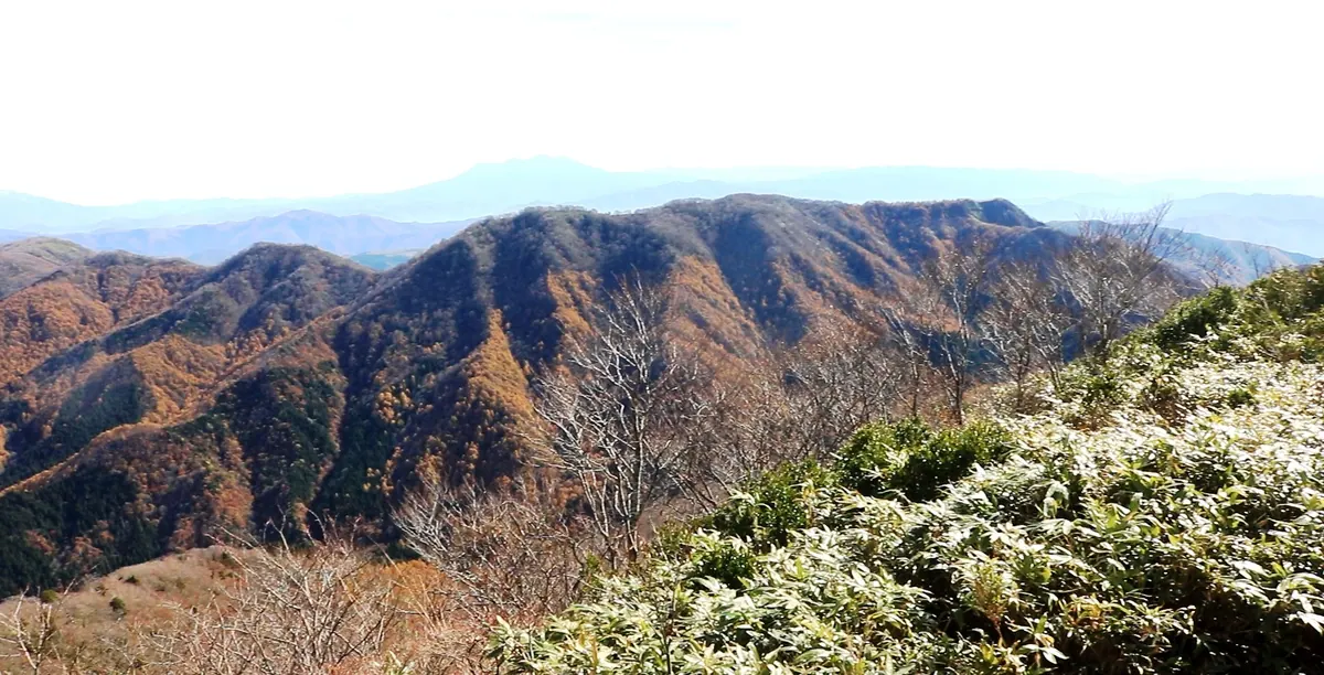
A 1,625-meter composite volcano in Gifu offering summit views of the Northern Alps and Mount Ontake.
What it is
- A 1,625.2-meter high composite volcano located in the Hida Highlands.
- One of the 100 Mountains of Gifu spanning Takayama and Gujo cities.
- A watershed for the Kiso River system formed from andesite lava.
- Site of a massive landslide caused by the 1586 Tensho earthquake.
What to see
- Panoramic views of the Northern Alps and Mount Ontake from the summit.
- A second-class triangulation point located at the mountain peak.
- The Meiho Ski Resort situated on the northeastern slope.
- Andesite lava and pyroclastic materials forming the mountain structure.
When to go
- Winter season for skiing as there are no established snow-free hiking trails.
Getting there
- The peak is located 10.7 kilometers east of the Takasu Interchange.
- National Route 472 runs along the eastern side of the mountain area.
07
Mount Hideri
GIFU · PLACE 日照岳
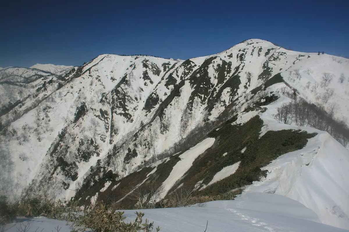
A 1,751-meter peak in Gifu known for morning sunlight, offering off-trail skiing and views of Lake Miboro during winter.
What it is
- A 1,751-meter mountain spanning Takayama City and Shirakawa Village in Gifu Prefecture.
- One of the 100 mountains of Gifu and part of the Ryohaku Mountains range.
- The name refers to the peak receiving the first morning sunlight.
- A natural site with no established hiking trails for summer visitors.
What to see
- Miboro Dam located at the northeastern foot of the mountain.
- Lake Miboro situated along the eastern base of the peak.
- Rivers that flow from the slopes into the Sho River system.
When to go
- The snowy season is the primary time for climbing or skiing.
- Early morning offers the chance to see the first sunlight hit the peak.
Getting there
- The peak is located 11 kilometers from the Shokawa Interchange.
- National Route 156 passes directly along the eastern foot of the mountain.
08
Mount Yari
GIFU · PLACE 槍ヶ岳
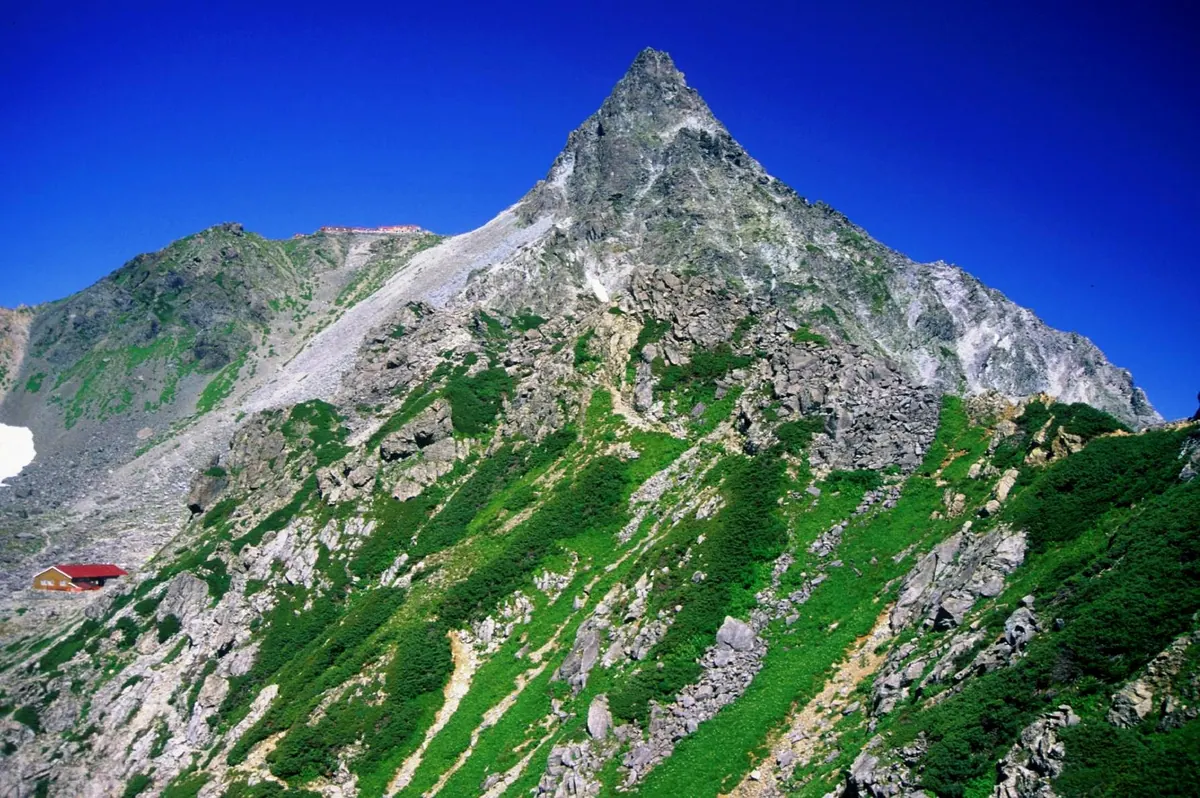
A 3,180-meter peak in Chubu-Sangaku National Park famous for its distinct spear-like shape and challenging alpine climbing routes.
What it is
- The fifth highest mountain in Japan standing at 3,180 meters above sea level
- Located within the borders of Chubu-Sangaku National Park
- First climbed by the Buddhist monk Banryu in 1828
- Features four major ridges extending from the summit in different directions
What to see
- A distinct glacial peak shaped like the head of a spear
- A small shrine located at the northern end of the summit
- Iron ladders and chains installed on the steep final approach to the top
- Expansive views of the surrounding Matsumoto, Omachi, and Takayama areas
When to go
- July through late August for the peak alpine flower season
Getting there
- Access the mountain through the Kamikochi trailhead
- Reach the summit via the Shinhotaka Onsen entrance
- Start the climb from the Nakabusa Onsen trailhead
09
Category:Mount Anbo (Gifu)
GIFU · PLACE 安峰山
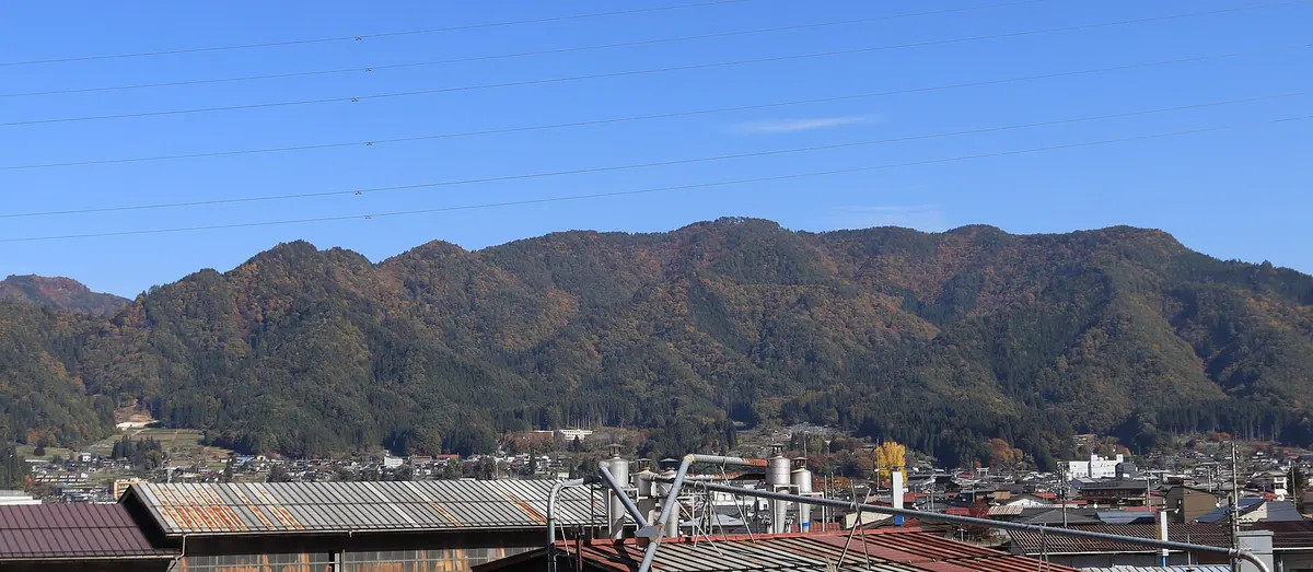
A 1,058-meter peak in Gifu offering panoramic views of the Hida Mountains and famous seasonal morning fog.
What it is
- A 1,058-meter mountain spanning Hida City and Takayama City in Gifu Prefecture.
- One of the Continued 100 Mountains of Gifu.
- A scenic location featured on a Japan Post stamp for its sea of clouds.
- The site of Keta Wakamiya Shrine located at the southwestern foot.
What to see
- A summit observation deck overlooking the Furukawa town area.
- Views of the Hida Mountains and Mount Ontake from the peak.
- A small shrine and a rest area located at the summit.
- Sites where twenty-five Bodhisattva statues were formerly located on the mountainside.
When to go
- Late October to December to see the morning fog and sea of clouds.
Getting there
- Located 2.5 kilometers northeast of Hida-Furukawa Station.
- Vehicle access is available near the mountain top via a forest road.
10
Mount Nukedo
GIFU · PLACE 抜戸岳
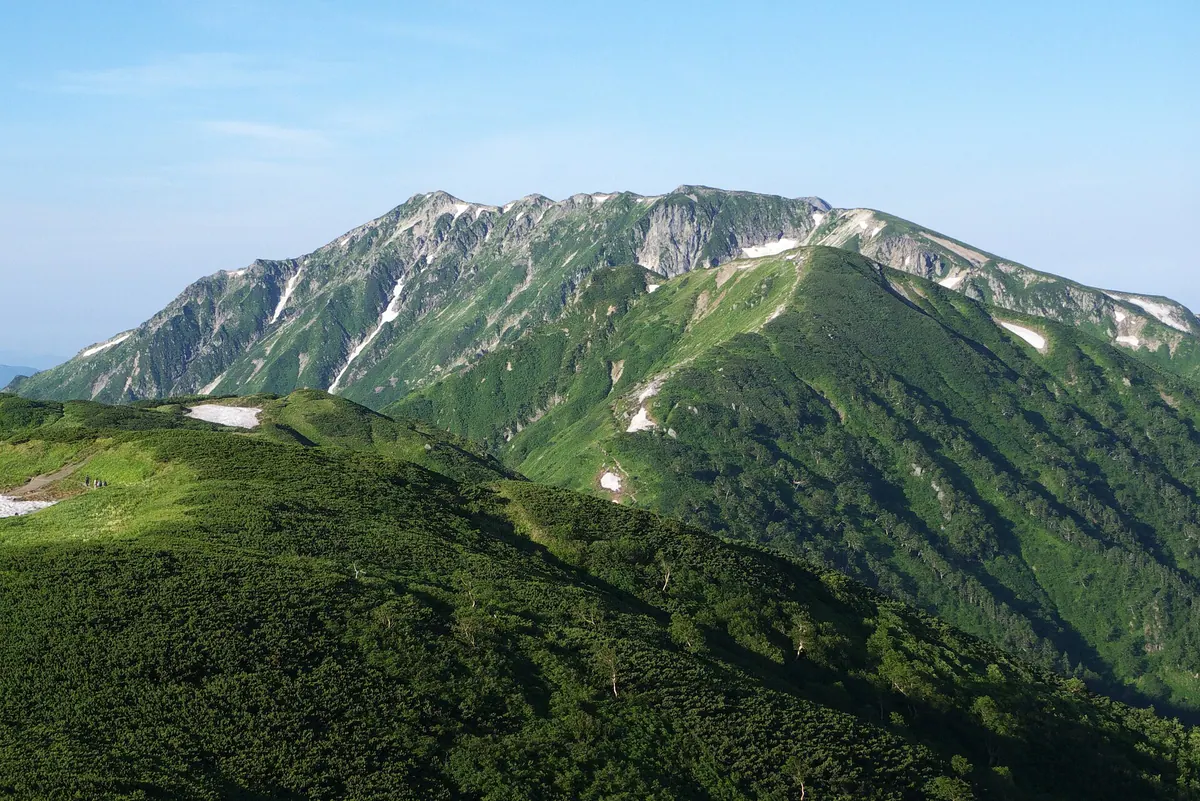
A 2,812-meter peak in the Hida Mountains known for its dramatic eastern collapse area and vibrant alpine plant life.
What it is
- A 2,812-meter mountain located in the Chubu Sangaku National Park of Gifu Prefecture.
- One of the 100 Mountains of Gifu situated between Yumiori Peak and Mount Kasagatake.
- A peak named for the large collapse area visible on its eastern slope.
- The source of several rivers that flow into the Takahara River system.
What to see
- The Okukasagatake third-class triangulation point located at the summit.
- Alpine plants growing within the Chichibudaira and Shakushidaira cirques.
- Rocky summit terrain covered with patches of Siberian dwarf pine.
- Views of the massive collapse area that defines the mountain's profile.
Getting there
- The peak is located 4.9 kilometers north of the Shinhotaka Onsen bus stop.
- Access the summit via the Kasa-shindo or Koike-shindo climbing trails.
11
Mount Sarugabanba
GIFU · PLACE 猿ヶ馬場山
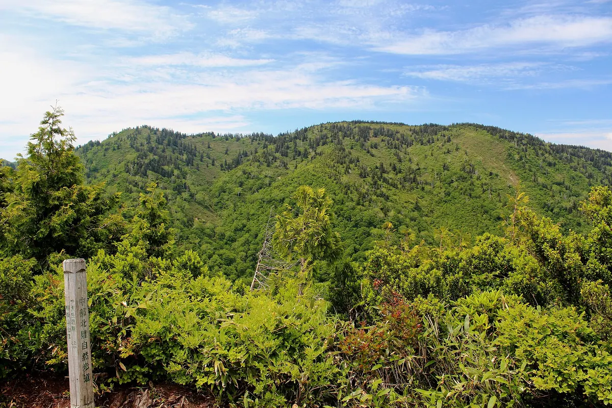
The highest peak in the Hida Highlands offering spring snow climbing and skiing near the historic Shirakawa-go village.
What it is
- The highest peak in the Hida Highlands standing at 1,875 meters tall.
- A featured peak on the list of 300 Famous Japanese Mountains.
- Part of the Amo Prefectural Natural Park located east of Shirakawa-go.
- A mountain containing a third-class triangulation point northwest of the summit.
What to see
- A summit area densely covered with Maries' fir trees.
- Mount Kiun which serves as a front peak to the main summit.
- Views of the surrounding Gifu Prefecture landscape from the high elevation.
When to go
- Visit during the spring season for snow climbing and backcountry skiing.
Getting there
- Start the climbing route next to Myozenji Temple in the village of Ogimachi.
- The peak is located 5.3 kilometers southeast of the Shirakawa-go Interchange.
12
Mount Hoko
GIFU · PLACE 保古山
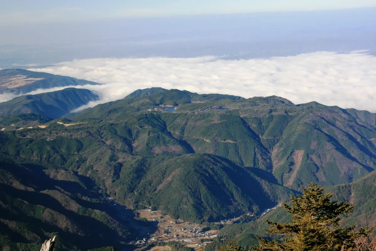
A 970-meter mountain and national recreation area featuring highland lakes, campgrounds, and scenic hiking trails on the Byobuyama fault scarp.
What it is
- A 970-meter mountain standing on the border of Nakatsugawa and Ena cities.
- Part of the Byobuyama fault scarp designated as a National Recreation Area.
- A plateau near the summit known as the Nenoue Highlands.
- One of the 100 famous mountains listed by the Gifu Prefecture Mountaineering Federation.
What to see
- Two reservoirs named Lake Hoko and Lake Nenoue located on the plateau.
- A public lodge and campground facilities for visitors staying overnight.
- Two golf courses situated at the foot of the mountain.
- Rivers originating from the slopes that flow toward Ise Bay and the Pacific Ocean.
Getting there
- Iinuma Station on the Akechi Railway is the nearest train station to the site.
- Gifu Prefectural Road 413 provides vehicle access near the mountain summit.
13
Mount Oizuru
GIFU · PLACE 笈ヶ岳
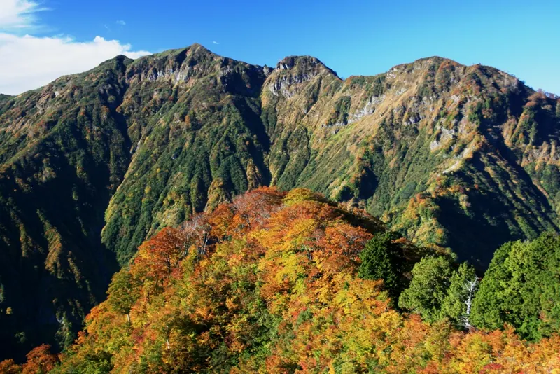
A remote 1,841-meter peak in Hakusan National Park known for its historical burial mound and challenging off-trail spring climbing.
What it is
- The highest peak in the northern Ryohaku Mountains at 1,841 meters above sea level.
- A sacred site reportedly opened by the monk Taicho within a Special Protection Zone.
- The mountain borders the three prefectures of Ishikawa, Toyama, and Gifu.
- A summit burial mound where artifacts dating back to 1518 were discovered.
What to see
- A third-class triangulation point installed at the very top of the mountain.
- Headwaters of several rivers that flow directly into the Sea of Japan.
- Panoramic views from the highest point in the northern Ryohaku range.
- The historical summit burial mound containing ancient artifacts.
When to go
- The snowy spring season is the typical time for climbers to visit.
- May is a recorded month for successful ascents of the peak.
14
Mount Matsuo
GIFU · PLACE 松尾山
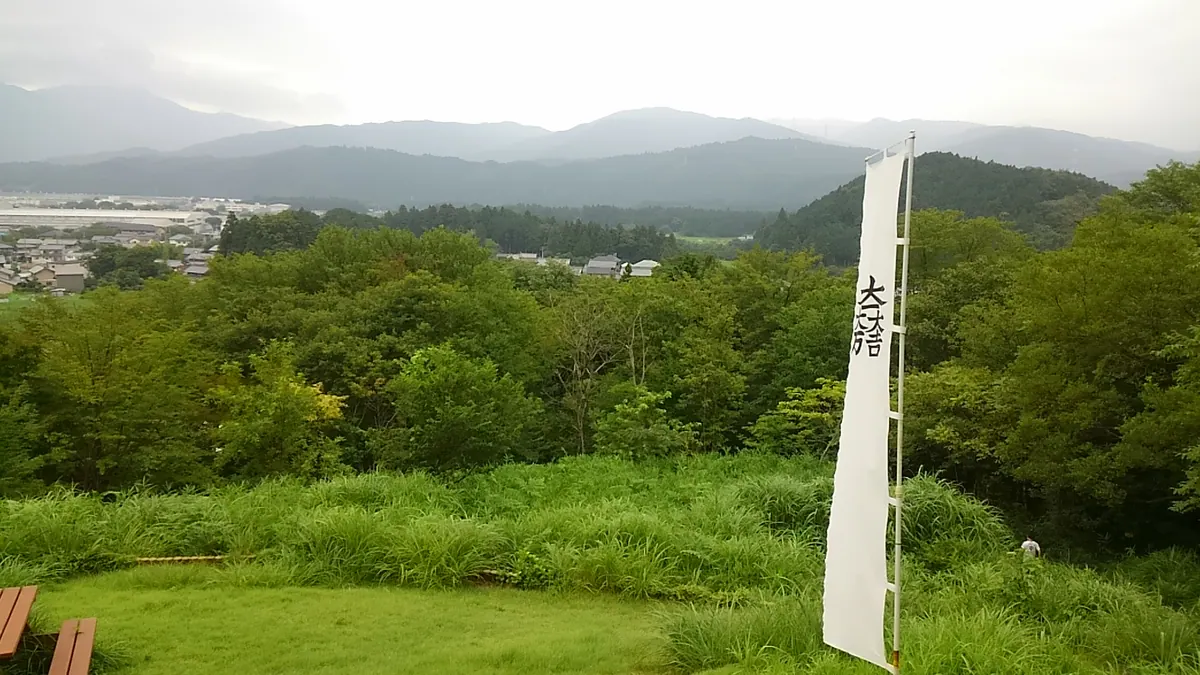
A historic mountain summit featuring medieval castle ruins and the strategic campsite used by Kobayakawa Hideaki during the Battle of Sekigahara.
What it is
- A 292.9 meter mountain serving as a Sekigahara Town designated historic site.
- The former campsite of Kobayakawa Hideaki during the historic Battle of Sekigahara.
- Location of the medieval Matsuo Castle ruins featuring preserved earthworks and enclosures.
What to see
- Remains of medieval castle structures including various enclosures and earthwork fortifications.
- Panoramic views of the Sekigahara urban area from the mountain summit.
- An observation deck and public restroom facilities located at the top.
Getting there
- A hiking trail leads from the base to the summit in approximately 40 minutes.
- The trailhead is situated two kilometers south of the Matsuo Intersection.
- A dedicated parking lot is available at the entrance of the hiking trail.
15
Mount Nangū
GIFU · PLACE 南宮山
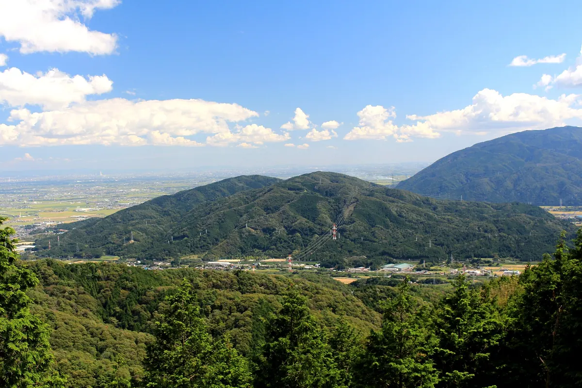
A 419-meter peak in Gifu featuring a historic samurai campsite, ancient burial mounds, and a prominent Shinto shrine.
What it is
- A 419-meter mountain located within the Ibi-Sekigahara-Yoro Quasi-National Park.
- The site where Mori Hidemoto stationed forces during the Battle of Sekigahara.
- A natural water source for the Kiso River system also known as Mino no Nakayama.
- A mountain range featuring active limestone quarrying on its southern face.
What to see
- Nangu Taisha shrine situated at the foot of the mountain.
- A hiking trail connecting the shrine to the historic Mori camp site.
- The Zobizan burial mounds located on the southeastern edge of the range.
- A second-class triangulation point marking the mountain summit.
- Views from the peak situated on the border of Ogaki and Tarui.
Getting there
- Tarui Station is located three kilometers northeast of the mountain.
16
Funa Yama
GIFU · PLACE 船山
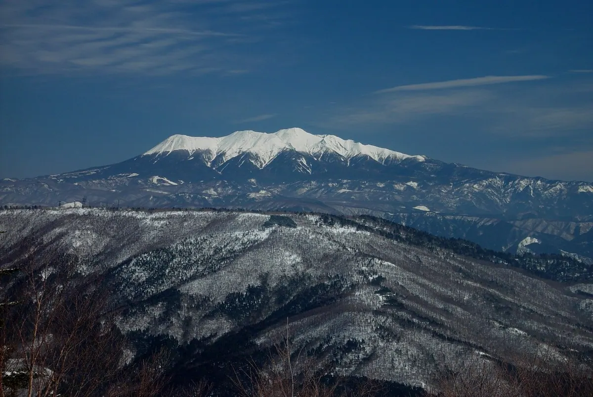
A 1,479-meter peak in Gifu offering hiking trails, a summit shrine, and seasonal sunflower gardens at its base.
What it is
- A 1,479-meter mountain in Gifu Prefecture located between Takayama and Gero cities.
- One of the Kuraiyama Three Mountains and designated as a prefectural natural park.
- A peak also known as Hida Fuji belonging to the Mount Norikura watershed.
- The site of Funayama Shrine which is located on the eastern side of the summit.
What to see
- Multiple radio and telecommunication facilities situated at the mountain summit.
- Orchards at the mountain base where apples, pears, and peaches are cultivated.
- A sunflower garden event held at the site of the former Alcopia snow resort.
- Hiking trails that lead from Kuraiyama Pass and Lake Araragi to the peak.
When to go
- The sunflower garden event takes place following the closure of the local ski resort.
17
Mount Norikura
GIFU · PLACE 乗鞍岳
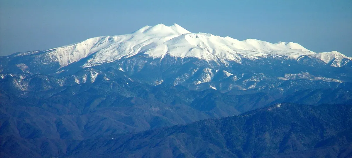
A 3,026-meter active volcano in Chubu Sangaku National Park offering high-altitude hiking accessible by shuttle bus.
What it is
- An active Rank C volcano located in Nagano and Gifu prefectures.
- The nineteenth highest mountain in Japan with twenty-three different peaks.
- A protected area designated as Chubu Sangaku National Park in 1934.
- One of the 100 Famous Japanese Mountains with its highest peak at Kengamine.
What to see
- Gongen-ike, which is the second highest volcanic lake in Japan.
- The Kengamine summit reaching an elevation of 3,026 meters.
- Rare and protected rock ptarmigan birds living in their natural habitat.
- Panoramic views from the Tatamidaira area at 2,702 meters altitude.
Getting there
- Shuttle buses transport visitors to the Tatamidaira station at 2,702 meters.
- Private cars are banned on the main access roads to the mountain.
- Official site
- norikuradake.jp
18
Mount Teraji
GIFU · PLACE 寺地山
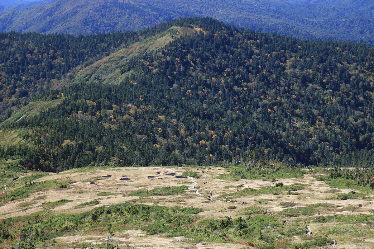
A 1,996-meter peak on the Toyama-Gifu border offering a flat plateau summit within the Chubu Sangaku National Park.
What it is
- A mountain standing 1,996 meters high on the border of Toyama and Gifu.
- Part of the Tateyama Range within the Hida Mountains.
- A designated area of the Chubu Sangaku National Park.
- One of the 100 Mountains of Gifu featuring a third-class triangulation point.
What to see
- A flat summit plateau surrounded by dense coniferous forests.
- The Kagamiikedaira pond located on the western side of the summit.
- The Hieetsu Shin-do trail established for climbers in 1995.
- A watershed area feeding into the Joganji and Takahara rivers.
When to go
- Avoid early November to early June when roads are closed for winter.
Getting there
- The Hieetsu Tunnel trailhead is located on the south side of the tunnel.
19
Kaore Dake
GIFU · PLACE 川上岳
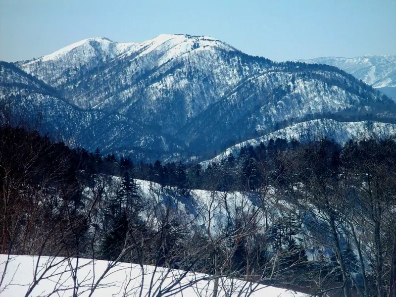
A 1,625-meter peak in Gifu offering 360-degree views of the Northern Alps and seasonal alpine flowers.
What it is
- A 1,625-meter mountain spanning Gero City and Takayama City in Gifu Prefecture.
- One of Japan's 300 Famous Mountains and part of the Kurai Sanzan group.
- A sacred site where a female deity is said to reside.
- A peak connected by a trail to the neighboring Mount Kurai.
What to see
- A 360-degree panoramic view of the Northern Alps from the summit.
- Lilium japonicum flowers blooming near the peak during the summer months.
- Enkianthus perulatus leaves turning bright red across the slopes in autumn.
- Climbing routes originating from the Yamanokuchi and Ichinomiya trailheads.
When to go
- Summer to see the blooming Lilium japonicum flowers near the summit.
- Autumn for the red foliage of the Enkianthus perulatus plants.
20
Mount Dainichi
GIFU · PLACE 大日ヶ岳
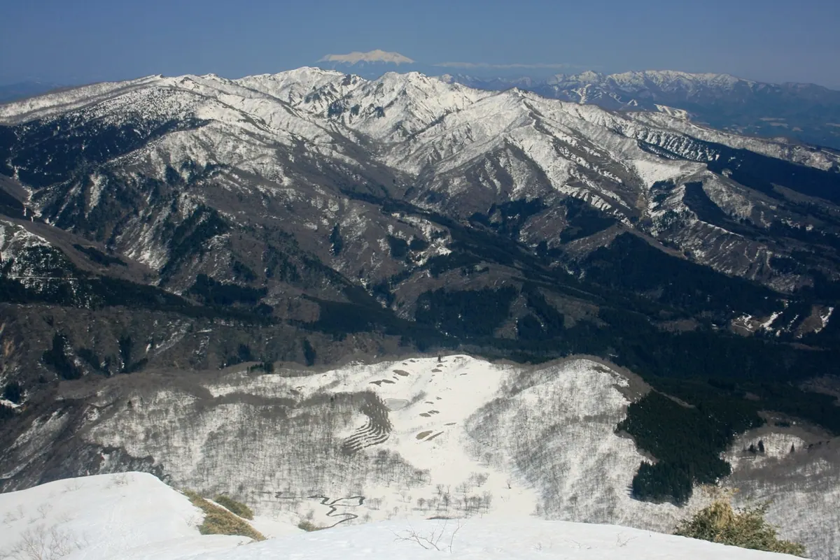
A 1,709-meter peak in Hakusan National Park featuring a historic summit statue, a 60-meter waterfall, and three active ski resorts.
What it is
- A 1,709-meter mountain in Gifu Prefecture located within Hakusan National Park.
- Founded by Taicho Daishi in 717 and formerly known as Mount Mikuni.
- One of the 200 Famous Japanese Mountains composed of andesite rocks.
- The source of rainwater for the Nagara, Sho, and Kuzuryu rivers.
What to see
- A statue of Dainichi Nyorai enshrined at the mountain summit.
- The 60-meter Amida Falls located on the southern side of the mountain.
- A first-class triangulation point positioned at the highest peak.
- Three different ski resorts operating on the mountain slopes.
Getting there
- Accessible via hiking trails starting from the Hirugano Highlands.
- The mountain can be reached by travelers from the Hinoki Pass area.