

20 Mountains in Hokkaidō worth your time
Japan Gems
183 Mountains in Hokkaidō, with what to see and how to get there.
Hokkaidō has 183 mountains on Japan Gems. Below are the 20 we can tell you the most about — each one written up in English from Japanese sources, with what to see and how to get there. See all mountains in Hokkaidō.
01
Mount Shokanbetsu
HOKKAIDō · PLACE 暑寒別岳
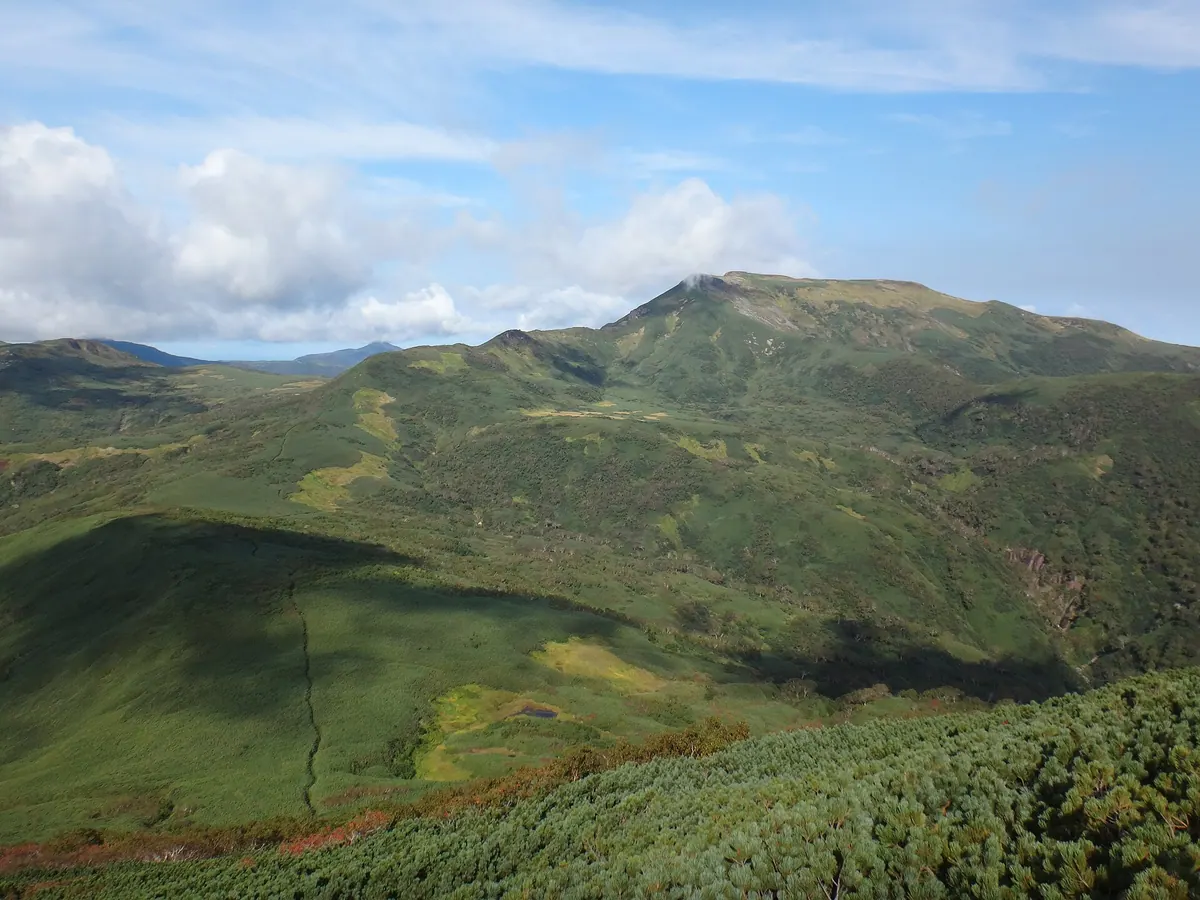
The highest peak in a coastal quasi-national park, offering alpine wetlands and views from a 1492-meter summit.
What it is
- The 1492-meter main peak of the Shokanbetsu mountain range in Hokkaido.
- A featured peak on the list of 200 Famous Japanese Mountains.
- The source of the Shokanbetsu River, named after an Ainu word for river above waterfalls.
- A protected area located within the Shokanbetsu-Teuri-Yagishiri Quasi-National Park.
What to see
- The Uryunuma Wetlands located along the climbing route from Uryu Town.
- A first-class triangulation point marking the highest point of the summit.
- Extensive views spanning across four different towns in the Hokkaido region.
- A campground located at the foot of the mountain for overnight stays.
When to go
- Visit between June and October when the base campground is operational.
- Early summer offers views of lingering snow across the mountain landscape.
- Be prepared for heavy snowfall conditions outside of the primary climbing season.
Getting there
- Access the mountain via established climbing routes starting from Mashike Town.
- Follow the Uryu route which leads hikers through the scenic wetland areas.
02
Mount Hattaomanai
HOKKAIDō · PLACE ハッタオマナイ岳
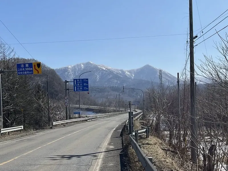
A 1,021-meter peak in the Yubari Mountains offering a rugged, trail-free climbing experience for experienced winter hikers.
What it is
- A 1,021.2 meter mountain located in the southern Yubari Mountains of Hokkaido.
- The name originates from an Ainu phrase referring to a stream with a deep pool.
- The mountain body extends approximately 20 kilometers from north to south.
- A first-class triangulation point marks the highest point of the summit.
What to see
- Panoramic views from the summit across Mukawa Town and Biratori Town.
- The Sekisho Jukai Road monument located near the designated parking area.
- Natural landscapes spanning the border of two Hokkaido districts.
- The Okotan Bridge which serves as a landmark for the climbing route.
When to go
- The remaining snow season is the standard time for climbers to visit.
- Winter or early spring is preferred as there are no established hiking trails.
Getting there
- Park near the Sekisho Jukai Road monument to begin the ascent.
- The common climbing route starts near the Okotan Bridge and passes through Shufuku.
03
Mount Tengu
HOKKAIDō · PLACE 天狗山
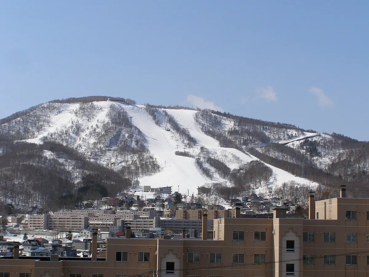
A 532-meter mountain in Otaru offering a top-ranked night view, unique mask museum, and seasonal outdoor activities via ropeway access.
What it is
- A 532.5-meter mountain peak overlooking Otaru City in Hokkaido.
- A spiritual site featuring a shrine and various stone monuments.
- A pilgrimage route designed to mimic the famous Shikoku 88 Temples.
- A recreational area home to the Otaru Nature Village campsite.
What to see
- A panoramic night view ranked among the top three in Hokkaido.
- The Tengu House displaying a collection of approximately 700 traditional masks.
- The Otaru Ski Museum located at the mountain summit.
- A seasonal chipmunk park and a slider attraction available during summer months.
- A ropeway system connecting the base of the mountain to the summit area.
When to go
- Summer for the chipmunk park, slider, and mountainside camping.
- Evening to witness the highly-ranked night view of the city below.
Getting there
- Buses run regularly from JR Otaru Station to the ropeway stop.
- The summit is accessible by car via a dedicated tourist road.
04
Mount Fuppushi
HOKKAIDō · PLACE フップシ岳
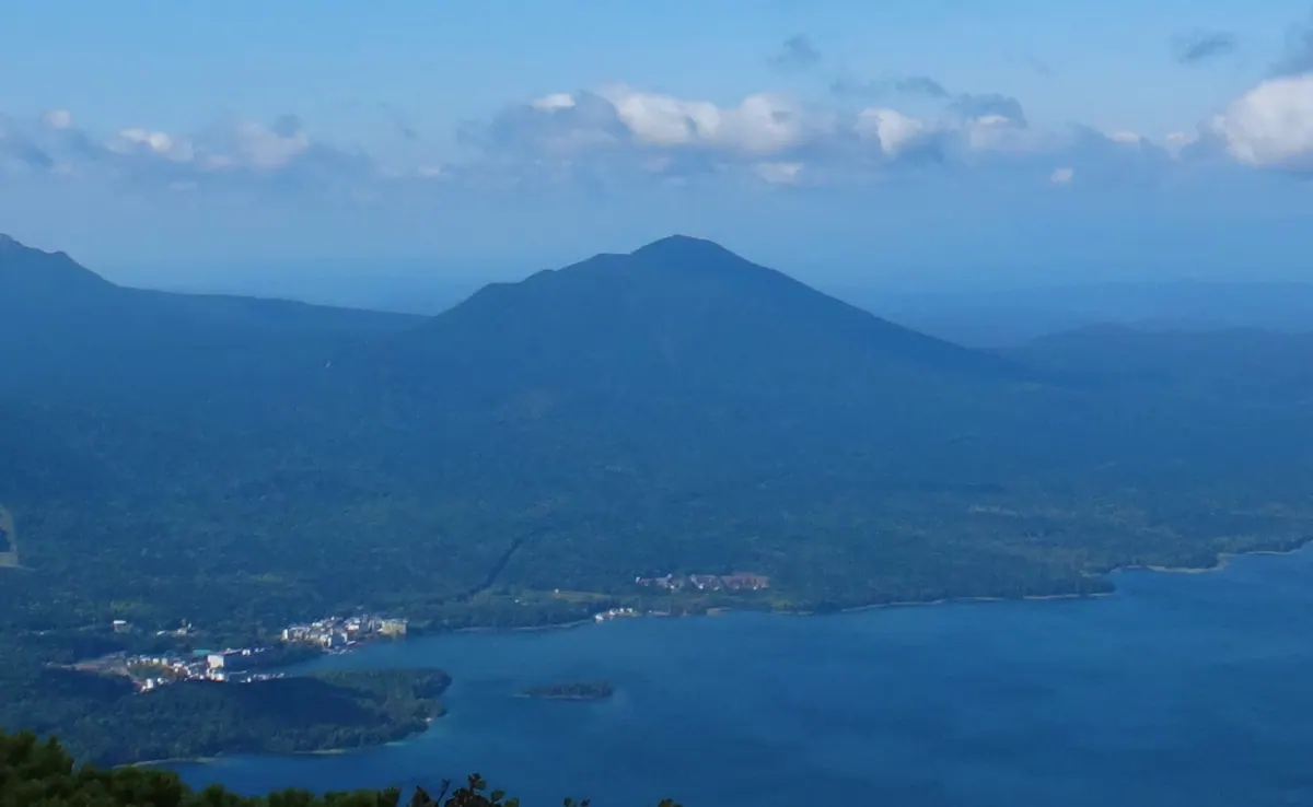
A 1,225-meter stratovolcano in Akan-Mashu National Park known for its Sakhalin fir forests and challenging off-trail winter climbing.
What it is
- A 1,225.4-meter stratovolcano located within the Akan volcanic group.
- The mountain name translates to a place with Sakhalin fir in the Ainu language.
- A second-class triangulation point marks the summit on the Kushiro and Ashoro border.
- The peak formed as a result of activity following the creation of the Akan Caldera.
What to see
- Dense Sakhalin fir forests that extend all the way to the mountain summit.
- Lava flows originating from the mountain visible at the nearby Shirafuji Falls.
- Natural ridge lines that define the municipal border between Kushiro and Ashoro.
When to go
- Visit during the remaining snow season when climbing is most common.
- Winter and spring are preferred as there are no established hiking trails.
Getting there
- Start the climb from the designated parking space located at Ashoro Pass.
- Follow the ridge line along the municipal border to reach the summit.
05
Mount Daisengen
HOKKAIDō · PLACE 大千軒岳
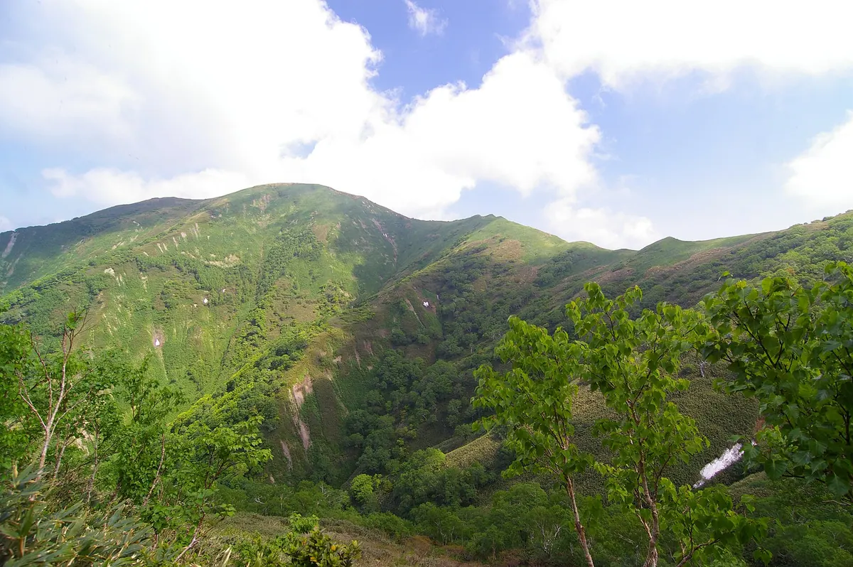
A 1,072-meter peak in Hokkaido known for its tragic Christian history and status as one of Japan's 300 Famous Mountains.
What it is
- A 1,072-meter mountain located in the southwestern Oshima Peninsula of Hokkaido.
- The site where one hundred and six Christians were executed in 1639.
- Home to Hokkaido's first first-class triangulation point installed in 1896.
- Recognized as one of the 300 Famous Mountains in Japan.
What to see
- Memorial crosses standing at the Kanayama guardhouse ruins and Sengen-daira ridge.
- The historic first-class triangulation point located within Matsumae Town.
- Alpine scenery along the Shirauchigawa, Shindo, and Kyudo climbing routes.
When to go
- A martyrdom memorial mass is held every last Sunday of July.
- Visitors should exercise extreme caution following fatal brown bear encounters in late 2023.
Getting there
- Access the Shirauchigawa climbing route starting from the Okufutamata trailhead.
- Reach the Shindo and Kyudo hiking routes via Matsumae Town.
06
Senpo
HOKKAIDō · PLACE 尖峰

A 953-meter peak in Shibetsu, Hokkaido, offering a rugged climbing experience for experienced hikers during the snowy season.
What it is
- A mountain standing at an elevation of 953 meters in Shibetsu Town, Hokkaido.
- A peak located on a ridge north of Mount Musa and south of Shiretoko.
- A wilderness area with no established hiking trails for visitors to follow.
- A destination featuring steep slopes near the summit area.
What to see
- Views from the 953-meter summit overlooking the surrounding Hokkaido mountain ranges.
- The Ikeshomanai River flowing along the initial approach to the mountain.
- Rugged ridges extending toward the Shiretoko mountain range to the north.
When to go
- The remaining snow season when climbers typically ascend the peak.
Getting there
- Start the ascent from Kanayama Bridge located on Route 244.
- Follow the Sasanozawa Forest Road along the Ikeshomanai River.
- Climb the ridge starting from the Sasanozawa second branch line.
07
Hokkaidō Koma-ga-take
HOKKAIDō · PLACE 北海道駒ヶ岳

An active stratovolcano and symbol of Onuma Quasi-National Park, offering unique volcanic landscapes and views of lakes it created.
What it is
- An active stratovolcano reaching 1,131 meters in elevation within a Quasi-National Park.
- One of Japan's 200 Famous Mountains monitored 24 hours a day for activity.
- A historic site where a 1640 eruption created the nearby Onuma and Konuma lakes.
- A natural landmark spanning the towns of Mori, Shikabe, and Nanae in Hokkaido.
What to see
- The highest peak of the mountain known as Kengamine.
- The Uma-no-se point which marks the current limit for climbing access.
- Views of the surrounding Onuma Quasi-National Park from the slopes.
- A rugged volcanic landscape shaped by major historical eruptions.
When to go
- Climbing is permitted only from June to October each year.
- Entry is restricted within four kilometers of the crater at all times.
Getting there
- The mountain is accessible via the JR Komagatake Station.
08
Mount Setaushi
HOKKAIDō · PLACE セタウシ山
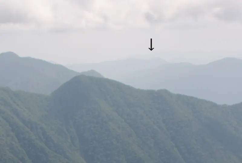
A remote 865-meter peak in the Hidaka Mountains known for its Ainu name meaning place with wolves.
What it is
- A 865-meter mountain peak located in the Hidaka Mountains of Hokkaido.
- The name originates from the Ainu language meaning place with wolves.
- A second-class triangulation point is located at the summit.
- The summit features a sign with kanji for a cow with horns.
What to see
- Views from the highest peak reaching 865 meters above sea level.
- Dense natural bush and vegetation covering the mountain slopes.
- A summit marker identifying the triangulation point.
When to go
- The remaining snow season is the preferred time for climbers.
- Summer visits require pushing through thick bush and heavy vegetation.
Getting there
- Start by walking from the gate located on Prefectural Road 746.
- Follow the Mikawa Right Fork Forest Road toward the mountain.
- There are no established hiking trails leading to the summit.
09
Mount Niseicharomappu
HOKKAIDō · PLACE ニセイチャロマップ岳
A 1,760-meter peak in the Northern Daisetsu range offering a rugged, trail-free wilderness experience for experienced backcountry hikers.
What it is
- A 1,760-meter mountain peak located within the Northern Daisetsu mountain range in Hokkaido.
- The name originates from the Ainu language and refers to the Niseicharomappu River.
- The mountain spans the border between Kamikawa Town and Engaru Town.
- A wild peak that is not listed on official Geospatial Information Authority maps.
What to see
- A high-altitude ridge connecting the summit to the nearby Shiyubetsu-dake to the northeast.
- Rugged terrain consisting of rocky streams and dense natural bushland.
- The confluence where the Niseicharomappu River joins the Ishikari River at Ohako.
Getting there
- Access the mountain via the Penke Shiyubetsu Forest Road.
- The ascent requires navigating the Ishinosawa River route without official trails.
- Reaching the summit involves climbing through rocky streams and significant bushwhacking.
10
Mount Tottabetsu
HOKKAIDō · PLACE 戸蔦別岳

A 1,959-meter peak in the northern Hidaka Mountains featuring a glacial cirque and challenging river-crossing hiking trails.
What it is
- A 1,959-meter mountain peak located in the northern Hidaka Mountains.
- The mountain spans Obihiro City, Biratori Town, and Niikappu Town.
- This peak lacks a formal triangulation point at its summit.
- The mountain serves as the source for the Niikappu and Tottabetsu rivers.
What to see
- The Nanatsunuma Cirque is located on the southeastern side of the mountain.
- Mount Poroshiri is visible directly to the south of the peak.
- A natural water source called Totta no Izumi is located along the trail.
- The Chiroro River course offers views from the nearby Mount Kita-Tottabetsu.
Getting there
- The Nukabira course requires taking a shuttle bus from Toyonuka Sanso.
- Access via the Nukabira course involves performing multiple river crossings.
- The Chiroro River course provides an alternative route through Mount Kita-Tottabetsu.
11
Mount Uenshiri
HOKKAIDō · PLACE ウエンシリ岳
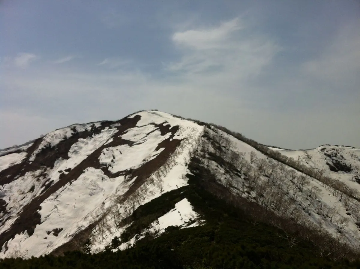
A 1,142-meter peak in Hokkaido featuring summer snow valleys and a rare ice tunnel accessible during a specific July event.
What it is
- A mountain standing 1,142.3 meters above sea level in northern Hokkaido.
- One of the 100 Famous Mountains of Hokkaido.
- The name originates from an Ainu word meaning bad mountain.
- The summit features a first-class triangulation point named Satsukurudake.
What to see
- Snow valleys that remain visible on the mountain even during the summer.
- An ice tunnel located near the Second Mookoppe River.
- Panoramic views from the summit triangulation point.
When to go
- Visit in July for a local event that opens the restricted ice tunnel.
- Summer months allow for viewing the persistent snow valleys.
Getting there
- Main climbing routes start from Nishiokoppe Village.
- One hiking route begins directly from the Uenshiri Campground.
- The Shimokawa route requires a prior entry permit for forest roads.
12
Mount Tokachi
HOKKAIDō · PLACE 十勝岳
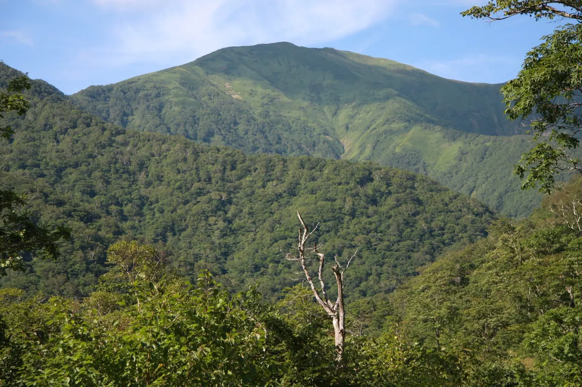
A 1,457-meter peak in Hokkaido's Hidaka Mountains offering rugged stream climbing and ridge hiking within a national park.
What it is
- A 1,457-meter mountain located in the southern Hidaka Mountains of Hokkaido.
- Part of the Hidaka Sanmyaku-Erimo-Tokachi National Park spanning Urakawa and Hiroo.
- Features a third-class triangulation point at the summit named Horoshiri.
What to see
- Views of nearby peaks including Mount Rakko, Mount Omushanupuri, and Mount Nozuka.
- The surrounding landscape of the Hidaka Sanmyaku-Erimo-Tokachi National Park.
- The Nikuboshumeshuubetsu River which provides a route for stream climbing.
- Distant views of Mount Hiroo and Mount Apoi from the high elevation.
Getting there
- Access the mountain trails starting from the Rakko Sanso hut.
- Reach the summit via a ridge hike starting from Mount Rakko.
- Follow the stream climbing route along the Nikuboshumeshuubetsu River.
- The mountain area is situated near National Route 236.
13
Mount Kataishi
HOKKAIDō · PLACE 硬石山
A 397-meter peak in Sapporo known for its dacite quarrying history and proximity to the Toyohira River.
What it is
- A central peak reaching an elevation of 397 meters in Sapporo.
- A source of hard dacite stone used for roadbeds and concrete aggregate.
- An active quarry site where operations first began in 1872.
- A mountain distinguished by its hard stone compared to local soft stone varieties.
What to see
- A large terraced quarry located on the eastern side of the mountain.
- The Toyohira River flowing along the south and east sides of the peak.
- Residential areas built into the northern, eastern, and southern foothills.
- Natural dacite rock formations created from ancient Miocene magma.
When to go
- Visitors should note that a brown bear advisory was issued here in 2022.
- The mountain is not generally used for climbing by the public.
Getting there
- The local bus stop for the area is named Kosekiyama.
14
Mount Toutsu
HOKKAIDō · PLACE トーウツ岳
A 742-meter peak in Hokkaido offering a rugged wilderness experience for experienced hikers seeking off-trail navigation and mountain views.
What it is
- A mountain peak standing 742.3 meters tall on the border of Oumu and Okoppe.
- The summit features a second-class triangulation point officially named Katsuchiyama.
- Its name derives from the Ainu word to-ut, meaning side river of the marsh.
- The peak was historically known by the name Katchinupuri.
What to see
- Views of Mount Iwagami located on the ridge to the south.
- The neighboring peak of Mount Chiseneshiri situated to the southeast.
- The headwaters of the Toutsu River originating from the mountain slopes.
- A triangulation point marker at the highest point of the summit.
Getting there
- The main approach begins from Hokkaido Prefectural Road 137.
- Access requires walking along an overgrown forest road near Oumu Dam.
- The forest road is closed to vehicles and there are no established hiking trails.
15
Mount Yūbari
HOKKAIDō · PLACE 夕張岳

A 1,668-meter peak in central Hokkaido famous for its unique serpentine geology and over 600 species of alpine plants.
What it is
- A 1,668-meter mountain located within the Furano-Ashibetsu Prefectural Natural Park in central Hokkaido.
- One of Japan's 200 Famous Mountains and a designated National Natural Monument.
- A site containing the largest distribution of serpentine rock in Japan.
- One of Japan's Top 100 Geological Sites where coal outcrops were discovered in 1888.
What to see
- Over 600 species of alpine plants growing across the mountain slopes.
- The Hiyamizu, Umanose, and Kanayama hiking trails leading to the summit.
- The Yūbari Hut which provides lodging for hikers on the mountain.
- Extensive serpentine rock formations throughout the protected natural area.
When to go
- Between June and September when the Yūbari Hut is open for lodging.
- During the summer months to view the diverse collection of alpine flowers.
16
Mount Poroshiri
HOKKAIDō · PLACE 幌尻岳

A 2,052-meter peak in Hokkaido's Hidaka Mountains famous for its glacial cirques and challenging river-crossing hiking trails.
What it is
- A 2,052-meter peak located within the Hidaka-sanmyaku Erimo-Tokachi National Park.
- One of the 100 Famous Japanese Mountains formed by geological activity 13 million years ago.
- The name comes from the Ainu word meaning big mountain.
- A protected area bordering the towns of Biratori and Niikapu in Hokkaido.
What to see
- The Seven Cirques of Mount Poroshiri, designated as a Japanese Geological Site.
- Local wildlife including the pika and the black woodpecker.
- Glacial landforms and rugged mountain scenery across the Hidaka range.
- The Nukabira River which hikers must cross multiple times on the Biratori route.
Getting there
- A shuttle bus runs from Toyonuka Sanso to the trailhead for the Biratori route.
- The Niikapu route requires a 19-kilometer walk along a forest road to reach the mountain.
17
Mount Meakan
HOKKAIDō · PLACE 雌阿寒岳
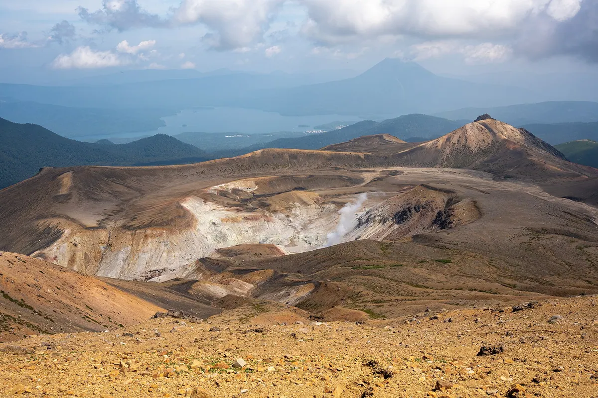
An active stratovolcano group in Hokkaido offering volcanic craters, alpine flora, and views from one of Japan's 100 famous mountains.
What it is
- A group of eight volcanoes located within the Akan Mashu National Park.
- The highest peak is Ponmachineshiri which reaches an elevation of 1,499 meters.
- An active volcanic site with activity dating back approximately 13,000 years.
- A destination listed among the 100 Famous Japanese Mountains.
What to see
- Active volcanic vents located at the Ponmachineshiri and Nakamachineshiri craters.
- The symmetrical cone of Akan Fuji, one of the eight volcanoes in the group.
- Unique alpine plants including the Meakan-kinbai and Meakan-fusuma.
- A stone monument at the summit dedicated to a student killed by lightning.
- Seismometers installed by the Japan Meteorological Agency to monitor volcanic activity.
Getting there
- Three main climbing routes begin from Onneto, Meakan-onsen, and Akanko-han.
18
Mount Shamansha
HOKKAIDō · PLACE 社満射岳
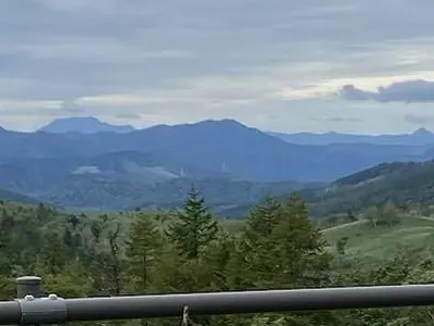
A 1,062-meter peak in the Yubari Range offering a rugged winter climbing experience with views of Mount Tomamu.
What it is
- A 1,062.5-meter mountain spanning Minamifurano Town and Shimukappu Village.
- Originally named Tomam-sa-un-nupuri, meaning a mountain in a wetland in the Ainu language.
- Part of the Yubari Mountain Range featuring a first-class triangulation point at the summit.
- A peak situated directly across the Ikutora Pass from Mount Tomamu.
What to see
- The 1,039-meter eastern peak known as Mount Takenoko.
- Panoramic views of the surrounding Yubari Mountain Range from the summit.
- Nearby peaks including Mount Kokkyoyama and Mount Maruyama.
When to go
- The remaining snow season is the typical time for climbers to visit.
- There are no established hiking trails available for summer trekking.
Getting there
- The climbing route begins from the end of the Zero Line road.
19
Mount Nukabira
HOKKAIDō · PLACE 糠平山
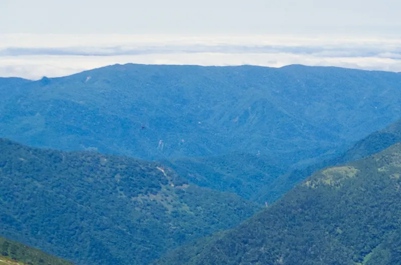
A 1,349-meter peak in the Northern Hidaka Mountains known for its Ainu heritage and challenging off-trail winter climbing.
What it is
- A 1,349.6 meter mountain located in the Northern Hidaka Mountains of Hokkaido.
- The name originates from the Ainu word Nokapira, meaning a cliff with a shape.
- The summit features a first-class triangulation point for geographical measurement.
- It spans the border between Hidaka Town and Biratori Town.
What to see
- A gentle ridge extending toward the north of the mountain range.
- Views connecting to nearby Mount Ganpi and Mount Horonaimaruyama.
- Natural cliff formations that inspired the original Ainu name.
When to go
- Climbers typically visit during the remaining snow season for easier access.
- Winter and early spring are preferred as there are no established hiking trails.
Getting there
- The route to the summit begins from the Mitsuiwa Forest Road.
20
Raiba-dake
HOKKAIDō · PLACE 来馬岳
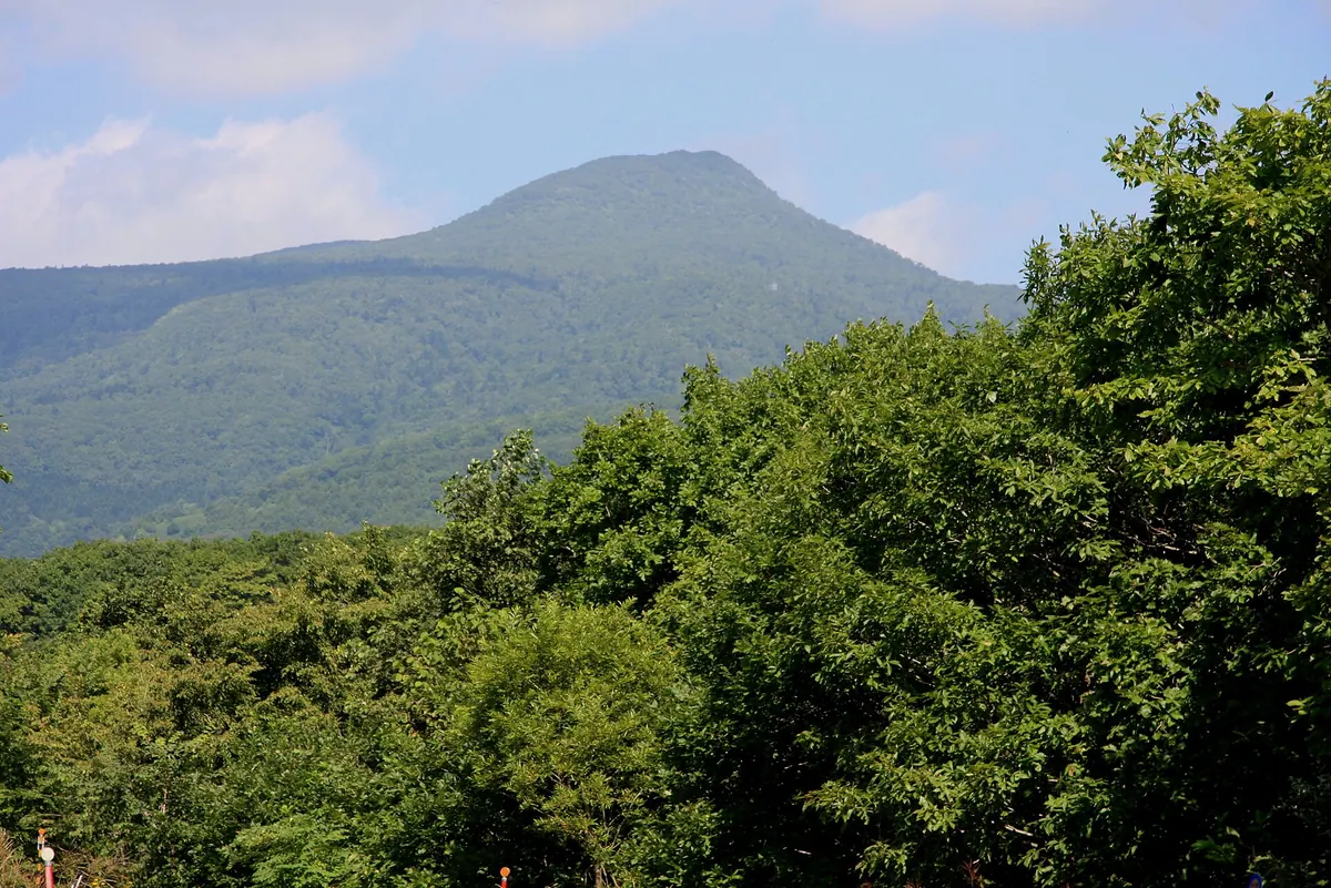
A 1,040-meter volcano in Noboribetsu offering alpine flowers and panoramic views of the Pacific Ocean and Mount Yotei.
What it is
- A volcano in Noboribetsu standing at an elevation of 1,040.1 meters.
- The name originates from the Ainu language word Raipa-nupuri.
- It serves as the primary water source for the Raiba River.
- The hiking trails are maintained by the Noboribetsu Mountaineering Club.
What to see
- A second-class triangulation point located at the mountain summit.
- Panoramic views of the Pacific Ocean and Mount Yotei from the top.
- Mount Koraiba situated on the western side of the mountain.
- Glaucidium corymbosum and other alpine plants blooming along the trails.
When to go
- Visit around June to see the alpine plants in bloom.
Getting there
- The primary climbing route starts from Karurusu Onsen.
- The trail passes through Sanlaiva Ski Resort to reach the fifth station.