

13 Mountains in Miyazaki worth your time
Japan Gems
13 Mountains in Miyazaki, with what to see and how to get there.
Miyazaki has 13 mountains on Japan Gems. Below are the 13 we can tell you the most about — each one written up in English from Japanese sources, with what to see and how to get there. See all mountains in Miyazaki.
01
Mount Wanitsuka
MIYAZAKI · PLACE 鰐塚山
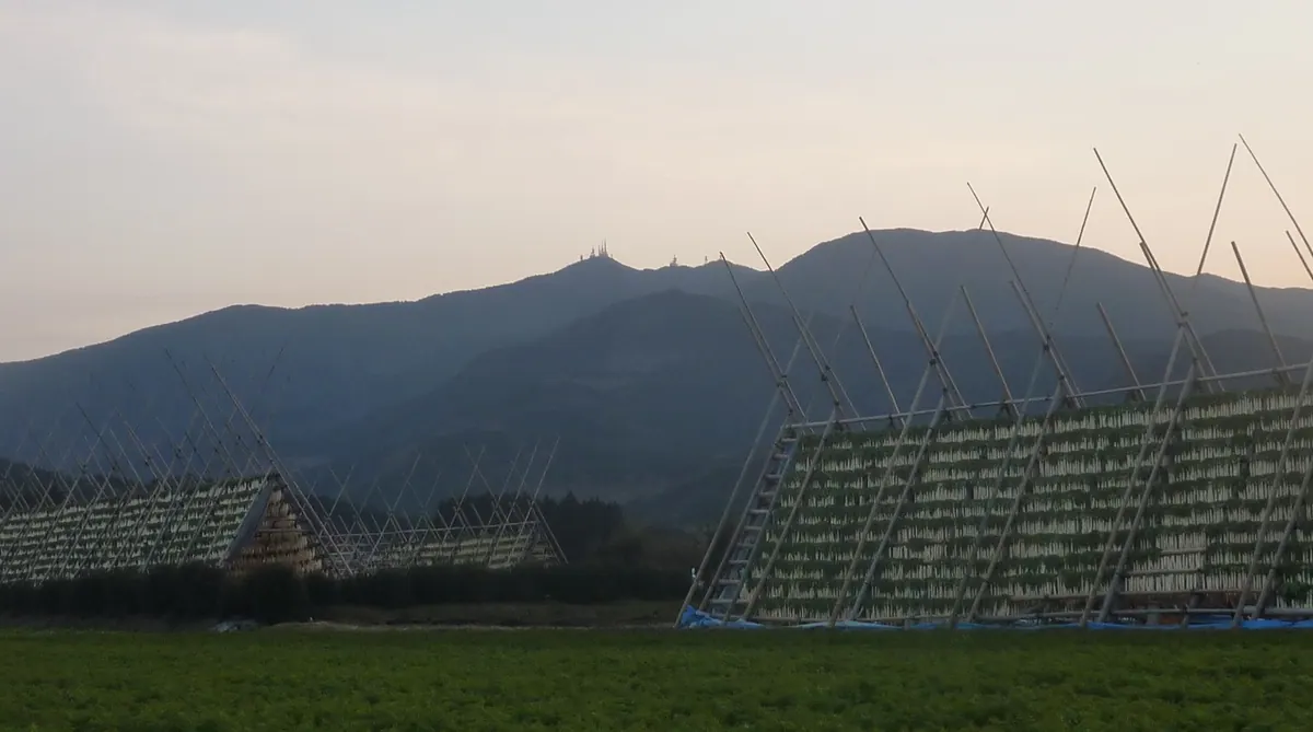
The highest peak of the Wanitsuka Mountains, offering panoramic views and serving as a major regional broadcasting hub.
What it is
- The highest peak of the Wanitsuka Mountains standing at 1,118 meters.
- A major television and radio transmission site serving most of Miyazaki's population.
- Part of the Wanitsuka Prefectural Natural Park spanning three different municipalities.
- A site for broadcasting facilities that first opened in 1960.
What to see
- Multiple transmission stations operated by NHK and MRT at the summit.
- Rare mushrooms known as Kirinomitake that grow on the mountain slopes.
- Views from the summit accessible via car or various hiking trails.
- The surrounding natural park area despite the loss of the valley recreation site.
When to go
- Winter months when cold winds from the peak help with local radish pickling.
- Clear days to avoid the heavy annual rainfall exceeding 3,000 millimeters.
02
Mount Boroishi
MIYAZAKI · PLACE 双石山
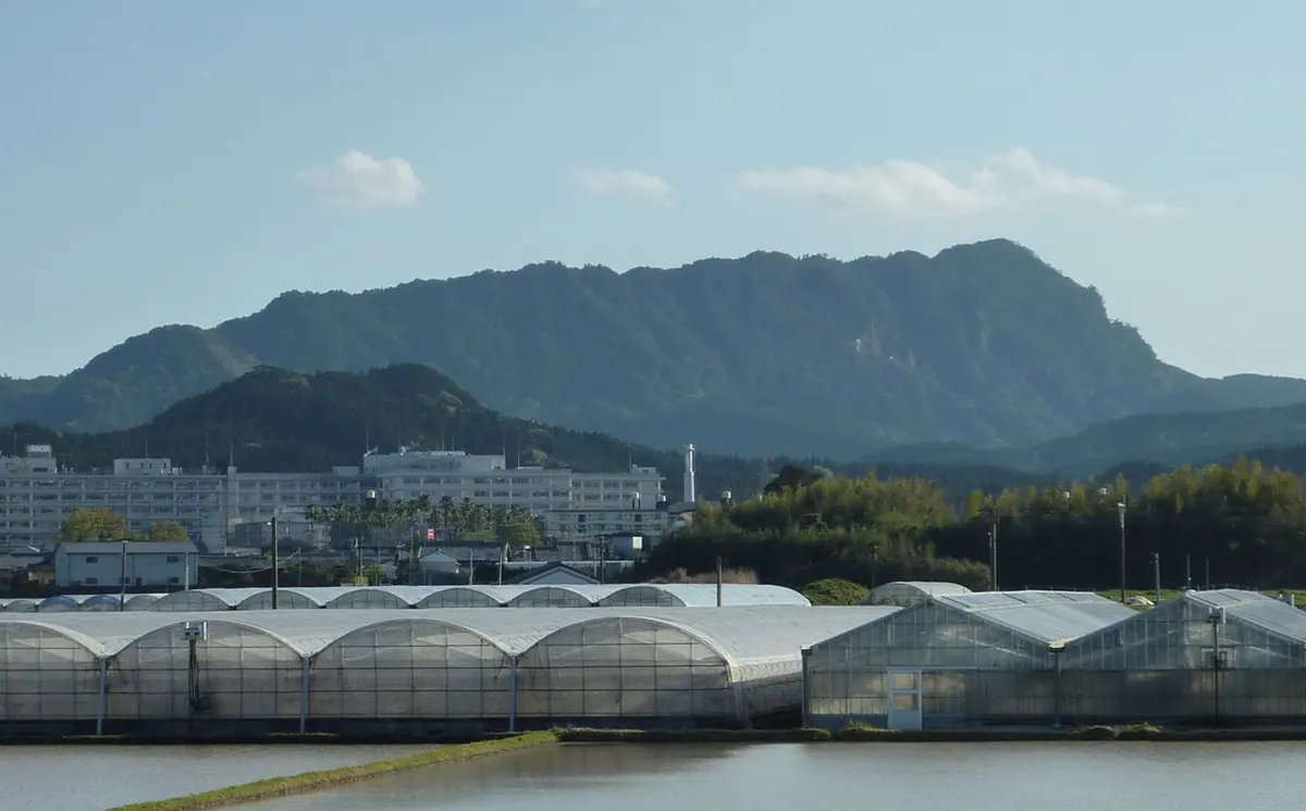
A National Natural Monument in Miyazaki featuring unique cuesta topography, tafoni rock formations, and views of the Hyuga Sea.
What it is
- A mountain in southern Miyazaki City located between the Kaeda and Kagami-zu Rivers.
- Designated as a National Natural Monument and a Nature Recreation Forest in 1970.
- Features unique geology composed of sandstone and conglomerate from the Miyazaki Group.
- Characterized by cuesta topography with notably steep slopes on the western side.
What to see
- Distinctive rock formations known as tafoni and the specific Tengu Rock.
- Summit observatory providing panoramic views of the Hyuga Sea.
- Dense evergreen broad-leaved forest covering the summit area.
- Climbing routes that pass through Harinonimi Shrine and the Elephant Graveyard.
- Steep cliffs used frequently by local rock climbers.
When to go
- October 15 marks the anniversary of the climb by scholar Yasui Sokken.
03
Shiratori Yama
MIYAZAKI · PLACE 白鳥山
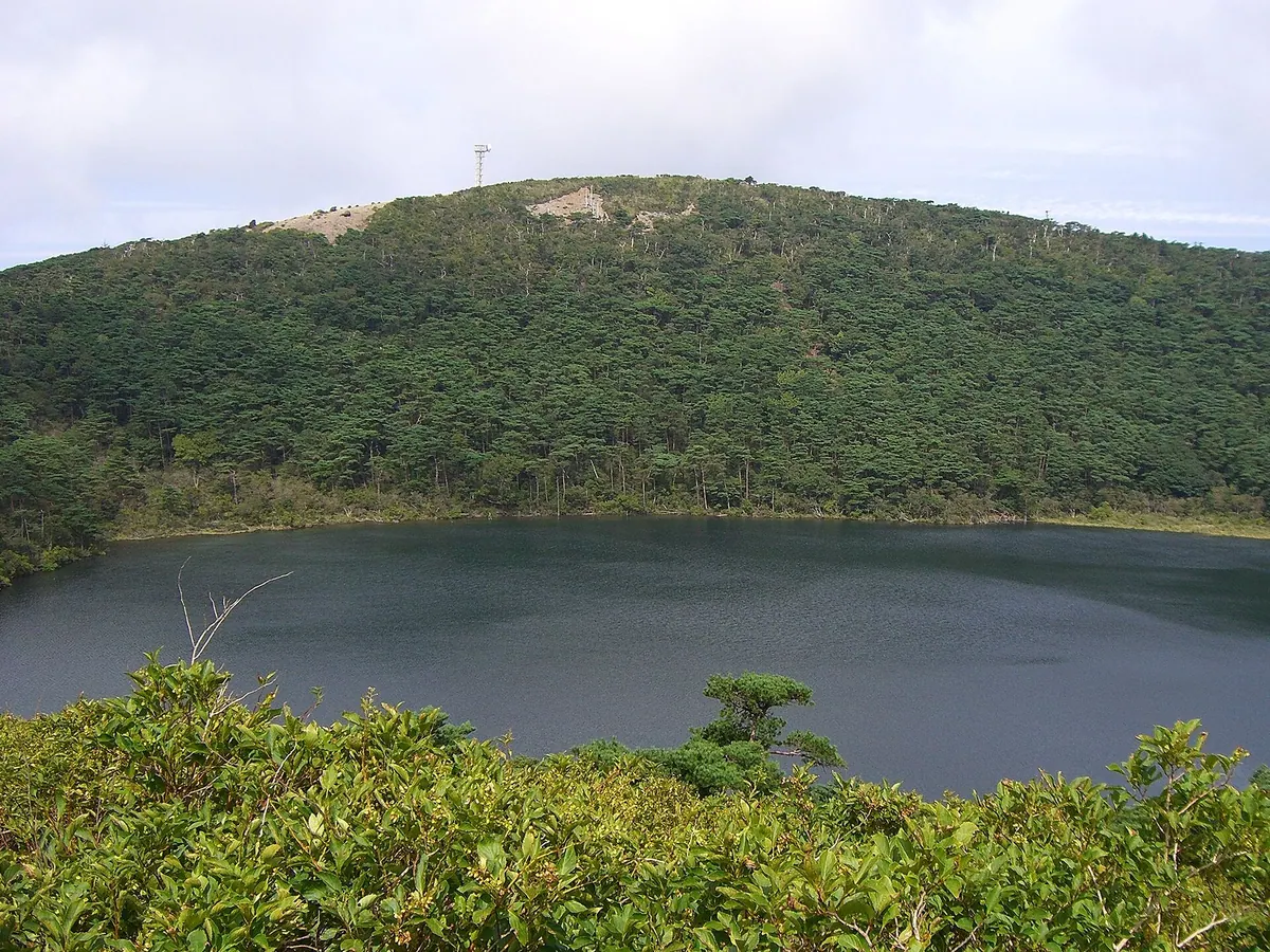
A composite volcano in the Kirishima Mountains featuring crater lakes, ancient shrines, and hot springs on its forested slopes.
What it is
- A composite volcano located in the northwestern Kirishima Mountains of Miyazaki Prefecture.
- Site of the Shiratori Shrine founded by Shoku in the year 959.
- A historic destination visited by the Shimazu clan during the Edo period.
- Volcanic peak featuring both artificial cedar forests and natural beech and fir stands.
What to see
- Byakushi Pond, a crater lake situated on the southern summit of the mountain.
- Rokukannon Miike, a volcanic maar located to the southeast of the peak.
- Shiratori Shrine and Shiratori Hot Spring located on the northern slope.
- Miyama Kirishima azaleas growing in the wild near the mountain summit.
- Natural forests of beech and fir trees along the shrine path.
04
Mount Koshiki
MIYAZAKI · PLACE 甑岳
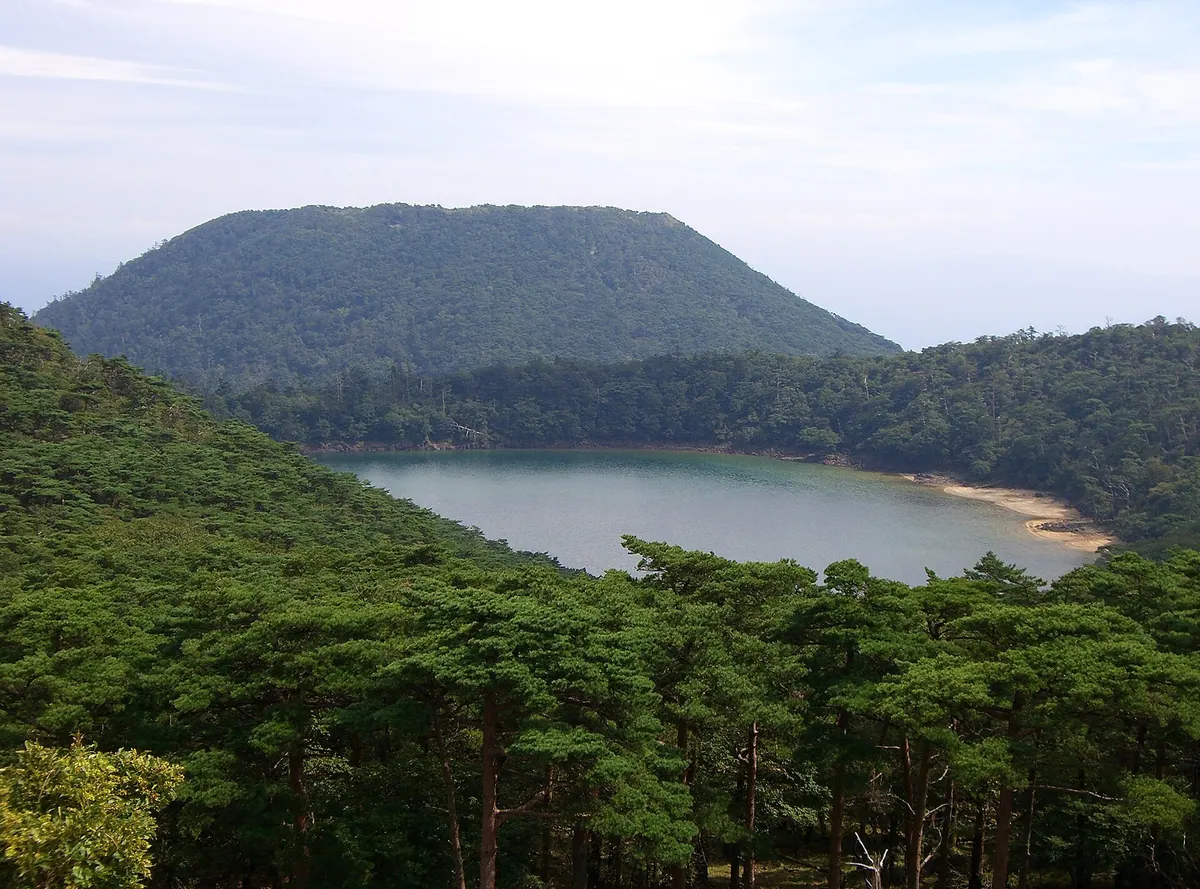
A prehistoric stratovolcano featuring a unique summit wetland and diverse forest ecosystems within a protected national park.
What it is
- A stratovolcano in the northern Kirishima Mountains formed approximately 18,000 years ago.
- A designated National Natural Monument and special protection area of Kirishima-Yaku National Park.
- The summit features a circular flat area measuring 400 meters in diameter.
- The site preserves a rare combination of forest, grassland, and wetland environments.
What to see
- Central peat deposits and a wetland hosting sundews and sphagnum moss.
- Coniferous forests growing along the eastern slopes of the mountain.
- Diverse plant life including Japanese red pine, Mizunara oak, and Kyushu azalea.
- The 400-meter wide circular summit plateau and its unique high-altitude vegetation.
05
Mount Kirishima
MIYAZAKI · PLACE 霧島山
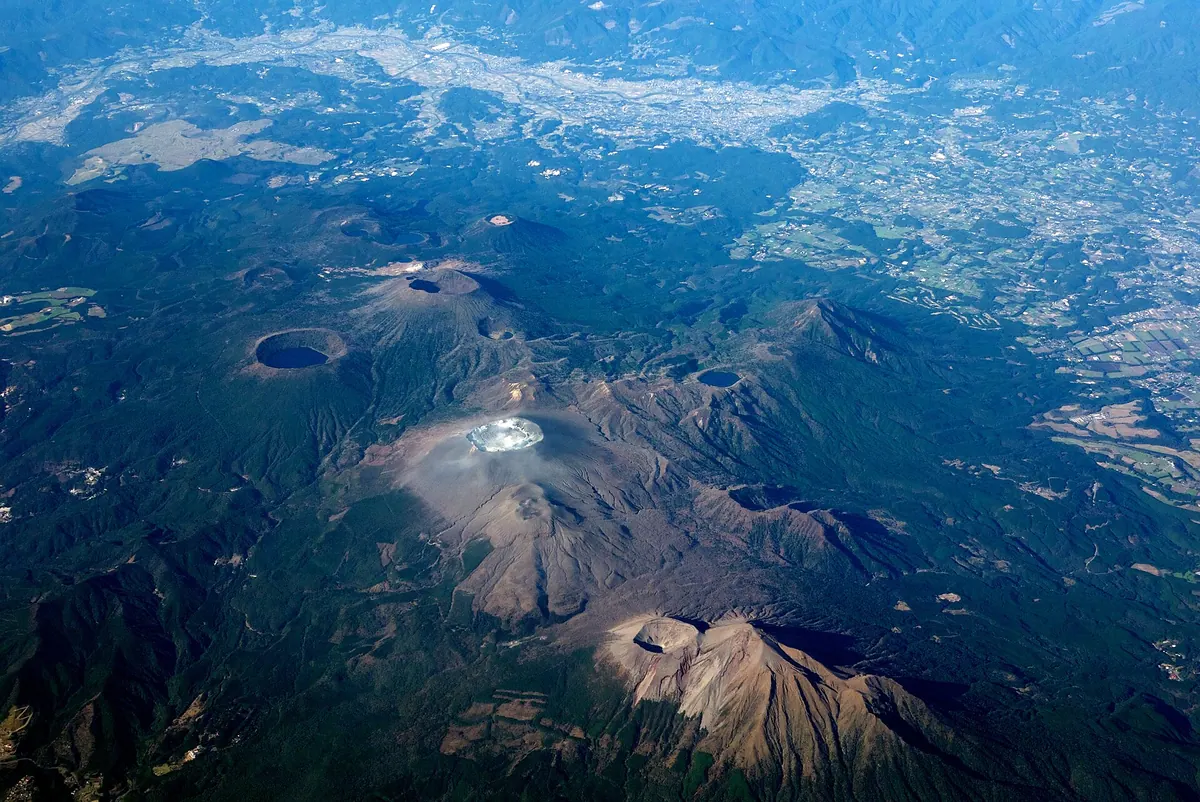
An active volcanic group and national park offering high-altitude hiking, rare endemic plants, and significant historical monuments.
What it is
- An active volcanic group located on the border of Miyazaki and Kagoshima prefectures.
- Part of the Kirishima-Kinkowan National Park and designated as a Geopark in 2010.
- One of the 100 Famous Japanese Mountains with activity divided into three historical periods.
- A historic destination visited by Sakamoto Ryoma for his honeymoon in 1866.
What to see
- The highest peak, Karakunidake, which reaches an elevation of 1,700 meters.
- The Ama-no-Sakahoko spear located at the summit of the Takachiho-no-mine peak.
- Endemic plant species including the Nokaidou and Kumoikogomegusa flowers.
- Diverse volcanic landscapes shaped by high annual rainfall exceeding 4,500 millimeters.
06
Mount Katamuki
MIYAZAKI · PLACE 傾山
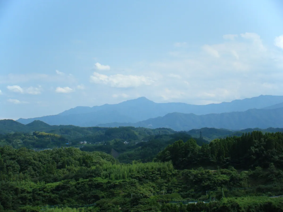
A 1,605-meter peak in a Quasi-National Park featuring three rocky ridges and a famous local legend.
What it is
- A 1,605-meter mountain located on the border of Oita and Miyazaki prefectures.
- One of Japan's 300 Famous Mountains, also known as Shioujimine.
- Part of the Sobo-Katamuki Quasi-National Park and a designated forest ecosystem conservation area.
- The setting for the traditional Yoshisaku Otoshi legend.
What to see
- The summit peak consisting of three distinct rocky ridges.
- Expansive views from the top located within Bungo-ono City.
- Surrounding landscapes of the protected national forest area.
Getting there
- Access the mountain via the Nishiyama forest road trailhead.
- The Sugigakoshi trailhead provides access from the Miyazaki side.
07
Mount Osuzu
MIYAZAKI · PLACE 尾鈴山
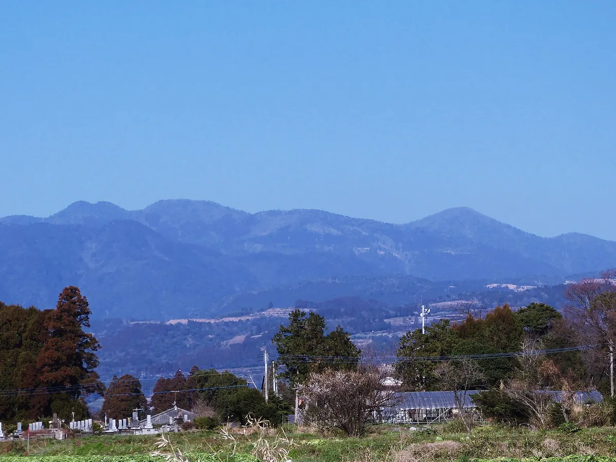
A 1,405-meter peak in Miyazaki featuring over thirty waterfalls and rare plant species within a designated prefectural natural park.
What it is
- A 1,405-meter mountain formed from the fifteen-million-year-old Osuzu Caldera.
- One of Japan's 200 Famous Mountains located within a designated prefectural natural park.
- A high-rainfall region home to unique plant species like the Kibananotsukinukihototogisu.
- The site of a first-class triangulation point located at the mountain summit.
What to see
- The Osuzu Falls collection consisting of over thirty different waterfalls.
- Yatagi Falls which is recognized as one of Japan's Top 100 Waterfalls.
- Waterfalls designated as a National Scenic Beauty since 1944.
- A panoramic view from the summit reached by a three-hour hiking trail.
08
Shinmoedake
MIYAZAKI · PLACE 新燃岳
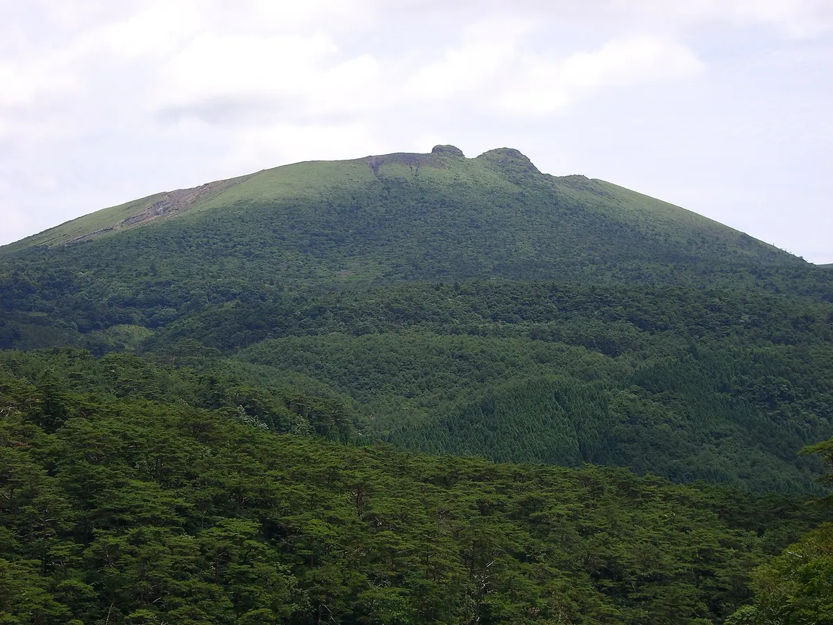
An active 1,421-meter conical volcano in the Kirishima range known for its massive crater and dramatic geological history.
What it is
- An active conical volcano standing 1,421 meters tall in the Kirishima mountain range.
- A designated National Park special zone since 1934 with recorded activity dating back to 1716.
- A geological site composed of pyroxene andesite and pyroclastic cones.
- A monitored volcanic peak situated between Kagoshima and Miyazaki prefectures.
What to see
- A massive circular crater measuring 750 meters in width.
- Two distinct rock peaks on the south wall known as Usagi-no-mimi.
- The volcanic ridge extending across the border of Kirishima and Kobayashi cities.
- The site where the Shinmoe-ike crater lake existed before the 2011 eruption.
09
Mount Takachiho
MIYAZAKI · PLACE 高千穂峰
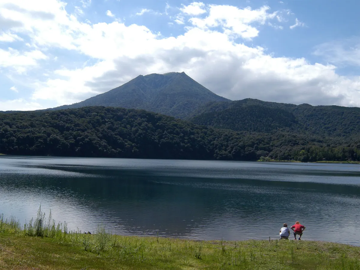
A sacred 1,574-meter volcano where Japanese mythology says the gods descended, featuring a legendary bronze spear at the summit.
What it is
- A 1,574-meter stratovolcano located on the border of Miyazaki and Kagoshima prefectures.
- The site where Ninigi-no-Mikoto reportedly descended to earth in Japanese mythology.
- Part of the Kirishima-Kinkowan National Park and one of Japan's 200 Famous Mountains.
- A sacred peak associated with the Kirishima Higashi Shrine.
What to see
- The Amano-sakahoko, a sacred bronze spear standing at the mountain summit.
- The Ohachi crater on the west side, which last erupted in 1913.
- A concrete mountain refuge hut located at the very top of the peak.
- Panoramic views from the second highest peak in the Kirishima mountain range.
10
Mount Ōkue
MIYAZAKI · PLACE 大崩山
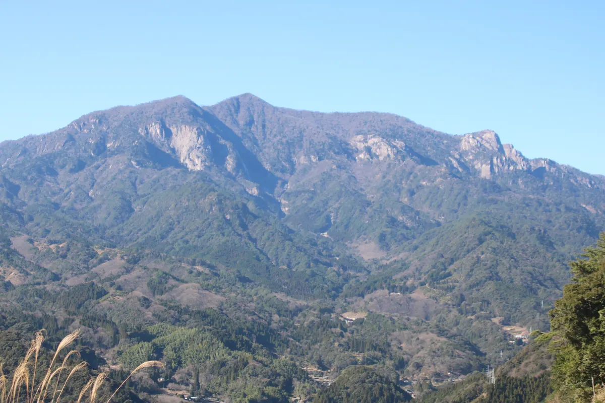
A granite peak in Miyazaki featuring unique geological formations and primary forests home to rare Japanese serows.
What it is
- A prominent peak in the Kyushu Mountain Range within a designated quasi-national park.
- The name derives from the weathered granite exposed on the eastern slopes.
- The terrain formed from volcanic activity approximately fourteen million years ago.
- A popular destination for hikers and climbers attracting twenty thousand visitors annually.
What to see
- A large granite ring dike that surrounds the mountain area.
- The summit area composed of hornfels and a distinct granite dome.
- Primary forests that provide a habitat for the Japanese serow.
- A first-class triangulation point located at the mountain summit.
11
Hinamori Dake
MIYAZAKI · PLACE 夷守岳
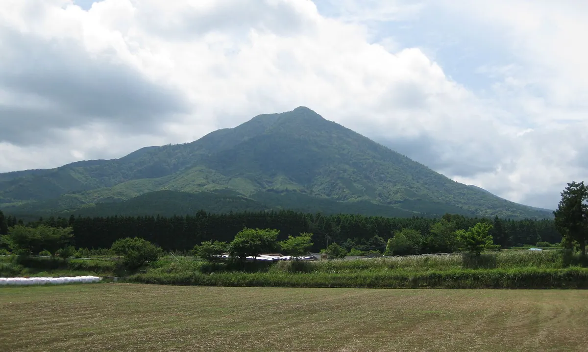
A steep volcanic peak nicknamed Ikoma Fuji, featuring distinct forest zones and a history as a former shrine site.
What it is
- A volcano located at the northern end of the Kirishima Mountains range.
- Nicknamed Ikoma Fuji because of its steep and symmetrical shape.
- Formed thirty-three thousand years ago as part of the New Kirishima Volcano group.
- The former site of the Kirishima Mine Shrine which stood here until 1873.
What to see
- The Ikoma Plateau extending across the northern foot of the mountain.
- Artificial forests of cedar and cypress covering the lower slopes.
- Natural vegetation including beech and oak trees at higher elevations.
- The steep volcanic profile rising above the surrounding landscape.
12
Atago-yama
MIYAZAKI · PLACE 愛宕山 (延岡市)
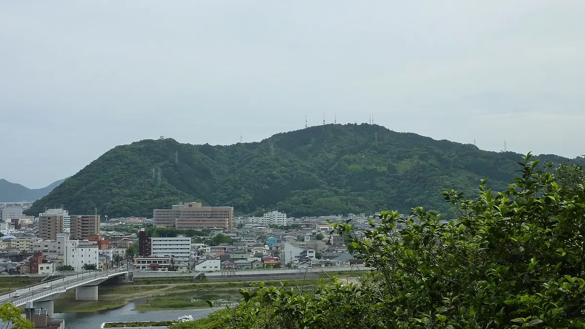
A 251-meter mountain in Nobeoka featuring a heritage night view and the legendary meeting site of Shinto deities.
What it is
- A mountain in southern Nobeoka City standing at 251.3 meters high.
- The legendary meeting place of the deities Ninigi and Konohanasakuya-hime.
- Named after the Atago Shrine located at the base of the mountain.
- A former island that became connected to the mainland through alluvial action.
What to see
- An observation deck situated at an elevation of 200 meters.
- A panoramic view designated as a Japan Night View Heritage site.
- A monument installed in 2008 specifically for hanging padlocks.
- Television and FM radio relay stations located near the summit.
13
Mount Io
MIYAZAKI · PLACE 硫黄山
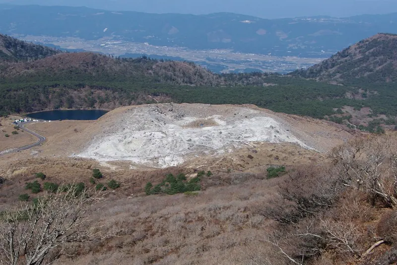
A 1,317-meter active lava dome volcano featuring a summit crater and historical sulfur mining ruins in Miyazaki Prefecture.
What it is
- A 1,317-meter high active lava dome volcano located in Ebino City.
- The site of a major eruption in 1768 and a recent eruption in 2018.
- A former commercial sulfur mine that operated until 1955.
- A peak primarily composed of silica-based volcanic rock northwest of Mount Karakuni.
What to see
- A shallow crater measuring 100 meters wide at the summit.
- Stone ruins from former sulfur cooling operations located inside the crater.
- Views of the western slope from Prefectural Road 1.