

10 Mountains in Kumamoto worth your time
Japan Gems
10 Mountains in Kumamoto, with what to see and how to get there.
Kumamoto has 10 mountains on Japan Gems. Below are the 10 we can tell you the most about — each one written up in English from Japanese sources, with what to see and how to get there. See all mountains in Kumamoto.
01
Mount Ichifusa
KUMAMOTO · PLACE 市房山
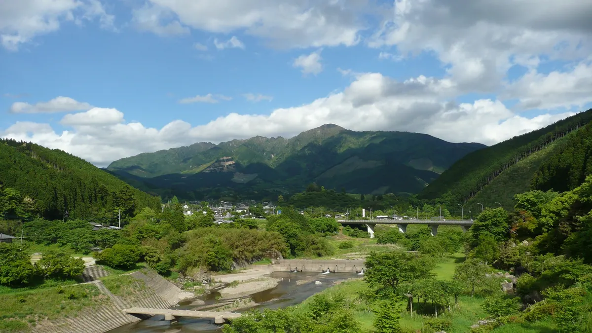
A 1,720-meter granite peak in southern Kyushu offering diverse plant life, seasonal blooms, and challenging hiking trails for nature enthusiasts.
What it is
- A 1,720.8-meter mountain located within the southern Kyushu Mountains range.
- The peak area consists of exposed granite formations.
- The environment supports over 8,000 different plant species due to high annual rainfall.
- The mountain spans the borders of Mizukami, Shiiba, and Nishimera villages.
What to see
- Exposed granite rock formations at the mountain summit.
- Akebono azaleas blooming across the landscape in late spring.
- Vibrant autumn foliage covering the slopes during the fall season.
- Diverse botanical life including thousands of native plant species.
When to go
- Late April to early May to see the Akebono azaleas in bloom.
- Mid-October for the peak of the autumn leaf colors.
Getting there
- Buses run from Yunomae Station directly to the mountain trailhead.
- The ascent from the Mizukami side requires nearly four hours of hiking.
- The mountain is 38 kilometers away from the Hitoyoshi Kuma Interchange.
02
Mount Daikanbō
KUMAMOTO · PLACE 大観峰
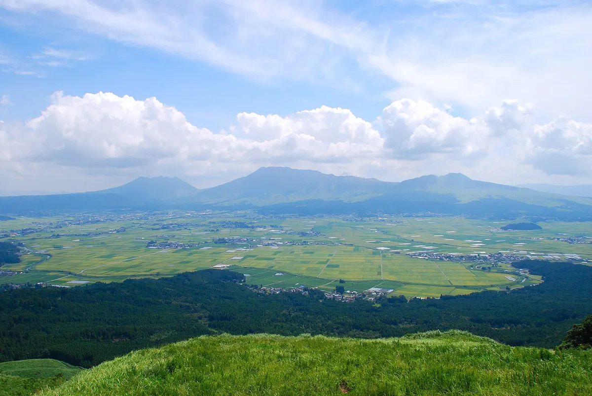
The highest peak of Aso North Outer Rim offering panoramic views of the Aso Five Peaks from a 936-meter elevation.
What it is
- The highest peak of the Aso North Outer Rim standing at 935.9 meters.
- A scenic viewpoint named by journalist Tokutomi Soho in May 1922.
- A site formerly known as Tomigahana that now hosts relay stations.
- A mountain destination featuring restaurants and souvenir shops for visitors.
What to see
- Panoramic views of the Aso Five Peaks from the observation point.
- Television and police wireless relay stations located on the mountain.
- The surrounding landscape of the Aso North Outer Rim.
Getting there
- Buses run from Aso Station to the Daikanbo-iriguchi stop.
- Accessible by car via National Route 212 and Prefectural Road 45.
- Located 40 kilometers from the Kumamoto Interchange.
- A parking lot is situated directly below the observation point.
03
Mount Aso
KUMAMOTO · PLACE 阿蘇山
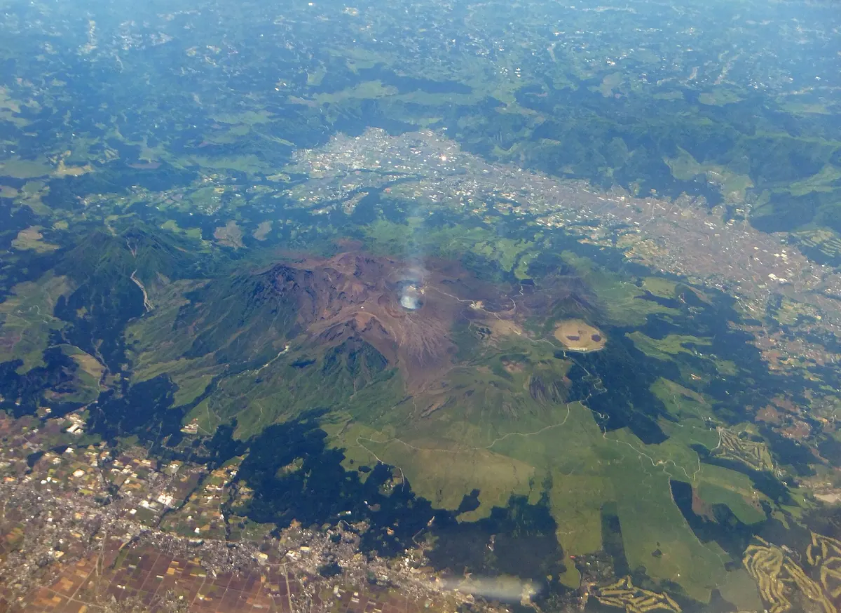
An active volcanic complex in Kyushu featuring one of the world's largest calderas and a smoking central crater.
What it is
- An active volcano in central Kyushu and part of Aso-Kuju National Park.
- A UNESCO Global Geopark featuring a massive caldera formed by four major eruptions.
- The highest peak is Mount Taka reaching 1,592 meters above sea level.
- The central Nakadake peak remains active and continuously emits volcanic smoke.
What to see
- The Nakadake crater area featuring thirteen concrete safety shelters for visitors.
- Kusasenrigahama, a designated National Scenic Spot and Natural Monument within the caldera.
- Komezuka, a 3,300-year-old scoria cone with a distinct recessed summit.
- Numerous hot spring resorts including Uchinomaki and Akamizu located throughout the area.
Getting there
- The JR Hohi Main Line runs through the northern part of the caldera basin.
04
Mount Hanaoka
KUMAMOTO · PLACE 花岡山
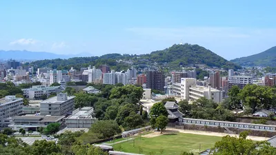
A historic 132-meter peak near Kumamoto Station featuring a Buddhist stupa, military monuments, and panoramic city views.
What it is
- A 132.2 meter high mountain park located in Nishi-ku, Kumamoto City
- Renamed from Gion Mountain to Mount Hanaoka in 1869
- Opened as a public park in 1972 on a site with deep historical significance
- Site of artillery batteries used by Satsuma forces during the Satsuma Rebellion
What to see
- A white Buddhist stupa completed on the summit in 1953
- The Kumamoto Band Memorial Monument erected in 1965
- A historic rock used by the feudal lord Kato Kiyomasa
- A military cemetery dedicated to the Shinpuren Rebellion
- The Hosokawa clan family graves designated as a national historic site
- Panoramic views of the Kumamoto city area from the summit
Getting there
- Located northwest of JR Kumamoto Station
- Accessible by taxi from JR Kumamoto Station
05
Mount Naka
KUMAMOTO · PLACE 中岳
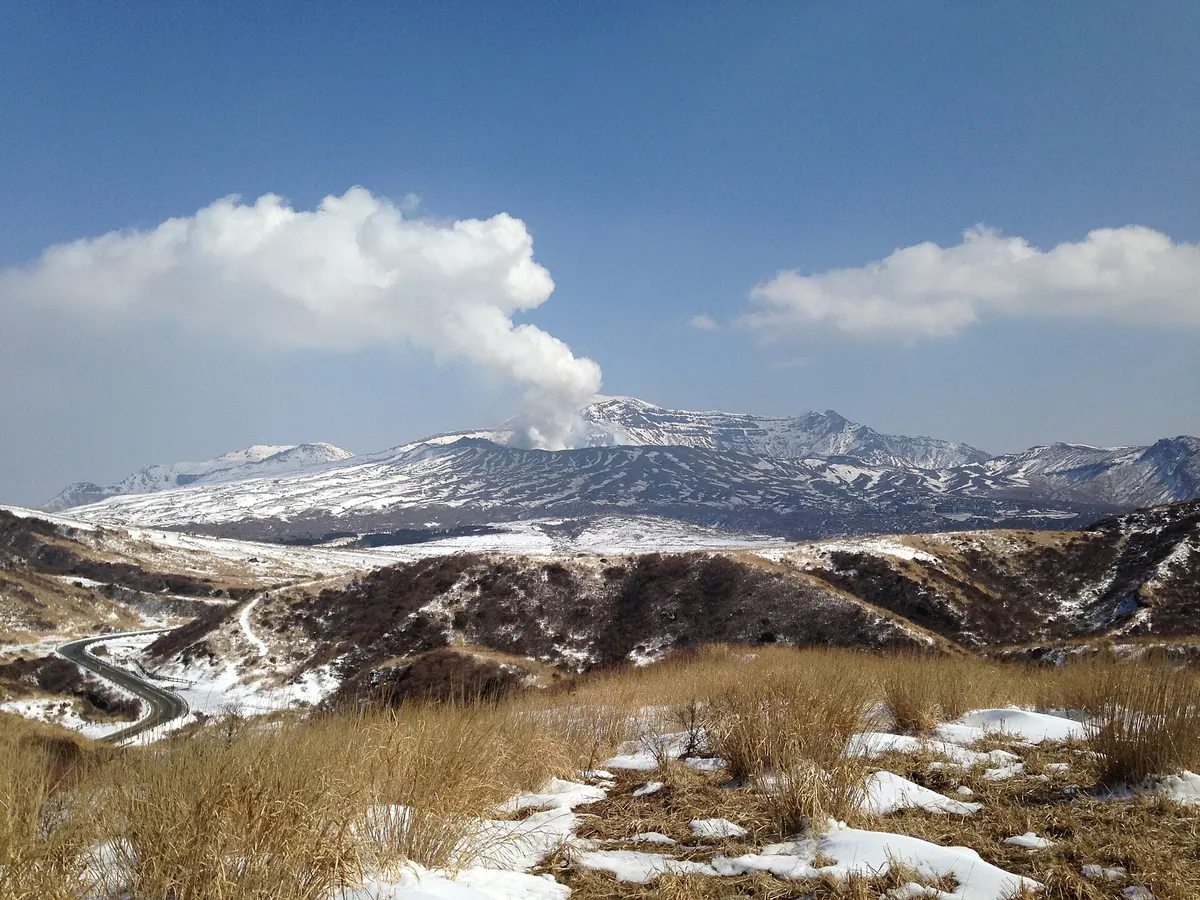
An active volcanic peak featuring seven craters and a turquoise acidic lake, offering a rare look at geological activity.
What it is
- An active volcano standing 1,506 meters high within the Aso Five Peaks.
- A geological site composed primarily of basaltic andesite rock.
- The location of the Aso Special Regional Meteorological Observatory.
- A site containing seven distinct craters with a history of frequent eruptions.
What to see
- The first crater which has remained active for over eighty years.
- A turquoise acidic crater lake known as Yudamari.
- Volcanic landscapes shaped by short-term eruptions occurring every few years.
- Panoramic views of the surrounding Kumamoto Prefecture mountain range.
When to go
- Check local alerts as volcanic gases often cause entry restrictions.
- Avoid the area during major eruption cycles every ten to twenty years.
06
Mount Tatsuda
KUMAMOTO · PLACE 立田山
A 151-meter mountain in Kumamoto City featuring historic samurai graves, ancient cave tombs, and a national nature park.
What it is
- A 151.7 meter high mountain located in the center of Kumamoto City.
- A designated national natural monument named after the dragon deity Kuraokami.
- The site of Taisho-ji Temple ruins and the Hosokawa family graves.
- A location where Jomon and Yayoi period artifacts were discovered.
What to see
- The Hokoku-byo mausoleum built by the feudal lord Kato Kiyomasa.
- Tsutsujigaoka horizontal cave tombs dating back to ancient times.
- Experimental forests managed by the Forestry and Forest Products Research Institute.
- Tatsuda Nature Park which is a designated national historic site.
Getting there
- The mountain is accessible from the nearby Tatsudaguchi Station on the JR Hohi Main Line.
07
Mount Kinbō
KUMAMOTO · PLACE 金峰山
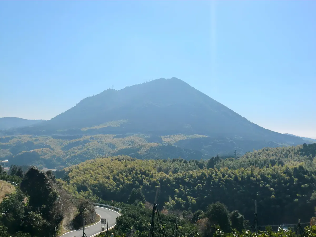
A 665-meter caldera volcano offering panoramic sea views and the historic cave where Miyamoto Musashi wrote his famous work.
What it is
- A caldera volcano in Kumamoto City reaching a height of 665 meters
- The site of Kinbozan Prefectural Natural Park formed over one million years
- A sacred peak featuring a shrine dedicated to the deity Zao Gongen
- The location of Reigando Cave where Miyamoto Musashi wrote The Book of Five Rings
What to see
- An observation deck at the summit overlooking the Ariake Sea
- Kawachi mandarin orchards cultivated by farmers on the western slopes
- Television and radio broadcasting stations located at the highest peak
- The historic Reigando Cave situated within the mountain area
Getting there
- Buses run from Kumamoto Sakuramachi Bus Terminal directly to the mountain
08
Mount Eboshi
KUMAMOTO · PLACE 烏帽子岳
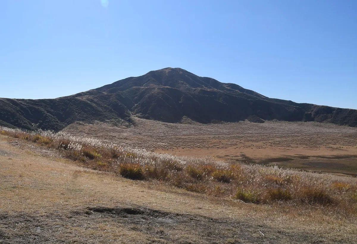
A 1,337-meter stratovolcano in the Aso Caldera offering hiking trails with views of active volcanic smoke and the Kumamoto Plain.
What it is
- The fourth highest peak among the Aso Five Mountains in western Kumamoto.
- A stratovolcano standing 1,337 meters above sea level at the western end of Aso.
- A mountain also known as Kunimiyama featuring a first-class triangulation point at the summit.
- A triangular peak located four and a half kilometers from Mount Taka.
What to see
- Volcanic smoke rising from nearby Mount Nakadake visible from the hiking trails.
- The triangular silhouette of the mountain peak as viewed from the Kumamoto Plain.
- Hiking routes spanning both the eastern and western sides of the volcano.
Getting there
- Hiking trails begin directly at the Kusasenrigahama public bus terminal.
09
Mount Kunimi
KUMAMOTO · PLACE 国見岳
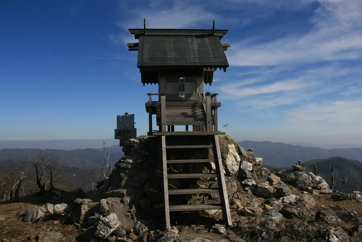
The highest peak in Kumamoto Prefecture offers hikers beech forests and rhododendrons within a protected quasi-national park.
What it is
- The highest peak in Kumamoto Prefecture standing at 1,739 meters.
- A designated part of the Kyushu Chuo Sanchi Quasi-National Park.
- One of the 300 Famous Japanese Mountains bordering Yatsushiro City and Shiiba Village.
- A natural watershed for the Kawabe and Mimi rivers.
What to see
- Natural forests consisting primarily of beech and fir trees.
- Rhododendron communities that grow around the mountain slopes.
- A first-class triangulation point located at the summit.
- Views from the ridge connecting to Mount Goyu.
Getting there
- A climbing route starts from the Momiki forest road.
- The summit is accessible via a ridge trail from Mount Goyu.
10
Mount Neko
KUMAMOTO · PLACE 根子岳
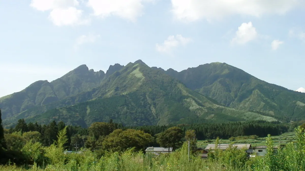
One of the Aso Five Peaks, this ancient stratovolcano features a unique jagged silhouette resembling a cat.
What it is
- One of the five central peaks of the Aso volcanic group.
- An andesite stratovolcano formed approximately 150,000 years ago.
- A mountain named for its physical resemblance to a cat.
- A site associated with legends of divine anger explaining its jagged shape.
What to see
- The highest point at Tengu Peak reaching 1,433 meters.
- The eastern peak featuring a survey triangulation point.
- Distinctive jagged rock formations created by ancient pyroclastic flow deposits.
- Views of the surrounding Aso caldera from the high ridges.