

20 Mountains in Osaka worth your time
Japan Gems
24 Mountains in Osaka, with what to see and how to get there.
Osaka has 24 mountains on Japan Gems. Below are the 20 we can tell you the most about — each one written up in English from Japanese sources, with what to see and how to get there. See all mountains in Osaka.
01
Mount Miyama
OSAKA · PLACE 深山
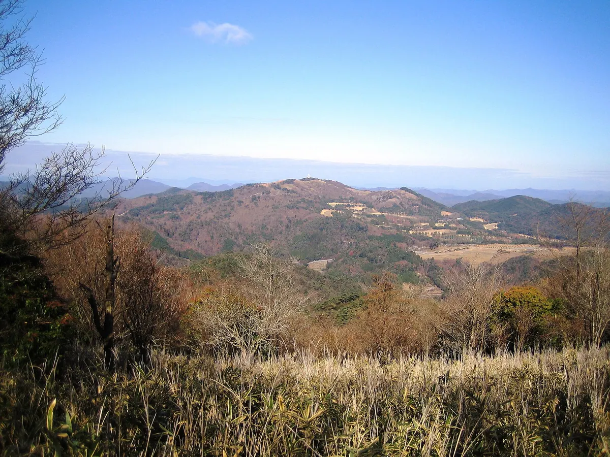
The highest peak in the Hokusetsu Mountains, offering three distinct hiking trails through northern Osaka and Hyogo prefectures.
What it is
- The highest peak in the Hokusetsu Mountains at an elevation of 790.5 meters.
- A prominent summit bordering Nose Town and Nantan City.
- The highest point in northern Osaka Prefecture and one of the Osaka 50 Mountains.
- A hiking destination accessible via three main climbing routes from different prefectures.
What to see
- The summit area reached by trails from Osaka and Hyogo.
- Natural landscapes along the 110-minute route from Okururikei.
- Scenic mountain paths passing through Sasayama Forest Park.
- Views from the highest vantage point in the Hokusetsu range.
Getting there
- Take a bus from Nissei-chuo or Sonobe stations to the Okururikei trailhead.
- Board a bus from Kameoka Station to reach the Hirono climbing area.
- Follow the trail from Fukuzumi for a 150-minute hike to the summit.
- Access the mountain through Sasayama Forest Park from the Hyogo Prefecture side.
02
Mount Satsuki
OSAKA · PLACE 五月山
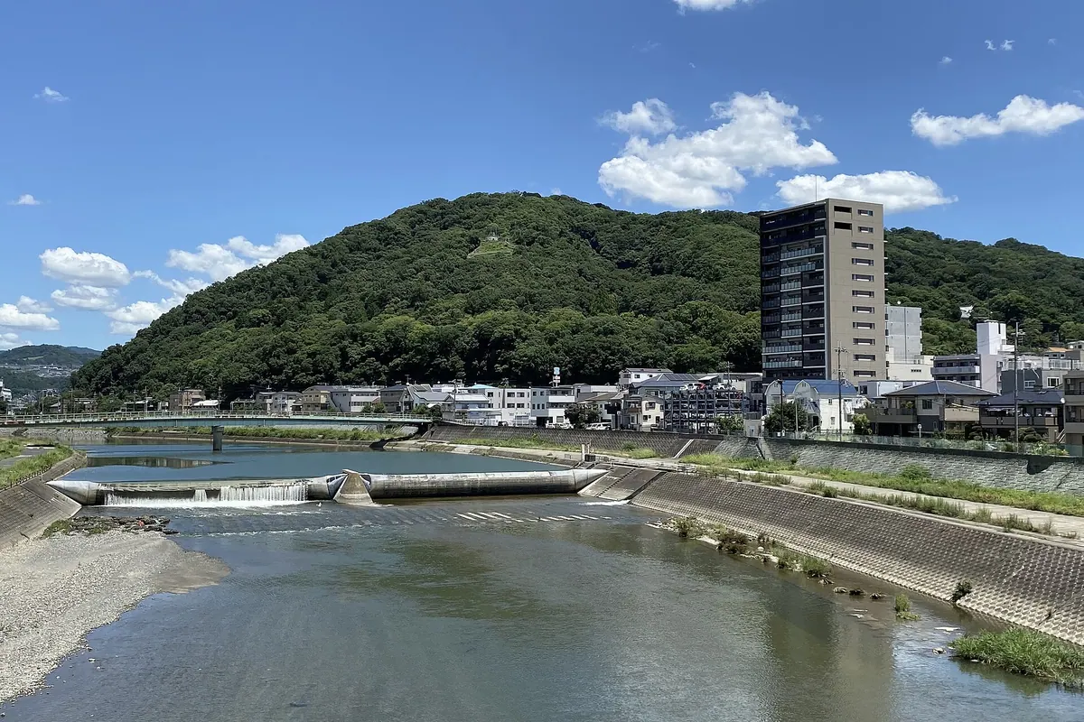
A 314-meter peak in Osaka featuring hiking trails, scenic observatories, and a park famous for seasonal cherry blossoms and autumn foliage.
What it is
- A mountain spanning Ikeda and Minoo cities recognized as one of the 50 Mountains of Osaka.
- The base of the mountain is developed as Satsuki-yama Park for public recreation.
- A natural habitat for wild monkeys, tanuki, deer, and boars.
- The area features a golf course and several local shrines.
What to see
- Five observatories offering views of the Osaka Plain and regional airports.
- Ishizumi Waterfall which features a vertical drop of 25 meters.
- Eight maintained hiking courses that traverse the mountain slopes.
- A driveway leading to the summit for easy access to various lookout points.
When to go
- Spring is a popular time to visit for the cherry blossoms.
- Autumn offers colorful foliage across the mountain landscape.
Getting there
- The nearest train stop is Hankyu Ikeda Station.
03
Mount Kongō
OSAKA · PLACE 金剛山
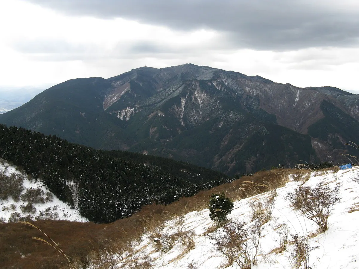
A 1,125-meter peak on the Osaka-Nara border offering historic Shugendo sites and popular hiking trails with a unique stamp system.
What it is
- A 1,125-meter mountain located on the border of Nara and Osaka prefectures.
- Founded by En no Gyoja as a sacred site for the Shugendo religion.
- Part of the Kongo-Ikoma-Kisen Quasi-National Park containing Osaka's highest point.
- A highly popular hiking destination that ranked second in Japan for total climbs in 2023.
What to see
- The Katsuraki Shrine and Tenpurin-ji Temple located near the summit area.
- The historic ruins of Chihaya Castle situated on the mountain slopes.
- A stamp system used by frequent hikers to track their total number of ascents.
When to go
- The Kongo Ropeway has been suspended since March 2019, requiring visitors to hike up.
Getting there
- Buses from Kawachinagano Station provide direct access to the various mountain trailheads.
04
Mount Yamato Katsuragi
OSAKA · PLACE 大和葛城山
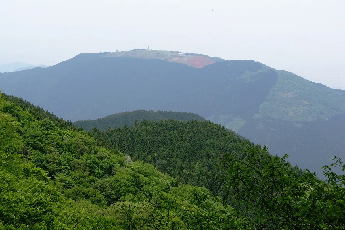
A 959-meter peak on the Nara-Osaka border famous for its vast plateau of spring azaleas and panoramic mountain views.
What it is
- A 959-meter peak located on the border of Nara and Osaka prefectures
- Part of the Kongo-Ikoma-Kisen Quasi-National Park and the 300 Famous Japanese Mountains
- A summit area known as the Katsuragi Plateau featuring a lodge and shrine
What to see
- Massive fields of blooming azaleas covering the plateau near the summit
- Several waterfalls located along the Kujira no Taki hiking course
- Katsuragi Tenjin Shrine situated near the top of the mountain
- The Diamond Trail which connects this peak to Mount Nijo and Mount Kongo
When to go
- Early to mid-May to see the azaleas in full bloom near the summit
Getting there
- Take a bus from Kintetsu Gose Station to reach the ropeway station
- Ride the Katsuragi Mountain Ropeway from the base directly to the summit
05
Mount Naka Katsuragi
OSAKA · PLACE 中葛城山
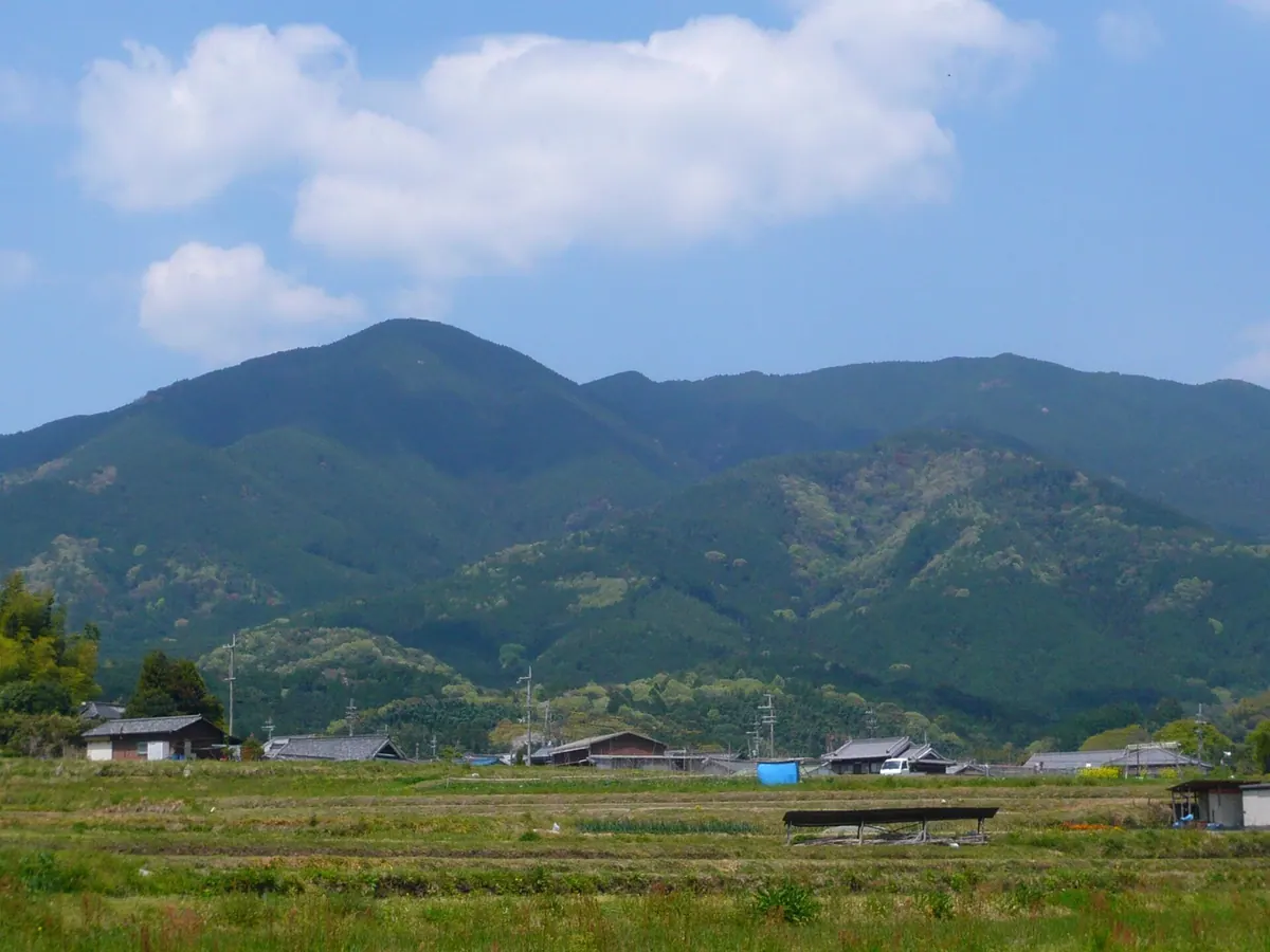
A 937-meter peak on the Diamond Trail offering a quiet hiking experience through cedar forests and bamboo grass fields.
What it is
- A 937.7 meter peak located in the Kongo-Ikoma-Kisen Quasi-National Park.
- The summit marks the geographical border between Osaka and Nara prefectures.
- A mountain situated south of Mount Kongo within the Kongo Mountain Range.
What to see
- Planted cedar trees and bamboo grass covering the Osaka side of the mountain.
- A third-class triangulation point located near the highest point of the summit.
- Shrubs and bamboo grass landscapes characteristic of the Nara side slopes.
- Kuruno Pass situated approximately 100 meters northeast of the mountain peak.
- The Diamond Trail long-distance hiking path which passes near the summit.
Getting there
- Accessible via a climbing route starting from Kowa-cho in Gojo City.
- The mountain can be reached from the Mount Kongo Ropeway bus stop.
06
Mount Iimori
OSAKA · PLACE 飯盛山
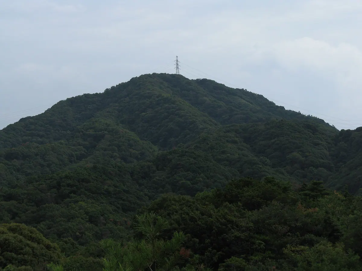
A 384.5-meter peak in the Kisen Alps offering panoramic views of Osaka Bay and historic military fortress ruins.
What it is
- A mountain standing 384.5 meters tall at the western end of the Izumi Mountains.
- Part of the Kisen Alps located within Misaki Town in Osaka Prefecture.
- Site of the former Yura Fortress built by the Japanese military.
- A planned natural park area featuring nearby Katsuragi Shugen training sites.
What to see
- Remaining structures and remnants of the historic Yura Fortress.
- Panoramic views overlooking Osaka Bay and Kansai International Airport.
- Clear sightings of Awaji Island and the Akashi Kaikyo Bridge from the peak.
- The Udobaka Burial Mound and Tannowa Ruins located along the hiking path.
Getting there
- Accessible via Tannowa Station on the Nankai Railway line.
- A hiking route of approximately 9.5 kilometers leads from the station to the summit.
07
Mount Utagaki
OSAKA · PLACE 歌垣山
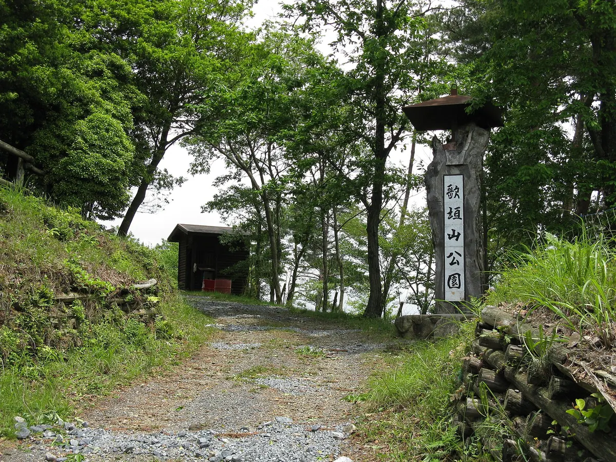
A 553-meter mountain in Osaka featuring two peaks, historic Utagaki gathering sites, and views from a summit observatory.
What it is
- A 553.5-meter mountain located within the Hokusetsu range in Nose Town.
- One of Japan's three major historic sites for traditional Utagaki gatherings.
- The mountain features two distinct peaks named Otokoyama and Onnayama.
- Utagaki Mountain Park is situated at the summit of the Otokoyama peak.
What to see
- An observatory located at the summit of Onnayama for panoramic views.
- The official triangulation point situated on the Onnayama peak.
- Kuragaki Tenmangu Shrine located at the western foot of the mountain.
- Myohoji Temple situated at the western base near the trailheads.
Getting there
- Take a bus from Myokenguchi Station to the Utagaki-yama-yamaguchi stop.
- The ascent to the summit takes approximately 40 minutes from the trailheads.
08
Mount Machikane
OSAKA · PLACE 待兼山
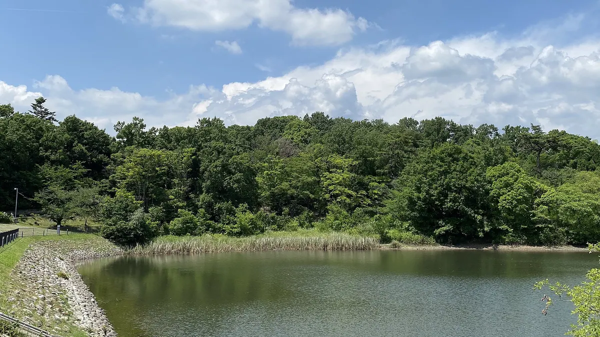
A historic 77-meter peak housing Osaka University, famous for ancient crocodile fossils and appearances in classical Japanese literature.
What it is
- A mountain standing 77.3 meters tall across Toyonaka, Ikeda, and Minoo cities.
- The primary site for the Osaka University Toyonaka Campus.
- A historic location mentioned in the classical text Makura no Soshi.
- Site of the Machikane Mountain Ruins containing a Yayoi period settlement.
What to see
- Nationally registered fossils of the Machikane crocodile discovered in 1964.
- A stone monument marking the spot where Emperor Taisho visited the summit.
- Osaka University Hall, which is a registered tangible cultural property.
- Scenic water features including Nakayama Pond and Machikane Pond.
Getting there
- Access the area via Shibahara-handai-mae or Ishibashi handai-mae stations.
- The southern edge is bordered by the Chugoku Expressway.
09
Mount Makio
OSAKA · PLACE 槇尾山
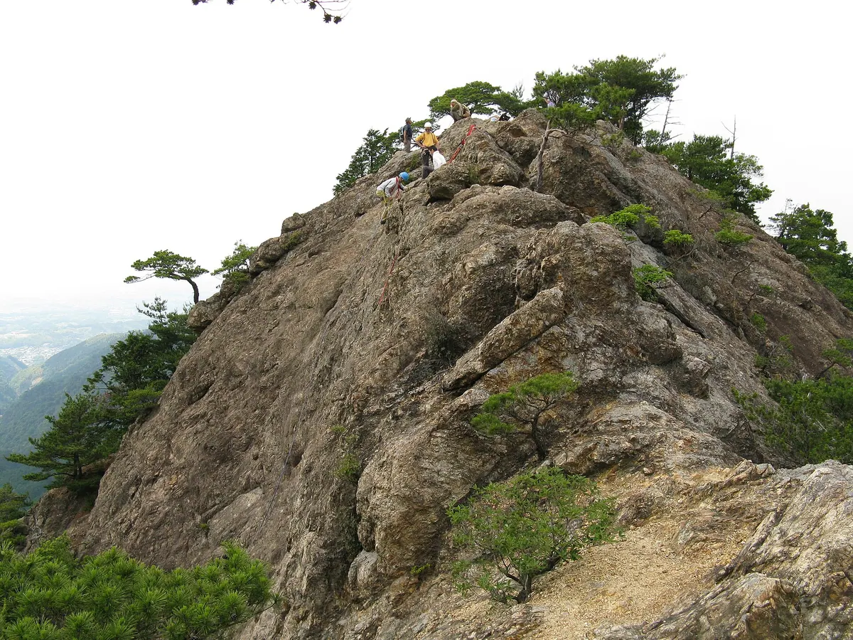
A 600-meter mountain in Osaka featuring a historic pilgrimage temple, hiking trails, and a long roller slide for families.
What it is
- A 600-meter mountain in Izumi City serving as the terminus for the Diamond Trail.
- Home to Sefuku-ji Temple, the fourth station of the Saigoku Kannon Pilgrimage.
- The temple enshrines Miroku Bosatsu and Senju Kannon at an elevation of 500 meters.
- A recreational area featuring the Izumi City Youth House and Makioyama Greenland.
What to see
- Sefuku-ji Temple buildings located high on the mountainside.
- A 100-meter long roller slide situated within Makioyama Greenland.
- Kura-iwa and Hotoke-iwa rock formations used by local rock climbers.
- Hiking trails that connect the mountain to Takihata in Kawachinagano City.
Getting there
- Access the mountain using the Choisoko Izumi demand-responsive transport system.
10
Ameyama
OSAKA · PLACE 雨山
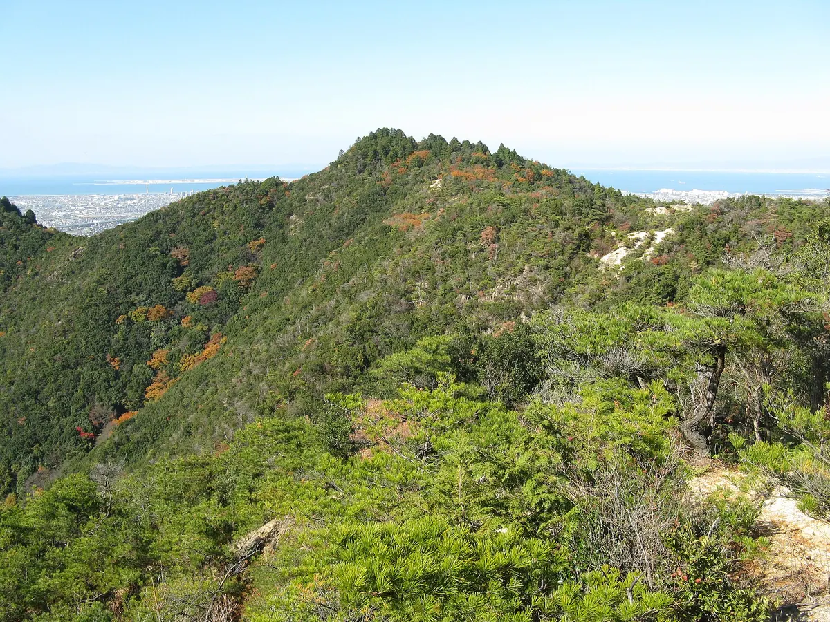
A 312-meter mountain in Osaka featuring a historic castle site, a summit shrine, and designated national ruins within a nature park.
What it is
- A 312-meter mountain located in Kumatori Town within the Okuyama Ameyama Nature Park.
- Site of a former mountain castle dating back to the Nanboku-cho period.
- A National Historic Site designated in 2013 as part of the Hine-no-sho remains.
- Historically used by local villagers who climbed the summit to pray for rain.
What to see
- Ameyama Shrine located at the very top of the mountain summit.
- Historical castle ruins including the areas known as Tsukimitei and Senjojiki.
- Panoramic views overlooking the Kokawa Highway from the mountain slopes.
- Natural forest scenery throughout the surrounding Okuyama Ameyama Nature Park.
When to go
- The Hassaku event is held annually on September 1st.
11
Mount Iwahashi
OSAKA · PLACE 岩橋山
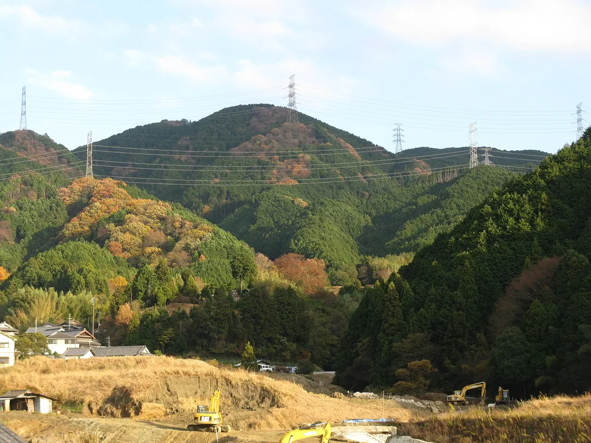
A 658-meter peak on the Osaka-Nara border featuring giant rocks and a legendary stone bridge site along the Diamond Trail.
What it is
- A 658.8-meter peak located on the border of Osaka and Nara prefectures.
- Part of the Kongo Mountain Range within a designated Quasi-National Park.
- One of the 50 Mountains of Osaka featuring a third-class triangulation point.
- A site where legend says En no Gyoja attempted to build a stone bridge.
What to see
- A group of giant rocks scattered across the mountain landscape.
- Planted forests of cedar and cypress trees surrounding the summit area.
- The Diamond Trail hiking route which passes directly through the summit.
- The mountain peak situated between Taisishi Pass and Iwahashi Pass.
Getting there
- Access is available via bus from Kishi Station or Tondabayashi Station.
12
Mount Iwawaki
OSAKA · PLACE 岩湧山
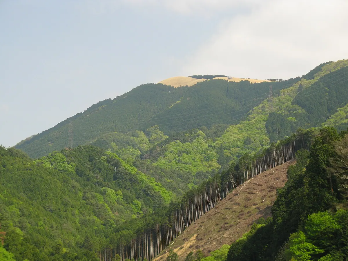
A scenic mountain peak featuring vast silver grass fields and panoramic views over the Osaka Plain and Osaka Bay.
What it is
- A mountain in Kawachinagano City with an elevation of 897.1 meters.
- One of the New 100 Famous Japanese Mountains and a local scenic landmark.
- A source of harvested silver grass used to restore Japanese cultural heritage buildings.
- A key point along the 45-kilometer Diamond Trail hiking route.
What to see
- An eight-hectare field of silver grass covering the summit area.
- Panoramic views stretching across the Osaka Plain to Osaka Bay.
- The Shikisaikan visitor center located at the Iwawakidera trailhead.
- Historical remnants of the former Umenoki Eikyu cableway.
Getting there
- Access the mountain via trailheads at Takihata Dam, Iwawakidera Temple, or Kimi Pass.
13
Mount Kenpi
OSAKA · PLACE 剣尾山
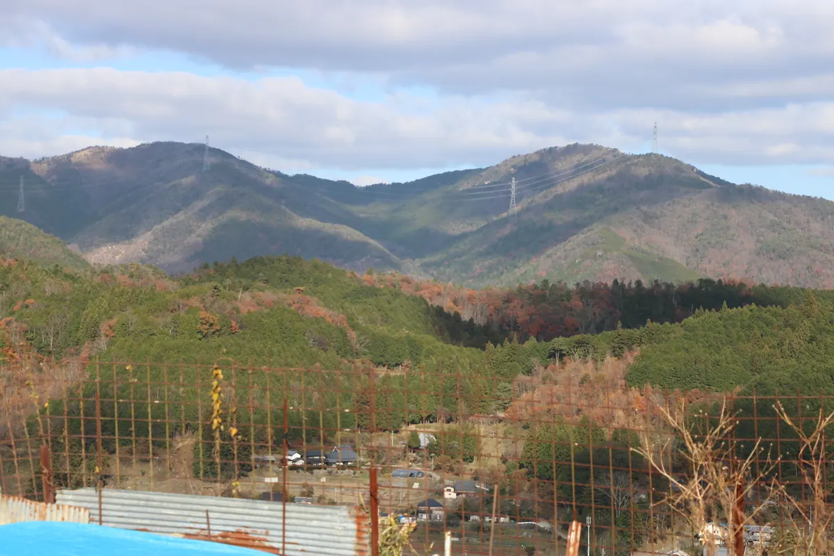
A 784-meter peak in the Hokusetsu range featuring ancient temple ruins and panoramic views of Kyoto and Osaka Bay.
What it is
- A 784-meter mountain in the Hokusetsu range also known as Tsukigamine.
- A historical center for mountain worship listed in the Settsu Meisho Zue.
- Site of the original Geppo-ji Temple ruins founded by Nichira Shonin.
- The temple was established under the orders of Prince Shotoku.
What to see
- Exposed bedrock and natural stone formations at the mountain summit.
- Panoramic views stretching from Kyoto to Osaka Bay from the peak.
- Remaining ruins of the ancient Geppo-ji Temple located near the summit.
Getting there
- Take the Hankyu Bus from Yamashita Station to the Gyojaguchi bus stop.
- The hike from the Gyojaguchi bus stop to the summit takes about 90 minutes.
14
Tōmyōgatake
OSAKA · PLACE 燈明ヶ岳
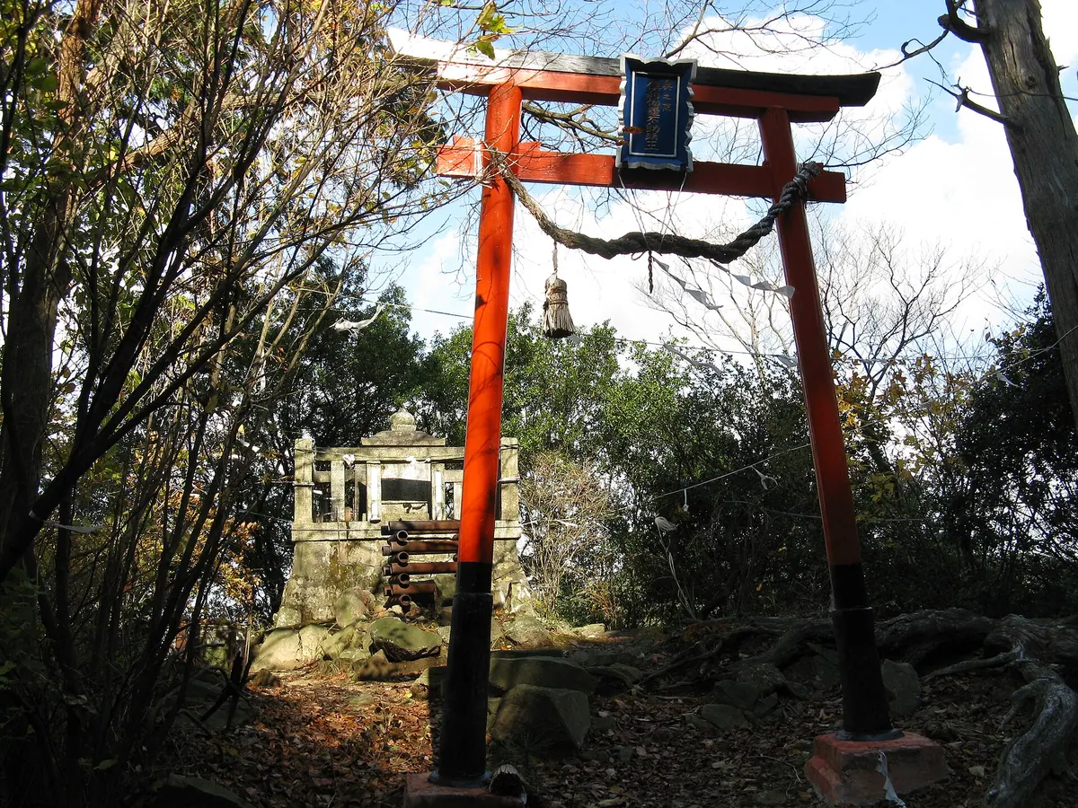
A 558-meter peak in a quasi-national park offering Shugendo training grounds, ancient sutra mounds, and stone Buddha statues.
What it is
- A 558-meter mountain peak located within the Kongo-Ikoma-Kisen Quasi-National Park.
- One of the fifty recognized mountains of Osaka Prefecture.
- A sacred training ground for practitioners of the Shugendo religion.
- Historically known for a light on the peak that guided ships at sea.
What to see
- Various shrines and stone Buddha statues scattered across the mountain slopes.
- Ancient sutra mounds preserved within the sacred mountain landscape.
- The Ura-gyoba section used for ascetic spiritual training.
- A large Fudo Myoo statue located near the start of the trail.
Getting there
- The trailhead is located directly behind the Fudo Myoo statue at Shipporyuji.
15
Mount Takao
OSAKA · PLACE 高尾山 (大阪府)
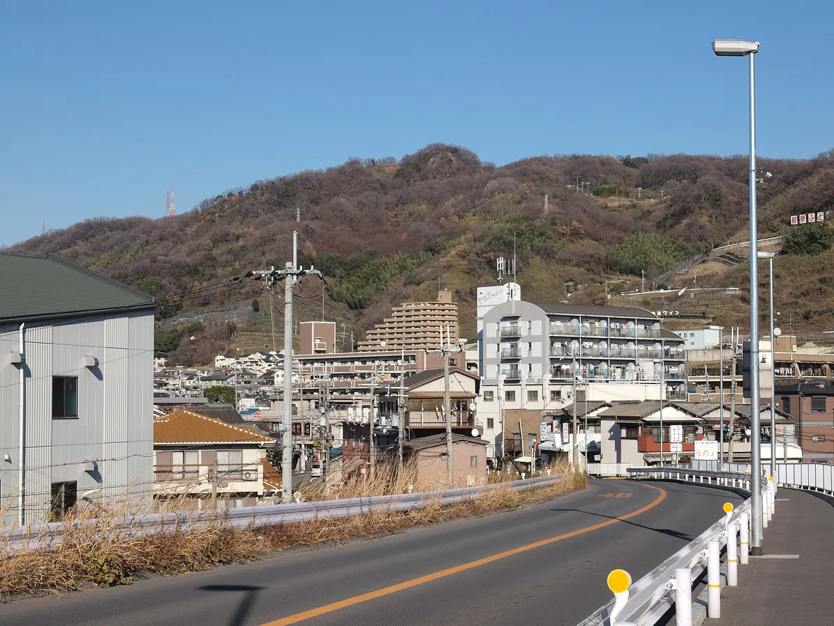
A scenic mountain park in Osaka featuring ancient Yayoi ruins, a cliffside shrine, and expansive forest trails for hiking.
What it is
- A mountain at the southern end of the Ikoma range in Kashiwara City.
- The site of a highland settlement dating back to the Yayoi period.
- A public forest park covering approximately 270,000 square meters completed in 1998.
- One of the designated 100 Greenery Sites in Osaka Prefecture.
What to see
- The Takuhiko Takuhime Shrine inner sanctuary built directly onto rocky cliffs.
- A large monument of the Kashiwara city emblem measuring 35 meters wide.
- The Ogata ruins at the foot of the mountain showing ancient blacksmithing evidence.
- A third-class triangulation point located near the mountain summit.
- Archaeological ruins of an ancient settlement situated at the peak.
16
Mount Dake
OSAKA · PLACE 嶽山
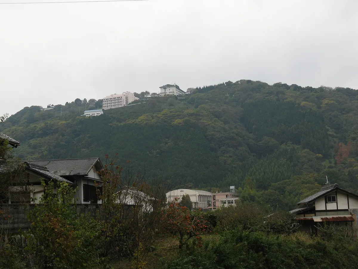
A 278-meter peak in Osaka featuring ancient castle ruins, historic temples, and scenic mandarin orange orchards on its slopes.
What it is
- A 278-meter mountain in Tondabayashi City formed by volcanic activity 17,000,000 years ago.
- One of the designated 50 mountains of Osaka featuring ancient burial mounds at its base.
- Site of Dakeyama Castle built by Kusunoki Masashige during the Kamakura period.
- A peak hosting a hotel and multiple historic religious sites on its slopes.
What to see
- The ruins of Dakeyama Castle located at the mountain summit.
- Ryusenji Temple situated on the mountainside.
- Takiya Fudo Myoo-ji Temple located on the north side of the mountain.
- Mandarin orange orchards cultivated on the sunny slopes.
- Several kofun burial mounds located at the base of the mountain.
17
Mount Tenpō
OSAKA · PLACE 天保山
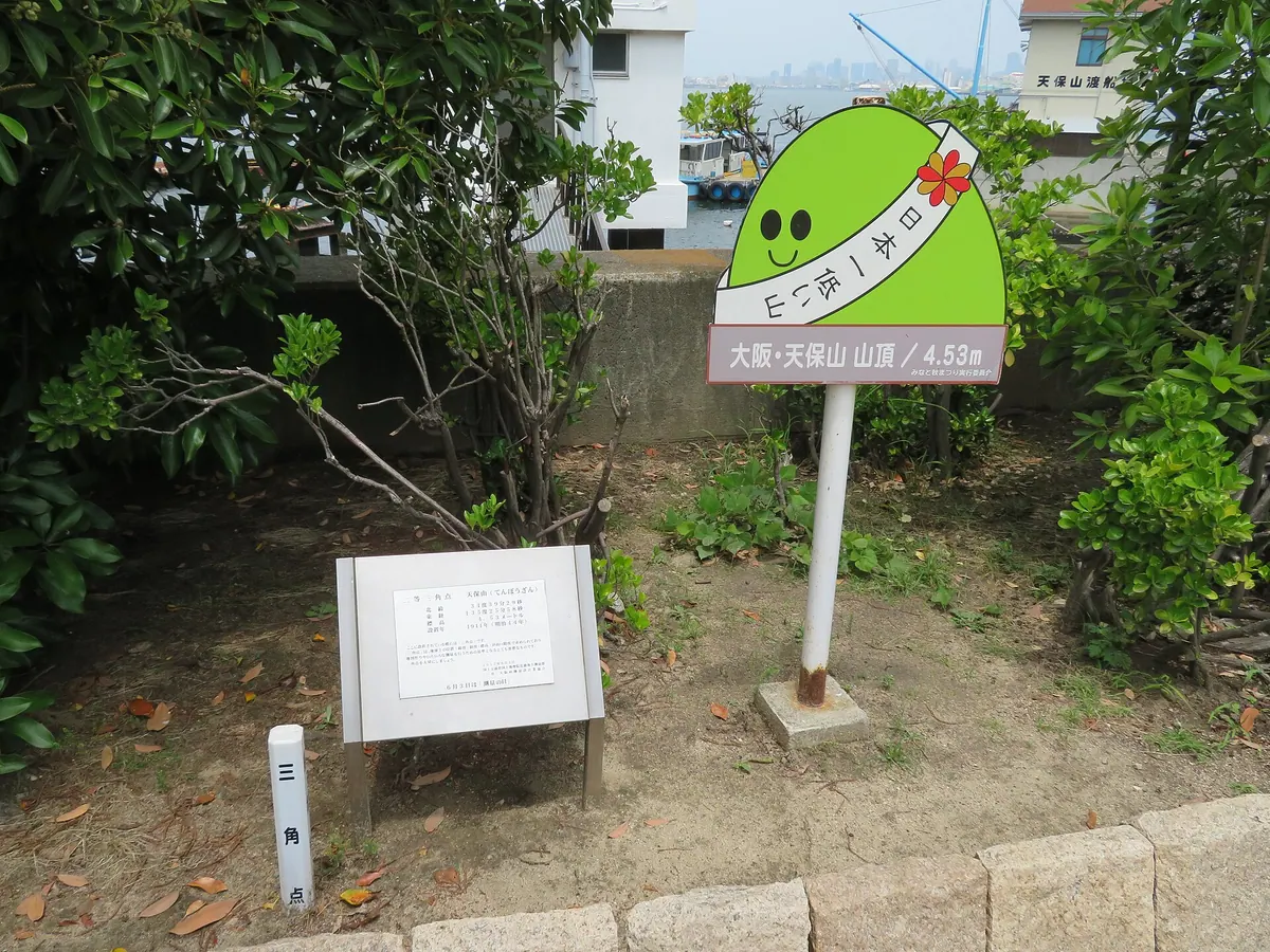
Japan's second lowest mountain, standing at 4.53 meters, offers a quirky climbing experience within a historic harbor park.
What it is
- A man-made mountain created in 1831 using soil from river dredging
- The second lowest mountain in Japan with an elevation of 4.53 meters
- A former military fort site that hosted Japan's first naval review in 1868
- A public space established as Tenpōzan Park in 1958
What to see
- The summit featuring a second-class triangulation point
- A monument commemorating the visit of the Meiji Emperor
- Official climbing certificates issued by a local mountaineering club for a fee
- Views of the nearby Osaka Kaiyukan aquarium and large Ferris wheel
Getting there
- A ten-minute walk from Osakako Station to reach the summit
18
Mount Ryūō
OSAKA · PLACE 竜王山
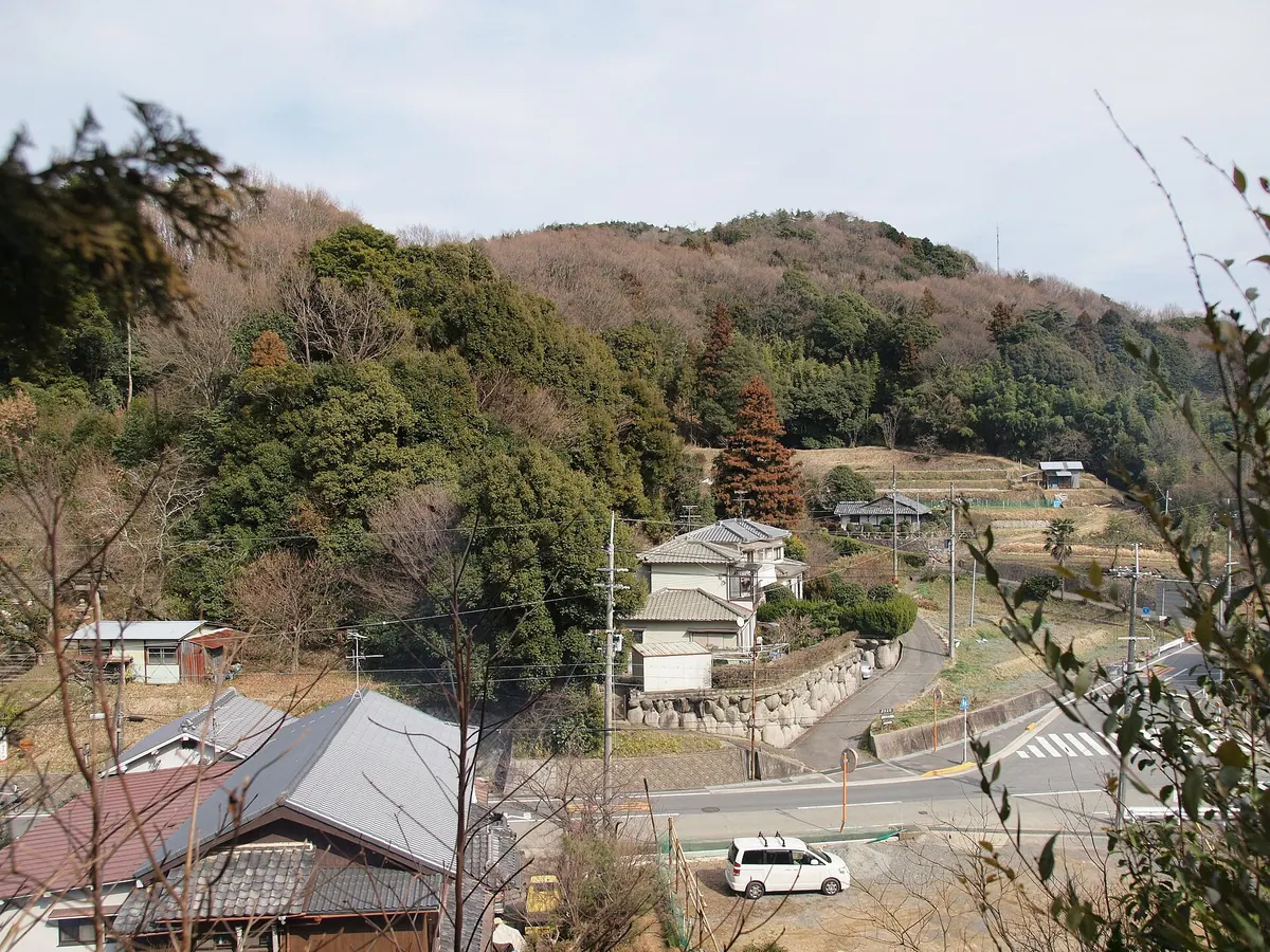
A 510-meter peak in the Hokusetsu range offering panoramic views of the Osaka Plain and historic religious sites.
What it is
- A 510-meter mountain in the Hokusetsu range also known as Mount Ninchoji
- The summit features a shrine dedicated to the deity Hachidai Ryuo
- The Tokai Nature Trail passes through this mountain area
- A third-class triangulation point marks the highest peak
What to see
- An observation deck providing views across the Osaka Plain
- The Ryuo Waterfall located along the climbing route
- Hochiji Temple situated near the western side of the summit
- A summit shrine dedicated to the dragon king deity
Getting there
- Accessible via the Ninchoji bus stop
- A forest road allows vehicle access near the summit
19
Mount Ittokubō
OSAKA · PLACE 一徳防山
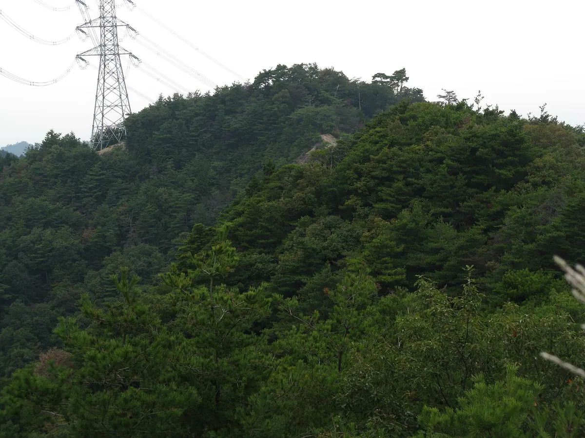
A 541-meter peak in Osaka Prefecture offering panoramic views and inclusion in the prestigious Osaka 50 Mountains list.
What it is
- A mountain peak standing at an elevation of 541 meters in Kawachinagano City.
- One of the designated Osaka 50 Mountains.
- A destination featuring a collapsed western summit and a nearby steel tower.
What to see
- A triangulation point at 544.3 meters elevation providing a 360 degree view.
- Views of Mount Amigasa and Mount Iwawaki looking toward the south.
- A steel tower located 500 meters southeast of the mountain summit.
Getting there
- Access the trailhead located near the Nakahino bus stop.
- Start the hike from the trailhead situated near Iwawaki-dera Temple.
20
Mount Kōno
OSAKA · PLACE 交野山
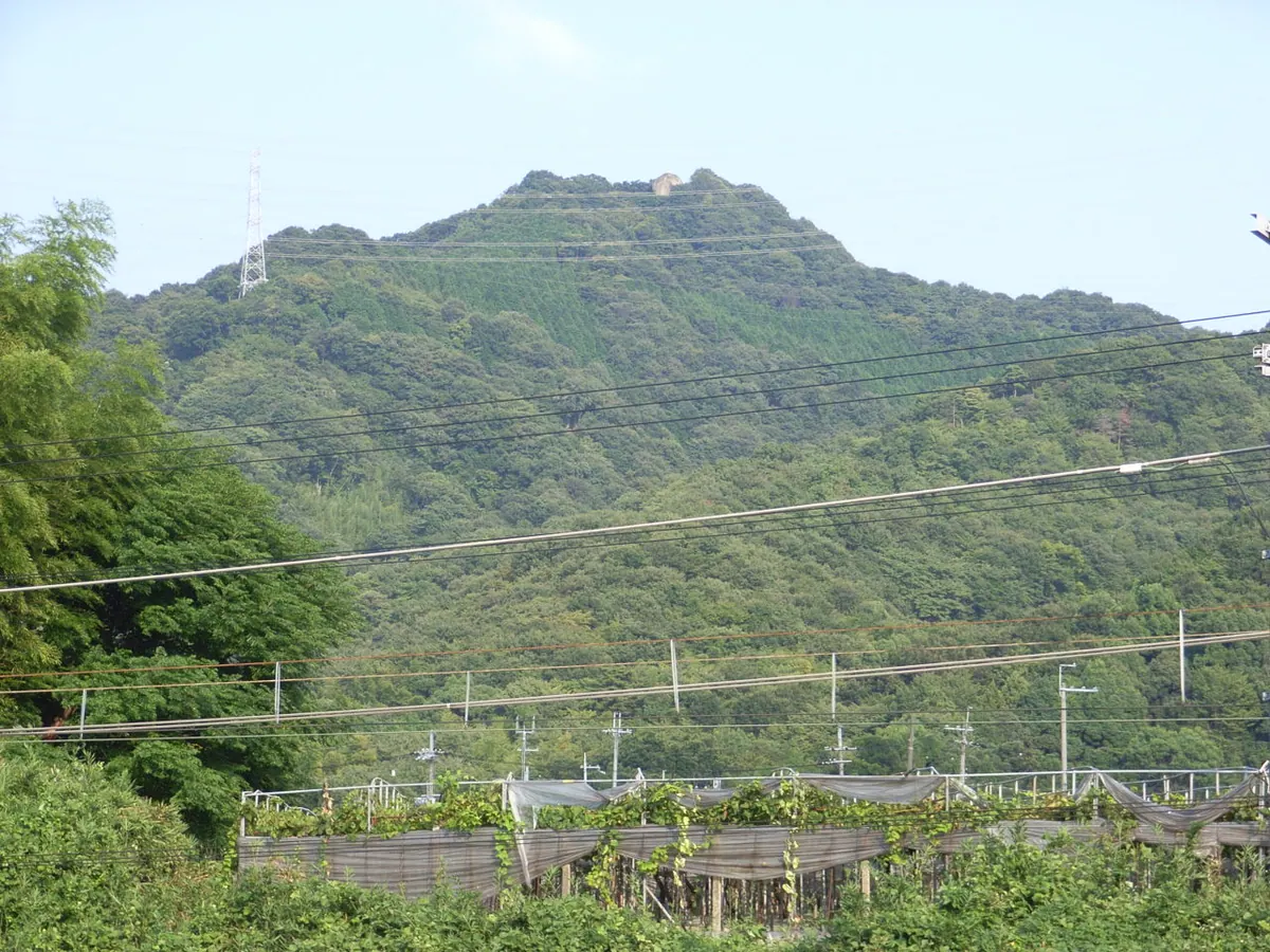
A scenic peak in Osaka featuring a massive sacred rock with ancient carvings and panoramic views of two major cities.
What it is
- A mountain peak located at the northern end of the Ikoma Mountains in Osaka.
- A natural site featuring a giant rock formation known as Kannon-iwa at the summit.
- Part of the Kansai Science City area with slopes shared by a golf course.
What to see
- The Kannon-iwa rock which features Sanskrit characters carved into its west side.
- Panoramic views of both Osaka and Kyoto from the mountain summit.
- The Katano City Wildlife Center located near the waters of Shirahata Pond.
- Hiking trails that traverse the mountain and pass through golf course private roads.