

20 Mountains in Kyoto worth your time
Japan Gems
31 Mountains in Kyoto, with what to see and how to get there.
Kyoto has 31 mountains on Japan Gems. Below are the 20 we can tell you the most about — each one written up in English from Japanese sources, with what to see and how to get there. See all mountains in Kyoto.
01
Ogurayama
KYOTO · PLACE 小倉山
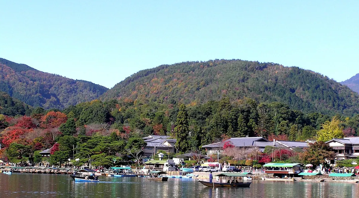
A historic Kyoto mountain famous for its autumn foliage and as the birthplace of Japan's most celebrated poetry collection.
What it is
- A 296 meter mountain located on the north bank of the Katsura River in Kyoto.
- The site where Fujiwara no Teika compiled the famous Ogura Hyakunin Isshu poetry collection.
- A historic area encompassing the eastern foothills known as Sagano.
- The location of several sites claimed to be the original Shiguretei villa.
What to see
- Forty-nine stone monuments inscribed with poems located within Kameyama Park.
- Traditional Buddhist architecture at the mountain temples of Jojakko-ji and Nison-in.
- A hiking trail leading from Kameyama Park to the mountain summit.
- Views of Arashiyama located directly across the river on the south bank.
When to go
- The area is a famous destination for viewing colorful autumn leaves.
Getting there
- The mountain is located 1.2 kilometers from Keifuku Arashiyama Station.
- JR Saga-Arashiyama Station is 1.4 kilometers from the start of the trailhead.
02
Narabigaoka
KYOTO · PLACE 双ヶ丘
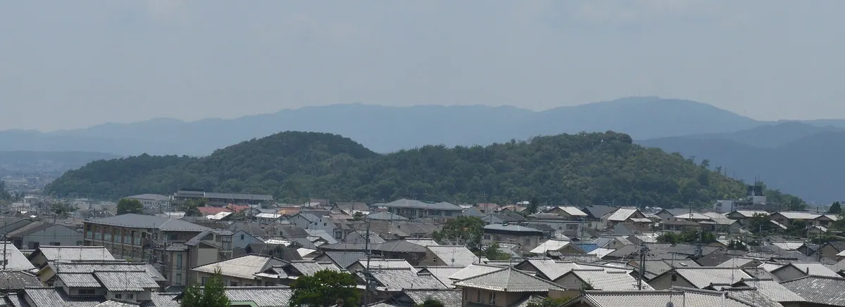
A scenic Kyoto hill featuring ancient burial mounds, historic literary connections, and views between two major Zen and Shingon temples.
What it is
- A government-designated Place of Scenic Beauty consisting of three hills aligned north to south.
- A Historical Climate Special Preservation District containing twenty-four burial mounds from the 6th century.
- The reported location where author Kenko Yoshida spent his final years.
- The site of 6th-century tombs believed to belong to leaders of the Hata clan.
What to see
- The highest peak, Ichino-oka, which reaches an elevation of one hundred sixteen meters.
- Ancient burial mounds scattered across the hillsides dating back to the 6th century.
- Myoshin-ji Temple located at the eastern foot of the hills.
- Ninna-ji Temple situated at the northern foot of the hills.
- The southern foot where a film studio operated during the 1920s.
Getting there
- A five-minute walk from Hanazono Station on the JR Sagano Line.
03
Mount Amidagamine
KYOTO · PLACE 阿弥陀ヶ峰
A historic peak in Kyoto's Higashiyama range featuring Toyotomi Hideyoshi's pagoda and a former Sengoku period castle site.
What it is
- One of the thirty-six peaks of the Higashiyama range in Kyoto City.
- A historic burial ground known as Toribeno where Amida Nyorai was enshrined.
- The site of Amidagamine Castle built during the Sengoku period.
- Home to the Toyokuni Mausoleum and Kyoto Women's University on its western slopes.
What to see
- A five-story pagoda dedicated to Toyotomi Hideyoshi at the mountain summit.
- The Toyokuni Mausoleum situated at the western foot of the mountain.
- Five hundred sixty-five stone steps leading up to the summit.
- The Kyoto Isshu Trail which passes through the eastern foot.
- Kyoto City Central Crematorium located at the eastern base.
Getting there
- Princess Line buses run directly to the Toyokuni Mausoleum entrance.
- The summit is accessible by climbing five hundred sixty-five stone steps.
04
Mount Kiyomizu
KYOTO · PLACE 清水山
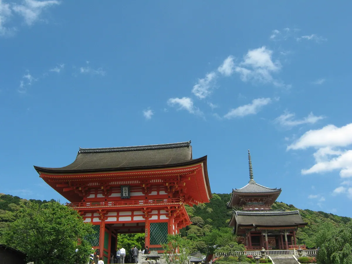
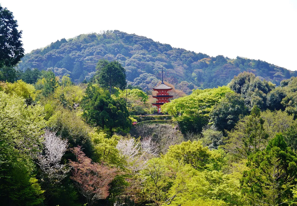
A peak in Kyoto's Higashiyama range home to the famous Kiyomizu-dera Temple and imperial mausoleums at Seikan-ji.
What it is
- One of the thirty-six peaks of the Higashiyama range in Kyoto.
- Also known as Mount Otowa, the official mountain name of Kiyomizu-dera Temple.
- Site of Seikan-ji Temple which houses the mausoleums of Emperor Rokujo and Emperor Takakura.
What to see
- Kiyomizu-dera Temple located on the western foot of the mountain.
- Seikan-ji Temple situated on the southern foot.
- The Koyasu Pagoda which serves as a trail entrance.
- The mountain summit located near marker 18-1 of the Kyoto Circuit Trail.
Getting there
- The nearest bus stop is Seikanji Yamanouchi-cho on National Route 1.
- A twenty-minute walk from the Seikan-ji trail entrance leads to the summit.
- The walk from the Koyasu Pagoda entrance takes twenty-five minutes.
- Walking from Kiyomizu-dera via marker 19 takes thirty-five minutes.
05
Arashiyama
KYOTO · PLACE 嵐山
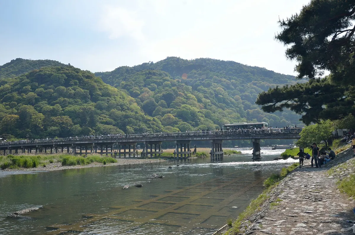
A scenic district in western Kyoto featuring a historic bridge, mountain views, and major temples designated as a National Historic Site.
What it is
- A 382-meter mountain and scenic district located in western Kyoto.
- A designated National Historic Site and Place of Scenic Beauty.
- A major Buddhist center featuring Tenryu-ji Temple at the mountain base.
- The site of Arashiyama Castle ruins located at the mountain summit.
What to see
- The Togetsukyo Bridge featuring a reinforced concrete structure with traditional wooden railings.
- The Katsura River which flows through the center of the area.
- Mount Iwata monkey park housing approximately 140 Japanese macaques.
- Arashiyama Onsen hot spring source excavated in 2004.
- The Sagano Scenic Railway which connects the area to Kameoka.
- Traditional boats arriving from the Hozugawa River Cruise.
When to go
- Springtime to visit one of Japan's top 100 cherry blossom spots.
06
Mount Minako
KYOTO · PLACE 皆子山
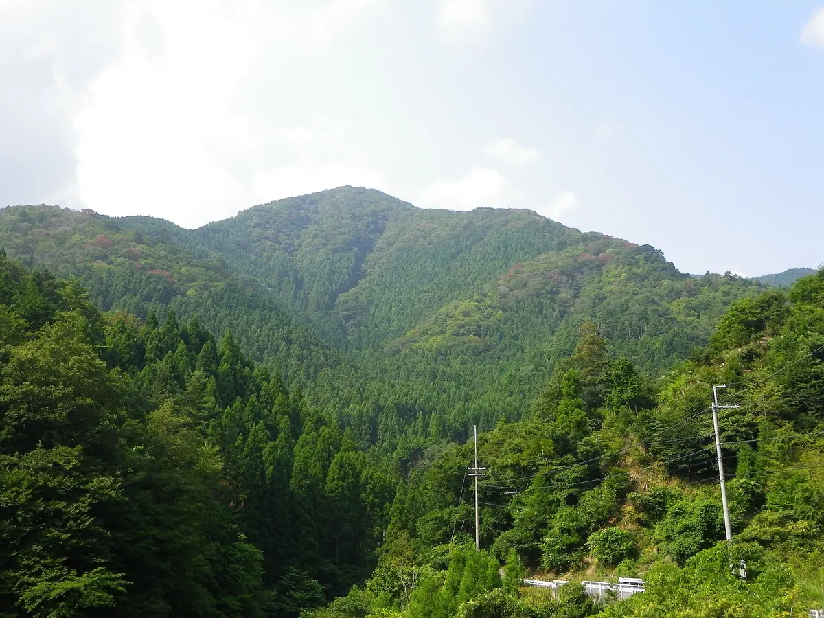
The highest peak in Kyoto Prefecture offers hikers a 971-meter climb through the Tanba Highland on the border of Shiga.
What it is
- The highest peak in Kyoto Prefecture standing at an elevation of 971 meters
- A mountain bordering Sakyo Ward in Kyoto and Otsu in Shiga Prefecture
- Part of the Tanba Highland region and the Hanaore Fault line
- A natural site featuring the Ashio Valley at its northern foot
What to see
- Views from the highest point in the prefecture across the Tanba Highland
- The Minako Valley flowing from the southern slope of the mountain
- Hiking trails along the eastern ridge and through the Ashio Valley
Getting there
- Kojaka Kotsu buses run from Katata Station to the mountain area
- The Ashio Valley trailhead is accessible from the Sakaguchi bus stop
- The eastern ridge route begins near the Taira bus stop
- A small parking lot is available for visitors near the Taira bus stop
07
Ōeyama
KYOTO · PLACE 大江山
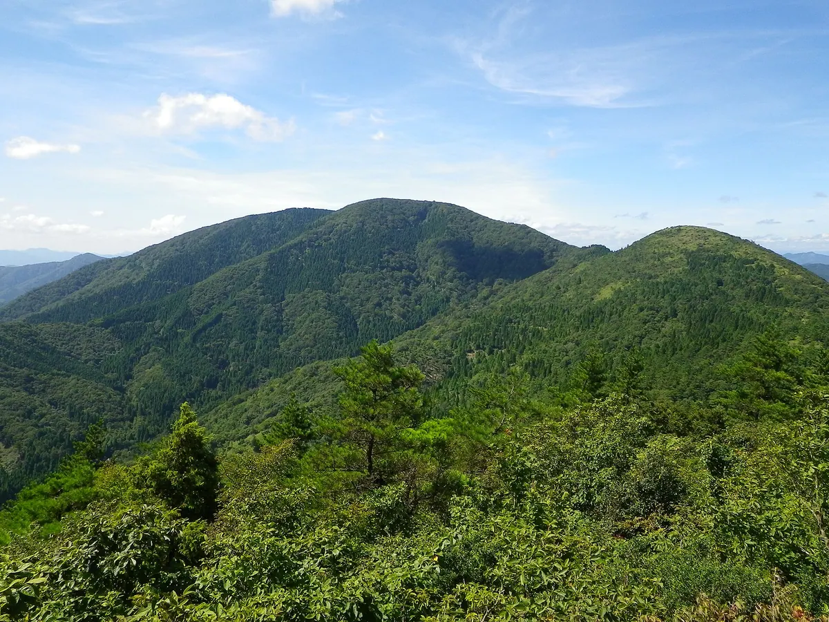
A quasi-national park mountain range famous for demon legends, seasonal sea of clouds, and diverse floral hiking trails.
What it is
- A mountain range and quasi-national park spanning Yosano, Fukuchiyama, and Miyazu in Kyoto Prefecture.
- The highest point in the Tango region with the peak of Senjogatake reaching 832.5 meters.
- A site famous for the Shuten-doji demon legend and historical nickel, copper, and chromium mining.
- One of the New 100 Famous Flower Mountains featuring peaks like Nabezuka and Hatogamine.
What to see
- The Japanese Oni Exchange Museum located at the base of the mountain.
- Onitake Inari Shrine which serves as a popular viewpoint for the landscape.
- Panoramic views from the summits of Senjogatake, Nabezuka, and Akaishigatake.
- Diverse seasonal flowers across the slopes of the mountain range.
When to go
- Autumn to early winter to observe the sea of clouds phenomenon.
08
Mount Mitake
KYOTO · PLACE 三岳山
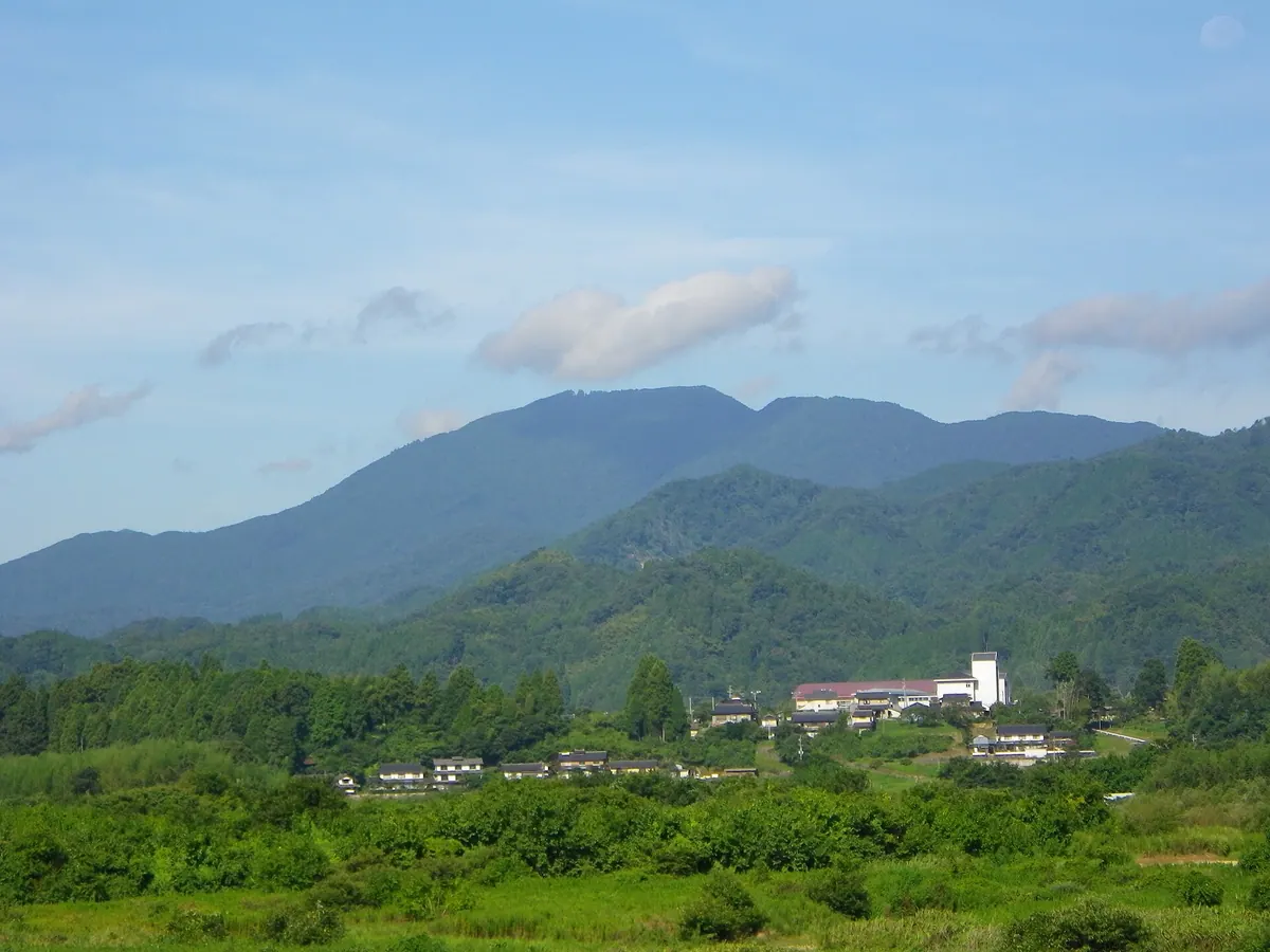
The highest peak in Fukuchiyama City, offering a historic shrine and hiking trails through dense beech and oak forests.
What it is
- The highest peak in Fukuchiyama City standing at 839.1 meters in the Tango Mountains.
- A historic site for mountain asceticism with a shrine founded in the fourteenth century.
- A natural landmark also known as Ontake-san covered in beech and oak forests.
- The site of Mitake Shrine which is dedicated to the deity Zao Gongen.
What to see
- Mitake Shrine situated on the mountain slopes at an elevation of 680 meters.
- A Kansai Electric Power reflector located at the mountain summit.
- A third-class triangulation point marking the highest peak.
- Dense forests of beech and oak trees covering the mountain slopes.
Getting there
- The Hotoke-zaka route provides a direct climb from the southwest.
- The Kita trailhead begins the ascent at an elevation of 350 meters.
09
Mount Kurama
KYOTO · PLACE 鞍馬山
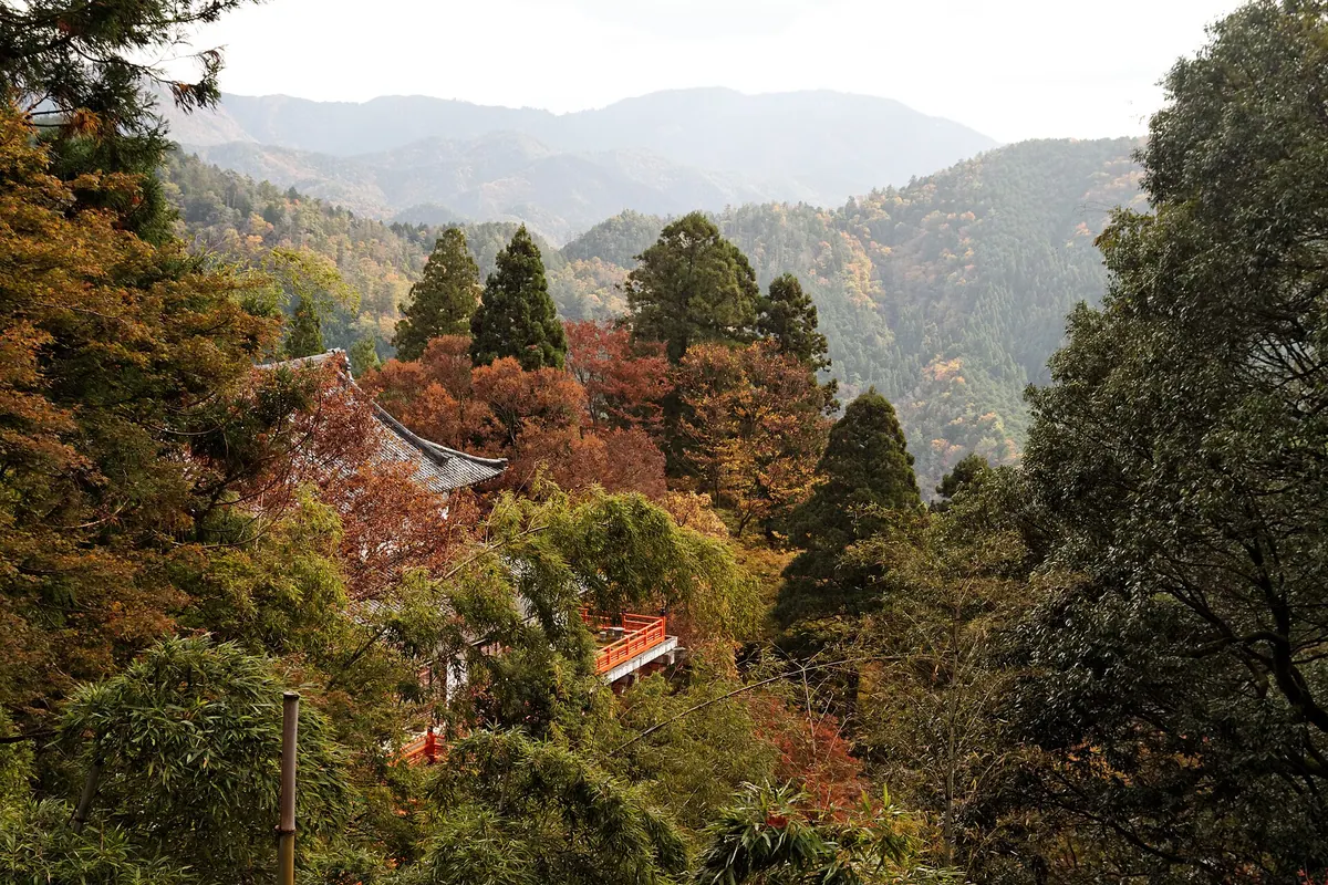
A sacred 584-meter mountain near Kyoto featuring an ancient temple, historical training grounds, and unique geological formations.
What it is
- A 584-meter mountain located between the Kurama and Kibune rivers in Kyoto.
- Home to Kurama-dera Temple which was founded in either 770 or 796.
- The site where historical figure Minamoto no Yoshitsune performed his martial arts training.
- A designated national forest enshrining the deity Bishamonten at the main temple.
What to see
- The ancient Kurama-dera Temple complex situated on the mountain slopes.
- Natural terrain consisting of limestone and greenstone originating from the equatorial region.
- A protected water source forest listed among the top one hundred in Japan.
- The origin site of high-grade Kurama stone within the forest grounds.
Getting there
- Access the mountain via the Eizan Electric Railway to Kurama Station.
10
Kasagiyama
KYOTO · PLACE 笠置山
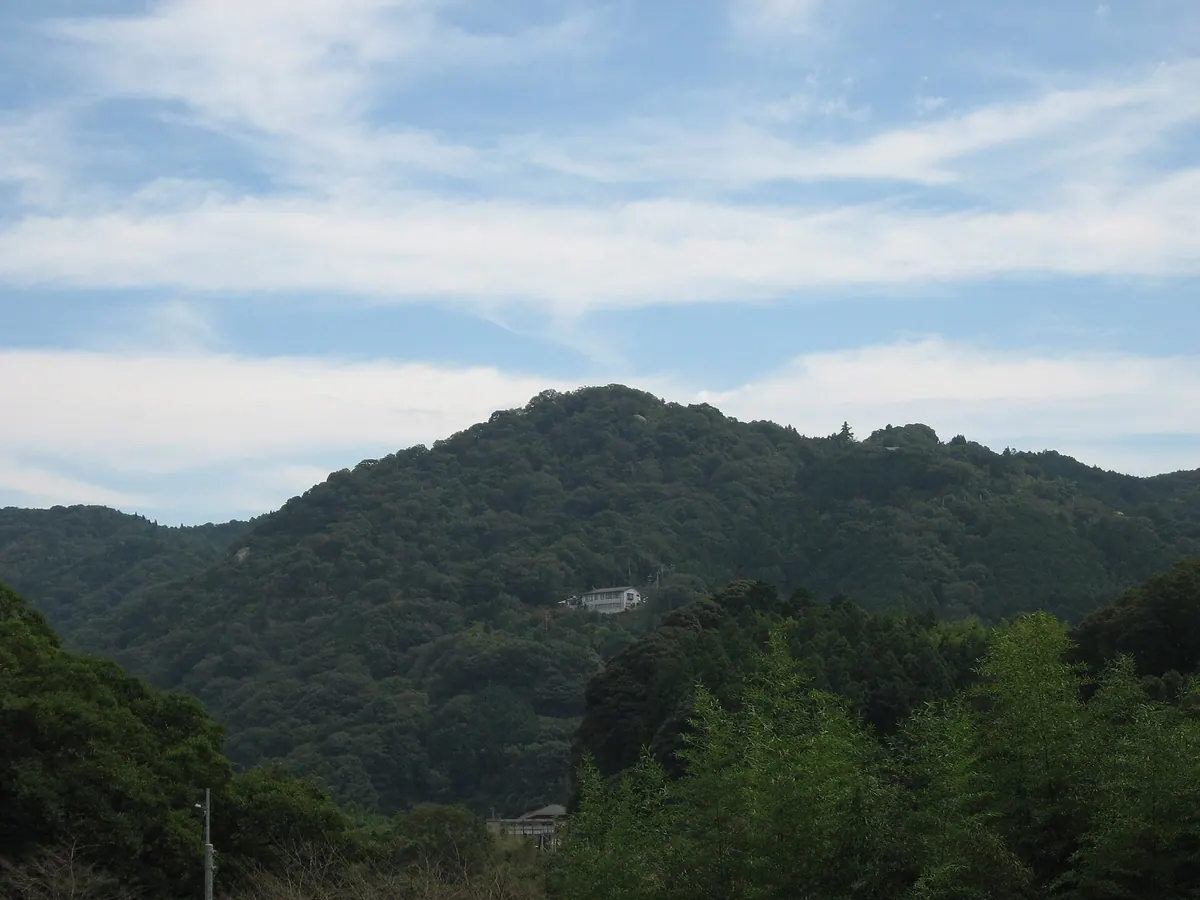
A historic 289-meter mountain featuring an ancient temple, granite formations, and sites from the 14th-century Genko War.
What it is
- A 289-meter granite mountain designated as a national historic site and natural park.
- Home to Kasagi-dera Temple, which was founded in the late seventh century.
- The former temporary residence of Emperor Go-Daigo during a battle in 1331.
- A site where ancient stone swords from the Yayoi period were excavated.
What to see
- Large granite rock formations positioned along the Kizu River.
- Broadleaf forests consisting of oak trees and dog laurels.
- Historic temple grounds that served as a military stronghold.
- Scenic views from the mountain overlooking the surrounding Kyoto Prefecture landscape.
When to go
- Springtime for the blooming of the local cherry blossoms.
- Autumn to view the changing colors of the mountain foliage.
11
Mount Hiei
KYOTO · PLACE 比叡山
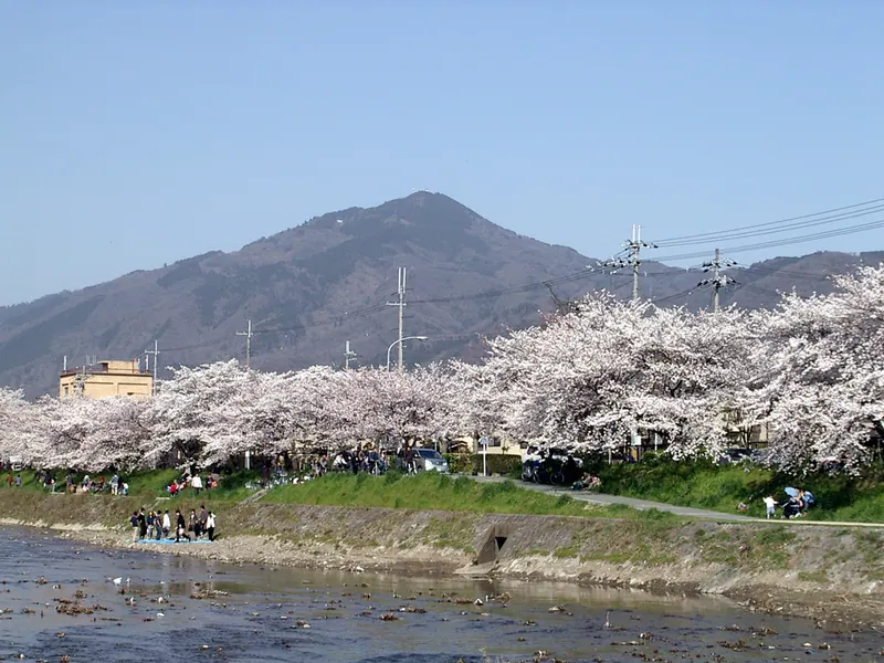
A sacred mountain straddling Kyoto and Otsu, home to the historic Enryaku-ji Temple and diverse natural bird breeding grounds.
What it is
- A mountain straddling Kyoto and Otsu consisting of two peaks, Ohie and Shimeigatake
- The headquarters of Tendai Buddhism known as Enryaku-ji Temple is located here
- A historic site mentioned in the Kojiki and nicknamed Miyako Fuji
- A major breeding ground for various species of birds
What to see
- Hiyoshi Taisha Shrine situated at the foot of the mountain
- Garden Museum Hiei located on the site of a former amusement park
- The Kirara-zaka trail used historically by monks and messengers
- Television and radio transmission towers serving the Kyoto area
- Views from the highest peak standing 848 meters above sea level
Getting there
- Visitors can reach the summit via cable car or ropeway
12
Mount Ichigao
KYOTO · PLACE 依遅ヶ尾山
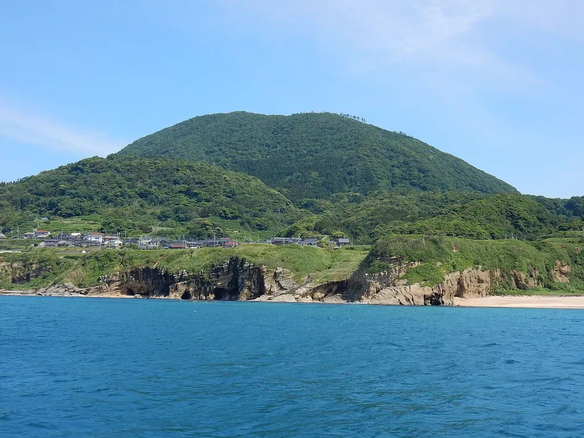
A 540-meter former volcano in Kyoto offering a short hike to a summit with religious shrines and coastal views.
What it is
- A former active volcano standing 540 meters above sea level on the Tango Peninsula.
- Part of the Tango-Amanohashidate-Oeyama Quasi-National Park and one of the Kansai 100 Famous Mountains.
- A natural formation consisting of Neogene Miocene dacite lava.
What to see
- A stone chamber dedicated to En no Gyoja located at the summit.
- A wooden shrine dedicated to Fudo Myoo standing at the peak.
- Panoramic views of the Sea of Japan and Taigoyama from the top.
- A second-class triangulation point located near the mountain summit.
Getting there
- Accessible by taking a bus from Mineyama Station to the area.
- The climb from the trailhead to the summit takes approximately 40 minutes.
13
Mount Oshio
KYOTO · PLACE 小塩山
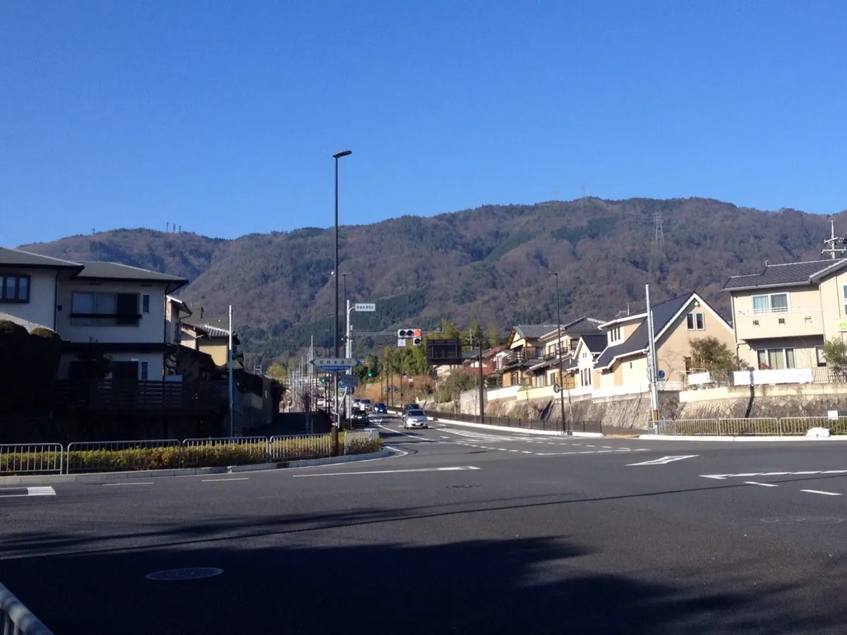
A 642-meter peak in Kyoto featuring an imperial mausoleum, radio transmission towers, and historical conservation districts at its base.
What it is
- The second highest peak in the Nishiyama range at 642 meters elevation
- A designated historical natural environment conservation district in Nishikyo Ward
- The site of the mausoleum of Emperor Junna at the summit
- A hub for FM radio transmission stations and government wireless relay antennas
What to see
- The imperial mausoleum located at the mountain peak
- Shoji-ji Temple and Oharano Shrine situated at the eastern base
- Multiple utility and government wireless relay antennas standing on the summit
- Views of the nearby Rakusai New Town from the lower slopes
When to go
- Daytime visits are necessary as general vehicle traffic is currently prohibited on the mountain road
14
Mount Nyoigatake
KYOTO · PLACE 如意ヶ嶽
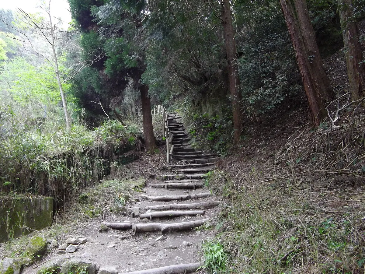
A 472-meter mountain in Kyoto's Higashiyama range, famous for the massive Daimonji bonfire and ancient temple ruins.
What it is
- A 472-meter peak marking the border between Kyoto and Shiga prefectures.
- The former site of a large Buddhist temple known as Nyoiji.
- A historical climate preservation district containing ruins of ancient fortifications.
- The location of the famous Gozan no Okuribi bonfire on its sub-peak.
What to see
- The sub-peak Mount Daimonji featuring a third-class triangulation point.
- The slope where the character for big is formed during summer festivals.
- Remnants of ancient fortifications and historical temple grounds.
- An aviation radio marker station situated at the mountain summit.
When to go
- August 16th to witness the traditional Gozan no Okuribi bonfire lighting.
15
Mount Kinugasa
KYOTO · PLACE 衣笠山
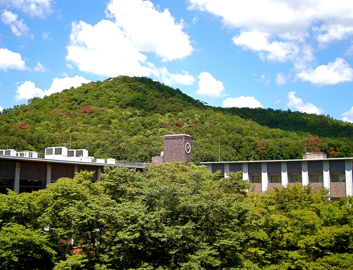
A 201-meter peak in Kyoto famous for the legend of Emperor Uda covering its slopes in white silk.
What it is
- A mountain standing 201 meters tall on the border of Kita and Ukyo wards.
- Also known as Kinukakeyama, it is a prominent landmark in northern Kyoto.
- The peak is the namesake for the local Kinugasa-don rice bowl dish.
- Legend says Emperor Uda draped the mountain in white silk to view snow in summer.
What to see
- The mountain peak which is officially recorded on national geospatial maps.
- Kinukake-no-michi, a scenic local road that runs along the base of the mountain.
- Nearby historic temples including Kinkaku-ji, Ryoan-ji, Ninna-ji, and Toji-in.
- The Domoto Insho Museum of Fine Arts located in the surrounding area.
- The campus of Ritsumeikan University situated near the foot of the slopes.
16
Ōeyama
KYOTO · PLACE 大枝山
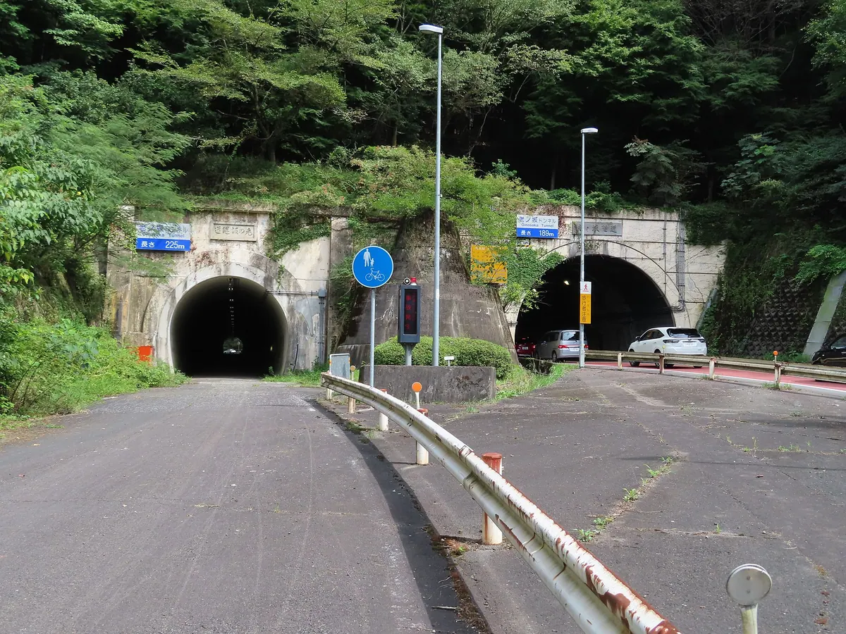
A historic mountain pass on the Kyoto border featuring a legendary demon's burial mound and ancient checkpoint ruins.
What it is
- A 480-meter mountain standing on the border of Kyoto and Kameoka.
- A former boundary of Heian-kyo that separated Yamashiro and Tanba provinces.
- Site of a Muromachi period checkpoint used by famous figures like Minamoto no Yoshitsune.
- A popular filming location for period movies near the Oinosaka Tunnel.
What to see
- The Oinosaka Pass located on the northern slope of the mountain.
- A head mound dedicated to the legendary demon Shuten-doji.
- The Koyasu Jizo statue enshrined near the mountain pass.
- National Route 9 which connects Kyoto and Tanba through the historic pass.
Getting there
- The Oinosaka Pass bus stop provides access to the historic area and shrine.
17
Mount Kachō
KYOTO · PLACE 華頂山
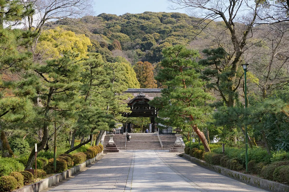
A historic peak in Kyoto's Higashiyama range featuring ancient burial mounds, a national treasure mandala, and scenic hiking trails.
What it is
- One of the thirty-six peaks of the Higashiyama range in Kyoto City
- A detached precinct of Shoren-in Temple containing the Shogunzuka mound
- The mountain name used by the nearby Chion-in Temple
- Site of the Shogunzuka tumulus group dating to the middle Kofun period
What to see
- The Seiryuden building which houses the Blue Fudo Myoo Mandala national treasure
- Dainichido hall enshrining a stone statue of Dainichi Nyorai
- The Shogunzuka mound built by Emperor Kanmu
- The Kyoto Isshu Trail which passes near the mountain summit
Getting there
- Keihan Bus route 70 stops at the Shogunzuka Seiryuden station
- Road access is available via the Higashiyama Driveway
18
Mount Isanago
KYOTO · PLACE 磯砂山
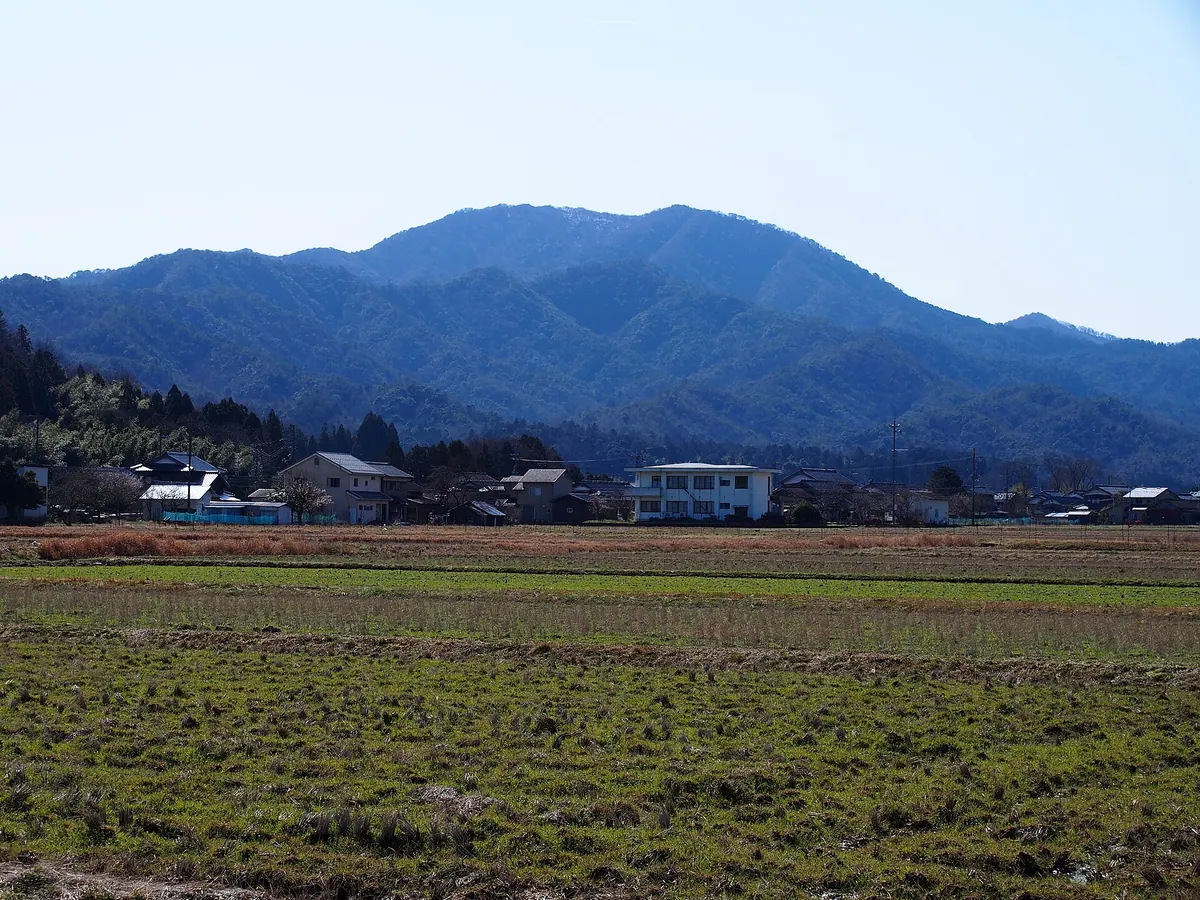
A 661-meter peak in Kyotango featuring a celestial maiden legend, diverse plant life, and a panoramic summit observatory.
What it is
- The third highest mountain in the Tango region standing at 661 meters.
- One of Kyoto's Top 200 Nature Sites associated with the Hagoromo celestial maiden legend.
- A natural habitat containing all plant species recorded in the ancient Gishiwajinden texts.
- Also known by the alternative names Mount Hijiyama and Mount Manai.
What to see
- A concrete staircase with 1010 steps leading visitors to the mountain summit.
- The Kirifuto Waterfall which was rediscovered on the mountain slopes in 1998.
- Otome Shrine located at the western foot of the mountain.
- An observatory and first-class triangulation point at the peak.
- The Hagoromo Chaya rest area situated at an elevation of 383 meters.
19
Mount Tsuzumi
KYOTO · PLACE 鼓ヶ岳
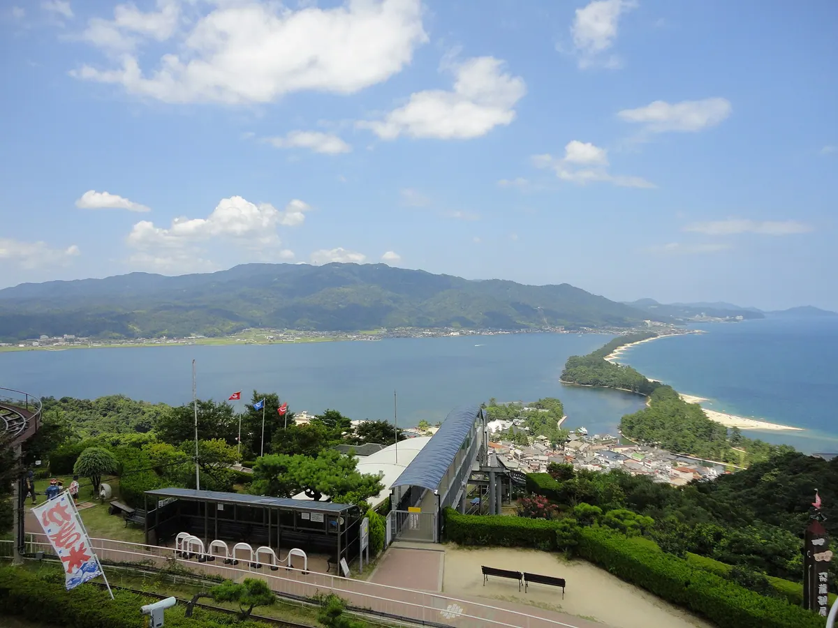
A 569-meter peak on the Tango Peninsula offering panoramic bay views, a historic temple, and a 600-year-old cedar tree.
What it is
- A mountain standing 569 meters tall on the Tango Peninsula in northern Kyoto.
- Also known as Mount Nariai, spanning Kyotango, Miyazu, and Yosano.
- The site of Nariaiji Temple, which is located on the mountainside.
- A natural landmark situated directly north of the Amanohashidate sandbar.
What to see
- The Nariaiyama Panorama Observatory providing views overlooking Miyazu Bay.
- An ancient cedar tree estimated to be 600 years old.
- A broadcasting relay tower and a second-class triangulation point at the peak.
- Summit views extending to Mount Takayama and Mount Aoba.
Getting there
- The summit is accessible to visitors via the Tango Jukan Forest Road.
20
Mount Sajikigatake
KYOTO · PLACE 桟敷ヶ岳
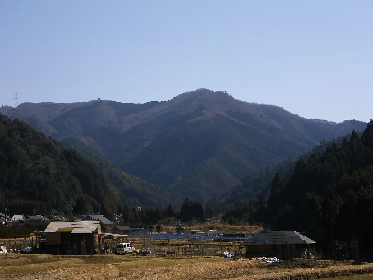
The highest peak in Kyoto's Kita Ward, offering city views and serving as the source of the Kamo River.
What it is
- The highest peak in Kita Ward, Kyoto, standing at 895.9 meters tall.
- A mountain included in the list of Kansai 100 Famous Mountains.
- The geographical source for both the Kamo River and the Kiyotaki River.
- A historic site where Prince Koretaka reportedly viewed the capital from the summit.
What to see
- A second-class triangulation point located at the mountain summit.
- Views of Kyoto City from a transmission tower near the peak.
- The Yakushi Pass trail leading upward from the Iwayabashi area.
Getting there
- Access the area using the Kumogahata Bus Mokumoku-go service.
- Reach the peak by hiking via the Yakushi Pass from Iwayabashi.